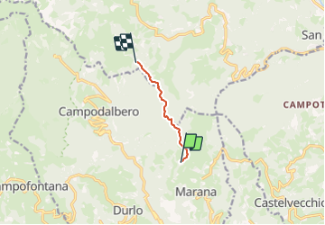
![](/images/other/stat-length.png)
![Tocht Te voet Crespadoro - 203, Delle casoline - Photo](https://media.geolcdn.com/t/1900/400/ff3ec53a-3774-464d-aa92-1322dbd74f4a.jpeg&format=pjpeg&maxdim=2)
203, Delle casoline
SityTrail - itinéraires balisés pédestres
Tous les sentiers balisés d’Europe GUIDE+
![Lengte](/images/other/stat-length.png)
Lengte
4,2 km
![Max. hoogte](https://static1.geolcdn.com/siteimages/upload/files/1508320355ic_sort_altitude_max_24dp.png)
Max. hoogte
1524 m
![Positief hoogteverschil](https://static1.geolcdn.com/siteimages/upload/files/1508320355ic_sort_den_pos_24dp.png)
Positief hoogteverschil
622 m
![Km-Effort](/images/other/stat-length.png)
Km-Effort
10,5 km
![Min. hoogte](https://static1.geolcdn.com/siteimages/upload/files/1508320355ic_sort_altitude_min_24dp.png)
Min. hoogte
907 m
![Negatief hoogteverschil](https://static1.geolcdn.com/siteimages/upload/files/1508320355ic_sort_den_neg_24dp.png)
Negatief hoogteverschil
15 m
![Boucle](https://static1.geolcdn.com/siteimages/upload/files/16400158638029165_repeat_loop_refresh_sync_direction_icon.png)
Boucle
Neen
Markering
Datum van aanmaak :
2022-02-15 01:16:04.075
Laatste wijziging :
2022-02-28 20:32:53.535
![Te voet](https://static1.geolcdn.com/sitytour/trail-icons/100.png)
2h22
Moeilijkheid : Gemakkelijk
![Scan deze QR-code om de tocht te openen in de SityTrail-applicatie](https://capi.geolives.com/qq0zvz2zws4bq2lad0pu/sitytour/trails/3113252/qr.png?size=200)
Gratisgps-wandelapplicatie
Over ons
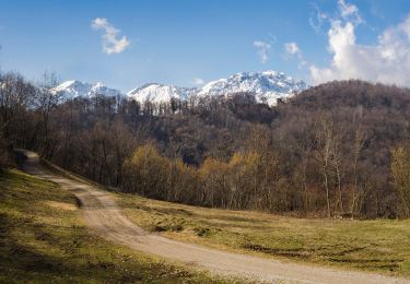
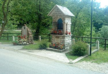
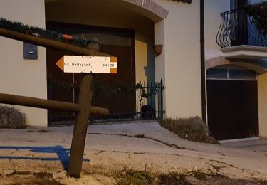
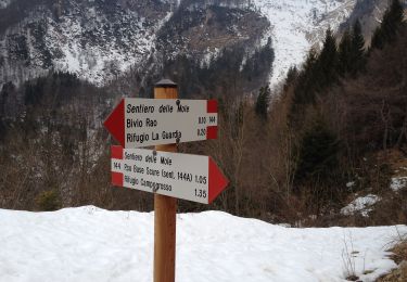
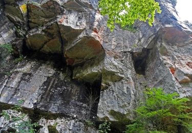
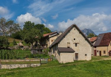
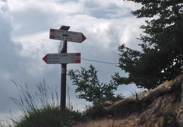
Tocht Te voet van 4,2 km beschikbaar op Veneto, Vicenza, Crespadoro. Deze tocht wordt voorgesteld door SityTrail - itinéraires balisés pédestres.
Beschrijving
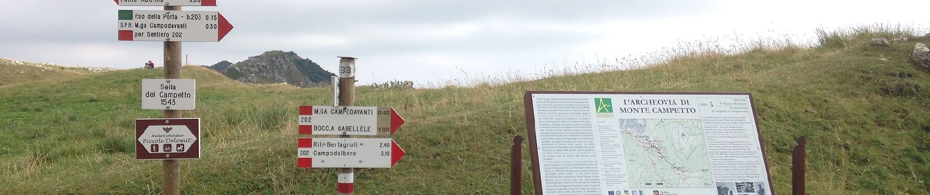
Trail created by C.A.I. Arzignano.
Symbol: 203 on white red flag
Website: http://www.caiarzignano.info/
Plaatsbepaling
Land:
Italy
Regio :
Veneto
Departement/Provincie :
Vicenza
Gemeente :
Crespadoro
Locatie:
Unknown
Vertrek:(Dec)
Vertrek:(UTM)
672476 ; 5056940 (32T) N.
Opmerkingen
Wandeltochten in de omgeving
![Tocht Te voet Crespadoro - 215 - Photo](https://media.geolcdn.com/t/375/260/3f985bbe-a1c9-439d-a48e-8466bd528543.jpeg&format=jpg&maxdim=2)
![Te voet Te voet](https://static1.geolcdn.com/sitytour/trail-icons/100.png)
![Tocht Te voet Crespadoro - Anello Ecoturistico Piccole Dolomiti 009 - Photo](https://media.geolcdn.com/t/375/260/92862afa-bf6e-4e71-abc6-4de07489d8fb.jpeg&format=jpg&maxdim=2)
![Te voet Te voet](https://static1.geolcdn.com/sitytour/trail-icons/100.png)
Anello Ecoturistico Piccole Dolomiti 009
Te voet
Gemakkelijk
Crespadoro,
Veneto,
Vicenza,
Italy
![](/images/other/stat-length.png)
4,6 km | 8,3 km-effort
1h 53min
![](https://static1.geolcdn.com/siteimages/upload/files/16400158638029165_repeat_loop_refresh_sync_direction_icon.png)
Neen
![Tocht Te voet Crespadoro - Anello Ecoturistico Piccole Dolomiti - Photo](https://media.geolcdn.com/t/375/260/53110be4-ca56-4dc7-ab46-c4a553067ed7.jpeg&format=jpg&maxdim=2)
![Te voet Te voet](https://static1.geolcdn.com/sitytour/trail-icons/100.png)
Anello Ecoturistico Piccole Dolomiti
Te voet
Zeer moeilijk
Crespadoro,
Veneto,
Vicenza,
Italy
![](/images/other/stat-length.png)
67 km | 100 km-effort
22h 38min
![](https://static1.geolcdn.com/siteimages/upload/files/16400158638029165_repeat_loop_refresh_sync_direction_icon.png)
Neen
![Tocht Te voet Altissimo - Anello Ecoturistico Piccole Dolomiti 002 - Photo](https://media.geolcdn.com/t/375/260/c9915f85-75a2-4f82-a8d5-507903a06499.jpeg&format=jpg&maxdim=2)
![Te voet Te voet](https://static1.geolcdn.com/sitytour/trail-icons/100.png)
Anello Ecoturistico Piccole Dolomiti 002
Te voet
Gemakkelijk
Altissimo,
Veneto,
Vicenza,
Italy
![](/images/other/stat-length.png)
12,2 km | 19,1 km-effort
4h 19min
![](https://static1.geolcdn.com/siteimages/upload/files/16400158638029165_repeat_loop_refresh_sync_direction_icon.png)
Neen
![Tocht Te voet Crespadoro - Anello Ecoturistico Piccole Dolomiti 003 - Photo](https://media.geolcdn.com/t/375/260/3d813d6a-80e7-41f0-a457-8e0b75a76092.jpeg&format=jpg&maxdim=2)
![Te voet Te voet](https://static1.geolcdn.com/sitytour/trail-icons/100.png)
Anello Ecoturistico Piccole Dolomiti 003
Te voet
Gemakkelijk
Crespadoro,
Veneto,
Vicenza,
Italy
![](/images/other/stat-length.png)
9,1 km | 16,1 km-effort
3h 39min
![](https://static1.geolcdn.com/siteimages/upload/files/16400158638029165_repeat_loop_refresh_sync_direction_icon.png)
Neen
![Tocht Te voet Recoaro Terme - Anello Ecoturistico Piccole Dolomiti 004 - Photo](https://media.geolcdn.com/t/375/260/415f08fe-adfd-4017-b0e4-f8688286a2bc.jpeg&format=jpg&maxdim=2)
![Te voet Te voet](https://static1.geolcdn.com/sitytour/trail-icons/100.png)
Anello Ecoturistico Piccole Dolomiti 004
Te voet
Zeer moeilijk
Recoaro Terme,
Veneto,
Vicenza,
Italy
![](/images/other/stat-length.png)
31 km | 46 km-effort
10h 27min
![](https://static1.geolcdn.com/siteimages/upload/files/16400158638029165_repeat_loop_refresh_sync_direction_icon.png)
Neen
![Tocht Te voet Selva di Progno - Dorsale Media della Lessinia - sezione Campofontana - Camposilvano - Photo](https://media.geolcdn.com/t/375/260/544a9a2d-d927-47f3-b72d-2fb12acc86c9.jpeg&format=jpg&maxdim=2)
![Te voet Te voet](https://static1.geolcdn.com/sitytour/trail-icons/100.png)
Dorsale Media della Lessinia - sezione Campofontana - Camposilvano
Te voet
Medium
Selva di Progno,
Veneto,
Verona,
Italy
![](/images/other/stat-length.png)
12,4 km | 21 km-effort
4h 49min
![](https://static1.geolcdn.com/siteimages/upload/files/16400158638029165_repeat_loop_refresh_sync_direction_icon.png)
Neen
![Tocht Te voet Recoaro Terme - IT-134 - Photo](https://media.geolcdn.com/t/375/260/aa372dd5-63ff-4066-ba92-1ce6530ff70f.jpeg&format=jpg&maxdim=2)
![Te voet Te voet](https://static1.geolcdn.com/sitytour/trail-icons/100.png)
IT-134
Te voet
Gemakkelijk
Recoaro Terme,
Veneto,
Vicenza,
Italy
![](/images/other/stat-length.png)
3,8 km | 5,4 km-effort
1h 13min
![](https://static1.geolcdn.com/siteimages/upload/files/16400158638029165_repeat_loop_refresh_sync_direction_icon.png)
Neen
![Tocht Te voet Selva di Progno - Campofontana - Passo della Scagina inn. sent. 221 - Photo](https://media.geolcdn.com/t/375/260/dbf57161-a557-4c5d-b47a-33ec77112c20.jpeg&format=jpg&maxdim=2)
![Te voet Te voet](https://static1.geolcdn.com/sitytour/trail-icons/100.png)
Campofontana - Passo della Scagina inn. sent. 221
Te voet
Gemakkelijk
Selva di Progno,
Veneto,
Verona,
Italy
![](/images/other/stat-length.png)
5,8 km | 10,8 km-effort
2h 26min
![](https://static1.geolcdn.com/siteimages/upload/files/16400158638029165_repeat_loop_refresh_sync_direction_icon.png)
Neen