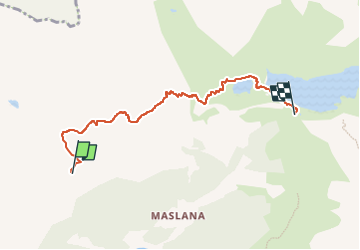
![](/images/other/stat-length.png)
![Tocht Te voet Valbondione - Sentiero delle Orobie Orientali - Tappa 6 - Photo](https://media.geolcdn.com/t/1900/400/dc9674ce-f30f-4d50-9299-0838a57baa41.jpeg&format=pjpeg&maxdim=2)
Sentiero delle Orobie Orientali - Tappa 6
SityTrail - itinéraires balisés pédestres
Tous les sentiers balisés d’Europe GUIDE+
![Lengte](/images/other/stat-length.png)
![Max. hoogte](https://static1.geolcdn.com/siteimages/upload/files/1508320355ic_sort_altitude_max_24dp.png)
![Positief hoogteverschil](https://static1.geolcdn.com/siteimages/upload/files/1508320355ic_sort_den_pos_24dp.png)
![Km-Effort](/images/other/stat-length.png)
![Min. hoogte](https://static1.geolcdn.com/siteimages/upload/files/1508320355ic_sort_altitude_min_24dp.png)
![Negatief hoogteverschil](https://static1.geolcdn.com/siteimages/upload/files/1508320355ic_sort_den_neg_24dp.png)
![Boucle](https://static1.geolcdn.com/siteimages/upload/files/16400158638029165_repeat_loop_refresh_sync_direction_icon.png)
![Te voet](https://static1.geolcdn.com/sitytour/trail-icons/100.png)
3h03
Moeilijkheid : Gemakkelijk
![Scan deze QR-code om de tocht te openen in de SityTrail-applicatie](https://capi.geolives.com/qq0zvz2zws4bq2lad0pu/sitytour/trails/3113026/qr.png?size=200)
Gratisgps-wandelapplicatie
Over ons
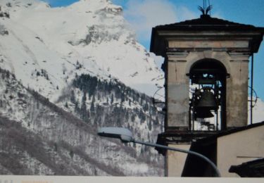
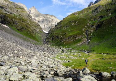
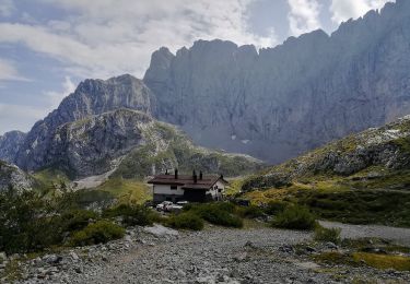
Tocht Te voet van 5,7 km beschikbaar op Lombardije, Bergamo, Valbondione. Deze tocht wordt voorgesteld door SityTrail - itinéraires balisés pédestres.
Beschrijving
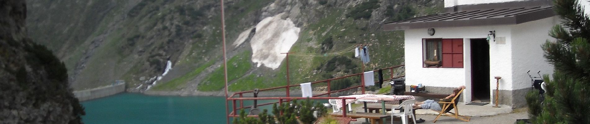
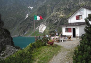
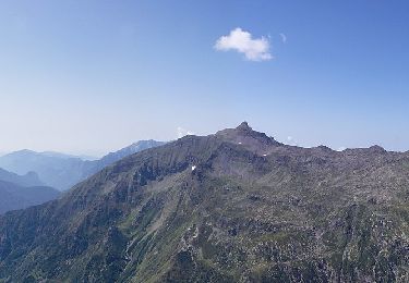
SENTIERO DELLE OROBIE (orientali)NB: Il tempo di percorrenza per questo sentiero è quello mediamente impiegato da un escursionista allenato (escluse le soste). Visto il tipo di fondo spesso "delicato" ove bisogna procedere con attenzione, questo tempo potrà variare anche di molto in base alle capacità ed allenamento del singolo escursionista.
Website: http://geoportale.caibergamo.it/sentiero/303
Plaatsbepaling
Opmerkingen
Wandeltochten in de omgeving
![Tocht Te voet Vilminore di Scalve - IT-407 - Photo](https://media.geolcdn.com/t/375/260/3a344b4e-a35f-4190-ad72-4463857492f4.jpeg&format=jpg&maxdim=2)
![Te voet Te voet](https://static1.geolcdn.com/sitytour/trail-icons/100.png)
Te voet
![](/images/other/stat-length.png)
![](https://static1.geolcdn.com/siteimages/upload/files/16400158638029165_repeat_loop_refresh_sync_direction_icon.png)
![Tocht Te voet Valbondione - (SI D21S) Rifugio Mario Merelli al Coca - Rifugio Antonio Curò - Photo](https://media.geolcdn.com/t/375/260/dc9674ce-f30f-4d50-9299-0838a57baa41.jpeg&format=jpg&maxdim=2)
![Te voet Te voet](https://static1.geolcdn.com/sitytour/trail-icons/100.png)
Te voet
![](/images/other/stat-length.png)
![](https://static1.geolcdn.com/siteimages/upload/files/16400158638029165_repeat_loop_refresh_sync_direction_icon.png)
![Tocht Te voet Valbondione - (SI D22S) Rifugio Antonio Curò - Rifugio Nani Tagliaferri al Passo di Venano - Photo](https://media.geolcdn.com/t/375/260/09774b9a-d4b0-47dc-9a41-3e254dcac854.jpeg&format=jpg&maxdim=2)
![Te voet Te voet](https://static1.geolcdn.com/sitytour/trail-icons/100.png)
Te voet
![](/images/other/stat-length.png)
![](https://static1.geolcdn.com/siteimages/upload/files/16400158638029165_repeat_loop_refresh_sync_direction_icon.png)
![Tocht Te voet Valbondione - 227: Fiumenero - Rifugio Baroni al Brunone - Photo](https://media.geolcdn.com/t/375/260/6f0e5eca-1ce1-4d9f-873a-af1d2c201f93.jpeg&format=jpg&maxdim=2)
![Te voet Te voet](https://static1.geolcdn.com/sitytour/trail-icons/100.png)
Te voet
![](/images/other/stat-length.png)
![](https://static1.geolcdn.com/siteimages/upload/files/16400158638029165_repeat_loop_refresh_sync_direction_icon.png)
![Tocht Te voet Valbondione - 323: Rifugio Coca - Bocchetta del Camoscio - Rifugio Curò - Photo](https://media.geolcdn.com/t/375/260/f53a505d-c2b6-4ef8-9eca-895079ec1f24.jpeg&format=jpg&maxdim=2)
![Te voet Te voet](https://static1.geolcdn.com/sitytour/trail-icons/100.png)
Te voet
![](/images/other/stat-length.png)
![](https://static1.geolcdn.com/siteimages/upload/files/16400158638029165_repeat_loop_refresh_sync_direction_icon.png)
![Tocht Te voet Valbondione - Sentiero delle Orobie Orientali - Tappa 7 - Photo](https://media.geolcdn.com/t/375/260/76765d9a-4898-4654-8692-0eca7d7ca2c7.jpeg&format=jpg&maxdim=2)
![Te voet Te voet](https://static1.geolcdn.com/sitytour/trail-icons/100.png)
Te voet
![](/images/other/stat-length.png)
![](https://static1.geolcdn.com/siteimages/upload/files/16400158638029165_repeat_loop_refresh_sync_direction_icon.png)
![Tocht Te voet Valbondione - 321: Rifugio Curò - Rifugio Tagliaferri - Photo](https://media.geolcdn.com/t/375/260/09774b9a-d4b0-47dc-9a41-3e254dcac854.jpeg&format=jpg&maxdim=2)
![Te voet Te voet](https://static1.geolcdn.com/sitytour/trail-icons/100.png)
Te voet
![](/images/other/stat-length.png)
![](https://static1.geolcdn.com/siteimages/upload/files/16400158638029165_repeat_loop_refresh_sync_direction_icon.png)
![Tocht Te voet Valbondione - 305: Valbondione - Rifugio Curò - Photo](https://media.geolcdn.com/t/375/260/41f82cff-ed6a-43d3-8f4d-37ae358c1c54.jpeg&format=jpg&maxdim=2)
![Te voet Te voet](https://static1.geolcdn.com/sitytour/trail-icons/100.png)
Te voet
![](/images/other/stat-length.png)
![](https://static1.geolcdn.com/siteimages/upload/files/16400158638029165_repeat_loop_refresh_sync_direction_icon.png)
![Tocht Te voet Valbondione - Sentiero Basso Brunone-Coca - Photo](https://media.geolcdn.com/t/375/260/d267633f-4c68-43b0-8e82-533cf7dc5ecc.jpeg&format=jpg&maxdim=2)
![Te voet Te voet](https://static1.geolcdn.com/sitytour/trail-icons/100.png)
Te voet
![](/images/other/stat-length.png)
![](https://static1.geolcdn.com/siteimages/upload/files/16400158638029165_repeat_loop_refresh_sync_direction_icon.png)