![](/images/other/stat-length.png)
![Tocht Te voet Valtorta - Sentiero 104: Valtorta (Costa) - Rifugio Grassi - Photo](https://media.geolcdn.com/t/1900/400/46c52b94-a4f6-46da-a2cc-e9178b760723.jpeg&format=pjpeg&maxdim=2)
Sentiero 104: Valtorta (Costa) - Rifugio Grassi
SityTrail - itinéraires balisés pédestres
Tous les sentiers balisés d’Europe GUIDE+
![Lengte](/images/other/stat-length.png)
![Max. hoogte](https://static1.geolcdn.com/siteimages/upload/files/1508320355ic_sort_altitude_max_24dp.png)
![Positief hoogteverschil](https://static1.geolcdn.com/siteimages/upload/files/1508320355ic_sort_den_pos_24dp.png)
![Km-Effort](/images/other/stat-length.png)
![Min. hoogte](https://static1.geolcdn.com/siteimages/upload/files/1508320355ic_sort_altitude_min_24dp.png)
![Negatief hoogteverschil](https://static1.geolcdn.com/siteimages/upload/files/1508320355ic_sort_den_neg_24dp.png)
![Boucle](https://static1.geolcdn.com/siteimages/upload/files/16400158638029165_repeat_loop_refresh_sync_direction_icon.png)
![Te voet](https://static1.geolcdn.com/sitytour/trail-icons/100.png)
3h34
Moeilijkheid : Gemakkelijk
![Scan deze QR-code om de tocht te openen in de SityTrail-applicatie](https://capi.geolives.com/qq0zvz2zws4bq2lad0pu/sitytour/trails/3112394/qr.png?size=200)
Gratisgps-wandelapplicatie
Over ons
Tocht Te voet van 6,4 km beschikbaar op Lombardije, Bergamo, Valtorta. Deze tocht wordt voorgesteld door SityTrail - itinéraires balisés pédestres.
Beschrijving
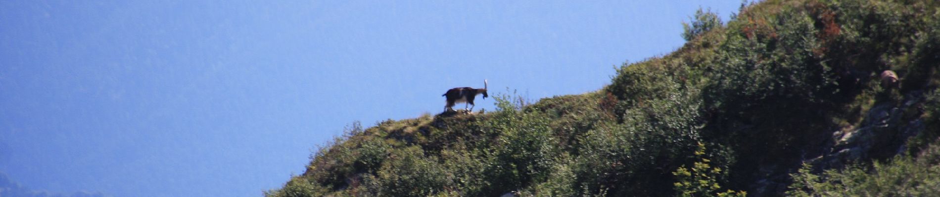
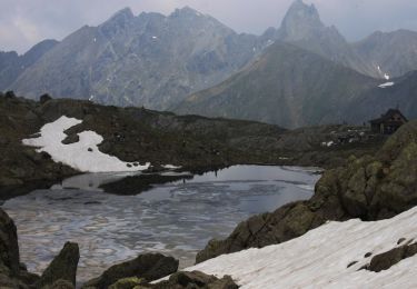
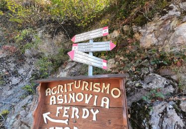
Dalla frazione Costa, sopra Valtorta (1113 m), si sale verso la Valle Grobbia lungo il lato destro (sinistro idrografico). Dopo circa 10 minuti si attraversa la valle e si sale con tornanti sull’altro versante. A quota 1336 m si arriva allo spartiacque con la valle del Borae che si sale dapprima nel bosco poi raggiungendo i prati nei pressi della baita Lavez (1508 m), della
Website: http://geoportale.caibergamo.it/sentiero/104
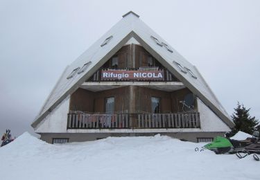
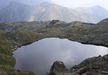
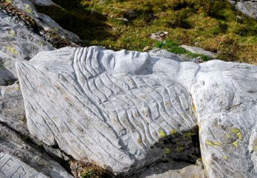
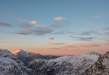
Plaatsbepaling
Opmerkingen
Wandeltochten in de omgeving
![Tocht Te voet Barzio - Sentiero delle Orobie Occidentali - Tappa 2 - Photo](https://media.geolcdn.com/t/375/260/62425f4a-83c8-4010-b4fe-ebd01c1857b6.jpeg&format=jpg&maxdim=2)
![Te voet Te voet](https://static1.geolcdn.com/sitytour/trail-icons/100.png)
Te voet
![](/images/other/stat-length.png)
![](https://static1.geolcdn.com/siteimages/upload/files/16400158638029165_repeat_loop_refresh_sync_direction_icon.png)
![Tocht Te voet Ornica - Sentiero delle Orobie Occidentali - Tappa 3 - Photo](https://media.geolcdn.com/t/375/260/bf042f57-cdb2-457c-931c-64f348431201.jpeg&format=jpg&maxdim=2)
![Te voet Te voet](https://static1.geolcdn.com/sitytour/trail-icons/100.png)
Te voet
![](/images/other/stat-length.png)
![](https://static1.geolcdn.com/siteimages/upload/files/16400158638029165_repeat_loop_refresh_sync_direction_icon.png)
![Tocht Te voet Barzio - Sentiero degli stradini - Photo](https://media.geolcdn.com/t/375/260/5a6a4880-c1df-4055-a06f-5e2791a54330.jpeg&format=jpg&maxdim=2)
![Te voet Te voet](https://static1.geolcdn.com/sitytour/trail-icons/100.png)
Te voet
![](/images/other/stat-length.png)
![](https://static1.geolcdn.com/siteimages/upload/files/16400158638029165_repeat_loop_refresh_sync_direction_icon.png)
![Tocht Te voet Valtorta - Piani di Valtorta – incrocio sentiero 101 (Rif. Cazzaniga) - Photo](https://media.geolcdn.com/t/375/260/80c66bfd-747f-47a1-9d7e-e3e28c8b9faf.jpeg&format=jpg&maxdim=2)
![Te voet Te voet](https://static1.geolcdn.com/sitytour/trail-icons/100.png)
Te voet
![](/images/other/stat-length.png)
![](https://static1.geolcdn.com/siteimages/upload/files/16400158638029165_repeat_loop_refresh_sync_direction_icon.png)
![Tocht Te voet Cusio - IT-108 - Photo](https://media.geolcdn.com/t/375/260/cd5b6074-39ef-42f7-b967-0a97a0b3a154.jpeg&format=jpg&maxdim=2)
![Te voet Te voet](https://static1.geolcdn.com/sitytour/trail-icons/100.png)
![Tocht Te voet Valtorta - (SI D15S) Rifugio Alberto Grassi - Rifugio Cesare Benigni - Photo](https://media.geolcdn.com/t/375/260/cd5b6074-39ef-42f7-b967-0a97a0b3a154.jpeg&format=jpg&maxdim=2)
![Te voet Te voet](https://static1.geolcdn.com/sitytour/trail-icons/100.png)
Te voet
![](/images/other/stat-length.png)
![](https://static1.geolcdn.com/siteimages/upload/files/16400158638029165_repeat_loop_refresh_sync_direction_icon.png)
![Tocht Te voet Ornica - (SI D16S) Rifugio Cesare Benigni - Rifugio Balicco - Photo](https://media.geolcdn.com/t/375/260/7b8815b0-6df3-4c6a-bc01-c96a03508ff7.jpeg&format=jpg&maxdim=2)
![Te voet Te voet](https://static1.geolcdn.com/sitytour/trail-icons/100.png)
Te voet
![](/images/other/stat-length.png)
![](https://static1.geolcdn.com/siteimages/upload/files/16400158638029165_repeat_loop_refresh_sync_direction_icon.png)
![Tocht Te voet Introbio - Sentiero 48 - Photo](https://media.geolcdn.com/t/375/260/3aca67b8-5df0-4a67-933d-9e5b474a1d24.jpeg&format=jpg&maxdim=2)
![Te voet Te voet](https://static1.geolcdn.com/sitytour/trail-icons/100.png)
Te voet
![](/images/other/stat-length.png)
![](https://static1.geolcdn.com/siteimages/upload/files/16400158638029165_repeat_loop_refresh_sync_direction_icon.png)
![Tocht Te voet Valtorta - IT-106 - Photo](https://media.geolcdn.com/t/375/260/1025f77c-2945-4774-af3c-4d35768f8b71.jpeg&format=jpg&maxdim=2)
![Te voet Te voet](https://static1.geolcdn.com/sitytour/trail-icons/100.png)
Te voet
![](/images/other/stat-length.png)
![](https://static1.geolcdn.com/siteimages/upload/files/16400158638029165_repeat_loop_refresh_sync_direction_icon.png)