![](/images/other/stat-length.png)
![Tocht Te voet Branzi - Rifugio Laghi Gemelli - Laghi: Colombo, Becco, Marcio - Rifugio Laghi Gemelli - Photo](https://media.geolcdn.com/t/1900/400/f3e4daa3-47f9-427a-a665-dfaad3be62d1.jpeg&format=pjpeg&maxdim=2)
Rifugio Laghi Gemelli - Laghi: Colombo, Becco, Marcio - Rifugio Laghi Gemelli
SityTrail - itinéraires balisés pédestres
Tous les sentiers balisés d’Europe GUIDE+
![Lengte](/images/other/stat-length.png)
Lengte
5,9 km
![Max. hoogte](https://static1.geolcdn.com/siteimages/upload/files/1508320355ic_sort_altitude_max_24dp.png)
Max. hoogte
2047 m
![Positief hoogteverschil](https://static1.geolcdn.com/siteimages/upload/files/1508320355ic_sort_den_pos_24dp.png)
Positief hoogteverschil
281 m
![Km-Effort](/images/other/stat-length.png)
Km-Effort
9,7 km
![Min. hoogte](https://static1.geolcdn.com/siteimages/upload/files/1508320355ic_sort_altitude_min_24dp.png)
Min. hoogte
1812 m
![Negatief hoogteverschil](https://static1.geolcdn.com/siteimages/upload/files/1508320355ic_sort_den_neg_24dp.png)
Negatief hoogteverschil
280 m
![Boucle](https://static1.geolcdn.com/siteimages/upload/files/16400158638029165_repeat_loop_refresh_sync_direction_icon.png)
Boucle
Ja
Markering
Datum van aanmaak :
2022-02-14 22:34:40.37
Laatste wijziging :
2022-02-28 16:03:43.548
![Te voet](https://static1.geolcdn.com/sitytour/trail-icons/100.png)
2h11
Moeilijkheid : Gemakkelijk
![Scan deze QR-code om de tocht te openen in de SityTrail-applicatie](https://capi.geolives.com/qq0zvz2zws4bq2lad0pu/sitytour/trails/3112093/qr.png?size=200)
Gratisgps-wandelapplicatie
Over ons
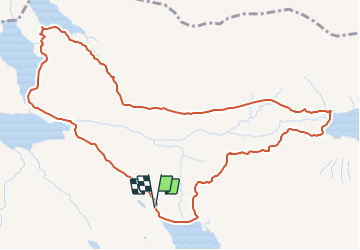
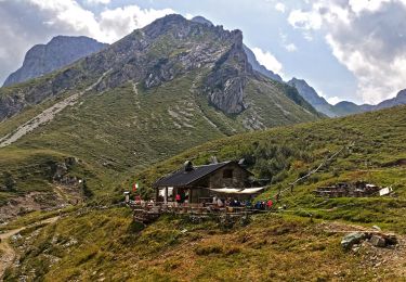
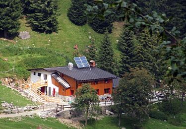
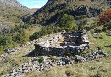
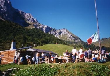
Tocht Te voet van 5,9 km beschikbaar op Lombardije, Bergamo, Branzi. Deze tocht wordt voorgesteld door SityTrail - itinéraires balisés pédestres.
Beschrijving
Trail created by Club Alpino Italiano Bergamo.
parte del sentiero delle Orobie Centro Orientali
Symbol: vertical stripes Red-White-Red, with a red 250 number
Plaatsbepaling
Land:
Italy
Regio :
Lombardije
Departement/Provincie :
Bergamo
Gemeente :
Branzi
Locatie:
Unknown
Vertrek:(Dec)
Vertrek:(UTM)
562236 ; 5093573 (32T) N.
Opmerkingen
Wandeltochten in de omgeving
![Tocht Te voet Valleve - Sentiero 117: Valleve (fraz. Valrobà) - Forcolino di Torcola - Photo](https://media.geolcdn.com/t/375/260/07a5e245-4604-4e71-a34e-39eb8136acfa.jpeg&format=jpg&maxdim=2)
![Te voet Te voet](https://static1.geolcdn.com/sitytour/trail-icons/100.png)
Sentiero 117: Valleve (fraz. Valrobà) - Forcolino di Torcola
Te voet
Gemakkelijk
Valleve,
Lombardije,
Bergamo,
Italy
![](/images/other/stat-length.png)
4,5 km | 11,8 km-effort
2h 41min
![](https://static1.geolcdn.com/siteimages/upload/files/16400158638029165_repeat_loop_refresh_sync_direction_icon.png)
Neen
![Tocht Te voet Valgoglio - IT-268 - Photo](https://media.geolcdn.com/t/375/260/e13e67f4-f369-416e-ab43-950817536408.jpeg&format=jpg&maxdim=2)
![Te voet Te voet](https://static1.geolcdn.com/sitytour/trail-icons/100.png)
IT-268
Te voet
Gemakkelijk
Valgoglio,
Lombardije,
Bergamo,
Italy
![](/images/other/stat-length.png)
6,4 km | 10,2 km-effort
2h 19min
![](https://static1.geolcdn.com/siteimages/upload/files/16400158638029165_repeat_loop_refresh_sync_direction_icon.png)
Neen
![Tocht Te voet Branzi - Rifugio Laghi Gemelli - Passo d'Aviasco - Photo](https://media.geolcdn.com/t/375/260/2f65df6b-db05-4818-a26d-7af006e6b5dc.jpeg&format=jpg&maxdim=2)
![Te voet Te voet](https://static1.geolcdn.com/sitytour/trail-icons/100.png)
Rifugio Laghi Gemelli - Passo d'Aviasco
Te voet
Gemakkelijk
Branzi,
Lombardije,
Bergamo,
Italy
![](/images/other/stat-length.png)
3,9 km | 7,9 km-effort
1h 48min
![](https://static1.geolcdn.com/siteimages/upload/files/16400158638029165_repeat_loop_refresh_sync_direction_icon.png)
Neen
![Tocht Te voet Carona - IT-209 - Photo](https://media.geolcdn.com/t/375/260/2dda619e-2d22-4d18-bff7-ab7fdf50f017.jpeg&format=jpg&maxdim=2)
![Te voet Te voet](https://static1.geolcdn.com/sitytour/trail-icons/100.png)
![Tocht Te voet Branzi - Sentiero delle Orobie Orientali - Tappa 3 - Photo](https://media.geolcdn.com/t/375/260/c237ea19-da1c-4881-924c-cb207b0f18eb.jpeg&format=jpg&maxdim=2)
![Te voet Te voet](https://static1.geolcdn.com/sitytour/trail-icons/100.png)
Sentiero delle Orobie Orientali - Tappa 3
Te voet
Gemakkelijk
Branzi,
Lombardije,
Bergamo,
Italy
![](/images/other/stat-length.png)
11,7 km | 19,4 km-effort
4h 24min
![](https://static1.geolcdn.com/siteimages/upload/files/16400158638029165_repeat_loop_refresh_sync_direction_icon.png)
Neen
![Tocht Te voet Oltre il Colle - Sentiero dei fiori - Photo](https://media.geolcdn.com/t/375/260/f404753e-5139-4c2c-8c0f-f5703bea0a69.jpeg&format=jpg&maxdim=2)
![Te voet Te voet](https://static1.geolcdn.com/sitytour/trail-icons/100.png)
Sentiero dei fiori
Te voet
Gemakkelijk
Oltre il Colle,
Lombardije,
Bergamo,
Italy
![](/images/other/stat-length.png)
3,5 km | 5,9 km-effort
1h 19min
![](https://static1.geolcdn.com/siteimages/upload/files/16400158638029165_repeat_loop_refresh_sync_direction_icon.png)
Neen
![Tocht Te voet Ardesio - Sentiero delle Orobie Orientali - Tappa 2 - Photo](https://media.geolcdn.com/t/375/260/224d9863-58ef-4ed1-bba3-8943a07df102.jpeg&format=jpg&maxdim=2)
![Te voet Te voet](https://static1.geolcdn.com/sitytour/trail-icons/100.png)
Sentiero delle Orobie Orientali - Tappa 2
Te voet
Gemakkelijk
Ardesio,
Lombardije,
Bergamo,
Italy
![](/images/other/stat-length.png)
5,8 km | 13,5 km-effort
3h 4min
![](https://static1.geolcdn.com/siteimages/upload/files/16400158638029165_repeat_loop_refresh_sync_direction_icon.png)
Neen
![Tocht Te voet Roncobello - Baite di Mezzeno - Rifugio Laghi Gemelli - Photo](https://media.geolcdn.com/t/375/260/f3e4daa3-47f9-427a-a665-dfaad3be62d1.jpeg&format=jpg&maxdim=2)
![Te voet Te voet](https://static1.geolcdn.com/sitytour/trail-icons/100.png)
Baite di Mezzeno - Rifugio Laghi Gemelli
Te voet
Gemakkelijk
Roncobello,
Lombardije,
Bergamo,
Italy
![](/images/other/stat-length.png)
4,4 km | 10,4 km-effort
2h 21min
![](https://static1.geolcdn.com/siteimages/upload/files/16400158638029165_repeat_loop_refresh_sync_direction_icon.png)
Neen
![Tocht Te voet Ardesio - IT-218 - Photo](https://media.geolcdn.com/t/375/260/78b0b6c1-7165-4bb5-a6a3-70a2fbd0b284.jpeg&format=jpg&maxdim=2)
![Te voet Te voet](https://static1.geolcdn.com/sitytour/trail-icons/100.png)
IT-218
Te voet
Gemakkelijk
Ardesio,
Lombardije,
Bergamo,
Italy
![](/images/other/stat-length.png)
7,4 km | 15,9 km-effort
3h 36min
![](https://static1.geolcdn.com/siteimages/upload/files/16400158638029165_repeat_loop_refresh_sync_direction_icon.png)
Neen