![](/images/other/stat-length.png)
![Tocht Te voet Alte - Águas Frias - Photo](https://media.geolcdn.com/t/1900/400/5a2d6c7b-af6c-48b4-acc0-1ac0890a0d55.jpeg&format=pjpeg&maxdim=2)
Águas Frias
SityTrail - itinéraires balisés pédestres
Tous les sentiers balisés d’Europe GUIDE+
![Lengte](/images/other/stat-length.png)
Lengte
12,3 km
![Max. hoogte](https://static1.geolcdn.com/siteimages/upload/files/1508320355ic_sort_altitude_max_24dp.png)
Max. hoogte
373 m
![Positief hoogteverschil](https://static1.geolcdn.com/siteimages/upload/files/1508320355ic_sort_den_pos_24dp.png)
Positief hoogteverschil
331 m
![Km-Effort](/images/other/stat-length.png)
Km-Effort
16,7 km
![Min. hoogte](https://static1.geolcdn.com/siteimages/upload/files/1508320355ic_sort_altitude_min_24dp.png)
Min. hoogte
174 m
![Negatief hoogteverschil](https://static1.geolcdn.com/siteimages/upload/files/1508320355ic_sort_den_neg_24dp.png)
Negatief hoogteverschil
332 m
![Boucle](https://static1.geolcdn.com/siteimages/upload/files/16400158638029165_repeat_loop_refresh_sync_direction_icon.png)
Boucle
Ja
Markering
Datum van aanmaak :
2022-02-14 15:22:03.715
Laatste wijziging :
2022-02-14 15:22:03.715
![Te voet](https://static1.geolcdn.com/sitytour/trail-icons/100.png)
3h47
Moeilijkheid : Gemakkelijk
![Scan deze QR-code om de tocht te openen in de SityTrail-applicatie](https://capi.geolives.com/qq0zvz2zws4bq2lad0pu/sitytour/trails/3110075/qr.png?size=200)
Gratisgps-wandelapplicatie
Over ons
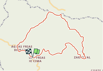
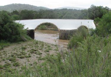
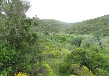
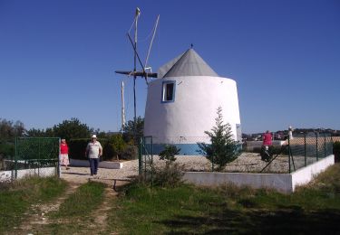
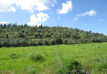
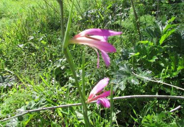
Tocht Te voet van 12,3 km beschikbaar op Algarve, Faro, Alte. Deze tocht wordt voorgesteld door SityTrail - itinéraires balisés pédestres.
Beschrijving
Trail created by Câmara Municipal de Loulé.
Plaatsbepaling
Land:
Portugal
Regio :
Algarve
Departement/Provincie :
Faro
Gemeente :
Alte
Locatie:
Unknown
Vertrek:(Dec)
Vertrek:(UTM)
573406 ; 4129933 (29S) N.
Opmerkingen
Wandeltochten in de omgeving
![Tocht Te voet Querença, Tôr e Benafim - Serra e Montes - Photo](https://media.geolcdn.com/t/375/260/9be057aa-c121-437c-ae24-52f39a384057.jpeg&format=jpg&maxdim=2)
![Te voet Te voet](https://static1.geolcdn.com/sitytour/trail-icons/100.png)
Serra e Montes
Te voet
Gemakkelijk
Querença, Tôr e Benafim,
Algarve,
Faro,
Portugal
![](/images/other/stat-length.png)
10,4 km | 14,9 km-effort
3h 22min
![](https://static1.geolcdn.com/siteimages/upload/files/16400158638029165_repeat_loop_refresh_sync_direction_icon.png)
Ja
![Tocht Te voet Salir - Rocha da Pena - Photo](https://media.geolcdn.com/t/375/260/ae95d569-9866-477e-bc45-d5c9477deebe.jpeg&format=jpg&maxdim=2)
![Te voet Te voet](https://static1.geolcdn.com/sitytour/trail-icons/100.png)
![Tocht Te voet Querença, Tôr e Benafim - Tôr - Photo](https://media.geolcdn.com/t/375/260/230737c3-2d59-445e-8c19-6cd12a0ea9d0.jpeg&format=jpg&maxdim=2)
![Te voet Te voet](https://static1.geolcdn.com/sitytour/trail-icons/100.png)
Tôr
Te voet
Gemakkelijk
Querença, Tôr e Benafim,
Algarve,
Faro,
Portugal
![](/images/other/stat-length.png)
5,3 km | 6,4 km-effort
1h 27min
![](https://static1.geolcdn.com/siteimages/upload/files/16400158638029165_repeat_loop_refresh_sync_direction_icon.png)
Ja
![Tocht Te voet Querença, Tôr e Benafim - Fonte Benémola - Photo](https://media.geolcdn.com/t/375/260/bcbc163c-e7e1-4cd3-bf1b-7c2d14573a35.jpeg&format=jpg&maxdim=2)
![Te voet Te voet](https://static1.geolcdn.com/sitytour/trail-icons/100.png)
Fonte Benémola
Te voet
Gemakkelijk
Querença, Tôr e Benafim,
Algarve,
Faro,
Portugal
![](/images/other/stat-length.png)
3,5 km | 4,3 km-effort
58min
![](https://static1.geolcdn.com/siteimages/upload/files/16400158638029165_repeat_loop_refresh_sync_direction_icon.png)
Ja
![Tocht Te voet Querença, Tôr e Benafim - 7 Fontes - Photo](https://media.geolcdn.com/t/375/260/1fae3fb9-1fae-4f37-a4bf-b3dcc35ff83f.jpeg&format=jpg&maxdim=2)
![Te voet Te voet](https://static1.geolcdn.com/sitytour/trail-icons/100.png)
7 Fontes
Te voet
Gemakkelijk
Querença, Tôr e Benafim,
Algarve,
Faro,
Portugal
![](/images/other/stat-length.png)
8,8 km | 11,8 km-effort
2h 40min
![](https://static1.geolcdn.com/siteimages/upload/files/16400158638029165_repeat_loop_refresh_sync_direction_icon.png)
Ja
![Tocht Te voet Paderne - Percurso do Castelo - Photo](https://media.geolcdn.com/t/375/260/98815ed8-b88e-4ca7-9075-2fc67c0dc504.jpeg&format=jpg&maxdim=2)
![Te voet Te voet](https://static1.geolcdn.com/sitytour/trail-icons/100.png)
Percurso do Castelo
Te voet
Gemakkelijk
(1)
Paderne,
Algarve,
Faro,
Portugal
![](/images/other/stat-length.png)
10,5 km | 13,6 km-effort
3h 5min
![](https://static1.geolcdn.com/siteimages/upload/files/16400158638029165_repeat_loop_refresh_sync_direction_icon.png)
Ja
![Tocht Te voet Paderne - Percurso do Cerro Grande - Photo](https://media.geolcdn.com/t/375/260/c29eb105-21fe-4578-a977-f77884173e47.jpeg&format=jpg&maxdim=2)
![Te voet Te voet](https://static1.geolcdn.com/sitytour/trail-icons/100.png)
Percurso do Cerro Grande
Te voet
Gemakkelijk
Paderne,
Algarve,
Faro,
Portugal
![](/images/other/stat-length.png)
11,4 km | 14,8 km-effort
3h 22min
![](https://static1.geolcdn.com/siteimages/upload/files/16400158638029165_repeat_loop_refresh_sync_direction_icon.png)
Ja
![Tocht Te voet São Bartolomeu de Messines - Vale Fuzeiros - Photo](https://media.geolcdn.com/t/375/260/698fdc58-e333-4423-a36c-2131f8fac965.jpeg&format=jpg&maxdim=2)
![Te voet Te voet](https://static1.geolcdn.com/sitytour/trail-icons/100.png)
Vale Fuzeiros
Te voet
Gemakkelijk
(1)
São Bartolomeu de Messines,
Algarve,
Faro,
Portugal
![](/images/other/stat-length.png)
6,9 km | 9,5 km-effort
2h 9min
![](https://static1.geolcdn.com/siteimages/upload/files/16400158638029165_repeat_loop_refresh_sync_direction_icon.png)
Ja
![Tocht Te voet Paderne - Percurso do Cerro de São Vicente - Photo](https://media.geolcdn.com/t/375/260/f581e8e9-24b3-4632-ad50-9e7b51c44a9e.jpeg&format=jpg&maxdim=2)
![Te voet Te voet](https://static1.geolcdn.com/sitytour/trail-icons/100.png)
Percurso do Cerro de São Vicente
Te voet
Gemakkelijk
(1)
Paderne,
Algarve,
Faro,
Portugal
![](/images/other/stat-length.png)
10,9 km | 13,7 km-effort
3h 7min
![](https://static1.geolcdn.com/siteimages/upload/files/16400158638029165_repeat_loop_refresh_sync_direction_icon.png)
Ja