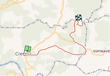
![](/images/other/stat-length.png)
![Tocht Te voet Crespià - Ruta de la Font - Photo](https://media.geolcdn.com/t/1900/400/b833bb1d-ec48-4995-bc7a-522ef4644659.jpeg&format=pjpeg&maxdim=2)
Ruta de la Font
SityTrail - itinéraires balisés pédestres
Tous les sentiers balisés d’Europe GUIDE+
![Lengte](/images/other/stat-length.png)
![Max. hoogte](https://static1.geolcdn.com/siteimages/upload/files/1508320355ic_sort_altitude_max_24dp.png)
![Positief hoogteverschil](https://static1.geolcdn.com/siteimages/upload/files/1508320355ic_sort_den_pos_24dp.png)
![Km-Effort](/images/other/stat-length.png)
![Min. hoogte](https://static1.geolcdn.com/siteimages/upload/files/1508320355ic_sort_altitude_min_24dp.png)
![Negatief hoogteverschil](https://static1.geolcdn.com/siteimages/upload/files/1508320355ic_sort_den_neg_24dp.png)
![Boucle](https://static1.geolcdn.com/siteimages/upload/files/16400158638029165_repeat_loop_refresh_sync_direction_icon.png)
![Te voet](https://static1.geolcdn.com/sitytour/trail-icons/100.png)
1h33
Moeilijkheid : Gemakkelijk
![Scan deze QR-code om de tocht te openen in de SityTrail-applicatie](https://capi.geolives.com/qq0zvz2zws4bq2lad0pu/sitytour/trails/3110057/qr.png?size=200)
Gratisgps-wandelapplicatie
Over ons
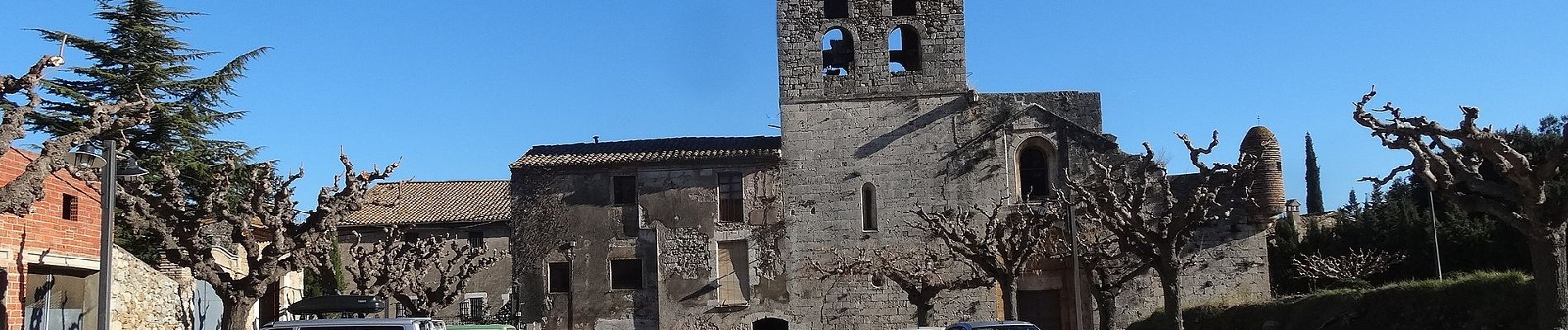
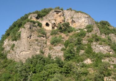
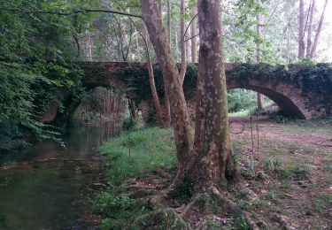
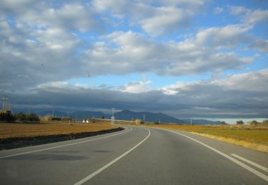
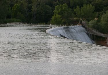
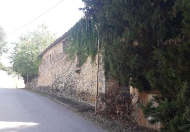
Tocht Te voet van 5,9 km beschikbaar op Catalonië, Gerona, Crespià. Deze tocht wordt voorgesteld door SityTrail - itinéraires balisés pédestres.
Beschrijving
Trail created by Consell Comarcal del Pla de L'Estany.
Website: http://turisme.plaestany.cat/wp-content/uploads/2018/07/camins-de-noguers-milenaris-turisme-pla-estany.pdf
Plaatsbepaling
Opmerkingen
Wandeltochten in de omgeving
![Tocht Te voet Crespià - Crespià-Pedrinyà-Sant Miquel de la Roca - Photo](https://media.geolcdn.com/t/375/260/f15c5281-f9ff-44dd-9738-7f66ab74f9cd.jpeg&format=jpg&maxdim=2)
![Te voet Te voet](https://static1.geolcdn.com/sitytour/trail-icons/100.png)
Te voet
![](/images/other/stat-length.png)
![](https://static1.geolcdn.com/siteimages/upload/files/16400158638029165_repeat_loop_refresh_sync_direction_icon.png)
![Tocht Te voet Maià de Montcal - Ruta del romaní - Photo](https://media.geolcdn.com/t/375/260/2c173b61-e6ce-4bbd-b16b-b8d172bb0f25.jpeg&format=jpg&maxdim=2)
![Te voet Te voet](https://static1.geolcdn.com/sitytour/trail-icons/100.png)
Te voet
![](/images/other/stat-length.png)
![](https://static1.geolcdn.com/siteimages/upload/files/16400158638029165_repeat_loop_refresh_sync_direction_icon.png)
![Tocht Te voet Maià de Montcal - Balcó de la Garrotxa - Photo](https://media.geolcdn.com/t/375/260/727141d5-2c9d-48b1-8444-e50cc7feda29.jpeg&format=jpg&maxdim=2)
![Te voet Te voet](https://static1.geolcdn.com/sitytour/trail-icons/100.png)
Te voet
![](/images/other/stat-length.png)
![](https://static1.geolcdn.com/siteimages/upload/files/16400158638029165_repeat_loop_refresh_sync_direction_icon.png)
![Tocht Te voet Serinyà - Itinerari Mitjà - Serinyà - Photo](https://media.geolcdn.com/t/375/260/5db1764c-cfad-4689-8bf0-466d4a67092f.jpeg&format=jpg&maxdim=2)
![Te voet Te voet](https://static1.geolcdn.com/sitytour/trail-icons/100.png)
Te voet
![](/images/other/stat-length.png)
![](https://static1.geolcdn.com/siteimages/upload/files/16400158638029165_repeat_loop_refresh_sync_direction_icon.png)
![Tocht Te voet Serinyà - Itinerari Llarg - Serinyà - Photo](https://media.geolcdn.com/t/375/260/dc157c92-fc6d-468a-8d4d-11d6001e0514.jpeg&format=jpg&maxdim=2)
![Te voet Te voet](https://static1.geolcdn.com/sitytour/trail-icons/100.png)
Te voet
![](/images/other/stat-length.png)
![](https://static1.geolcdn.com/siteimages/upload/files/16400158638029165_repeat_loop_refresh_sync_direction_icon.png)
![Tocht Te voet Fontcoberta - Itinerari Mitjà - Fontcoberta - Photo](https://media.geolcdn.com/t/375/260/3a50dc6f-a7ba-41a9-a9d5-33599dc651b3.jpeg&format=jpg&maxdim=2)
![Te voet Te voet](https://static1.geolcdn.com/sitytour/trail-icons/100.png)
Te voet
![](/images/other/stat-length.png)
![](https://static1.geolcdn.com/siteimages/upload/files/16400158638029165_repeat_loop_refresh_sync_direction_icon.png)
![Tocht Te voet Fontcoberta - Itinerari Llarg - Fontcoberta - Photo](https://media.geolcdn.com/t/375/260/3723e66b-0129-4439-9875-6515162a7c96.jpeg&format=jpg&maxdim=2)
![Te voet Te voet](https://static1.geolcdn.com/sitytour/trail-icons/100.png)
Te voet
![](/images/other/stat-length.png)
![](https://static1.geolcdn.com/siteimages/upload/files/16400158638029165_repeat_loop_refresh_sync_direction_icon.png)
![Tocht Te voet Serinyà - Pla de Martís i Fluvià - Photo](https://media.geolcdn.com/t/375/260/50065d0a-cf30-42ce-aae7-26cf203acadb.jpeg&format=jpg&maxdim=2)
![Te voet Te voet](https://static1.geolcdn.com/sitytour/trail-icons/100.png)
Te voet
![](/images/other/stat-length.png)
![](https://static1.geolcdn.com/siteimages/upload/files/16400158638029165_repeat_loop_refresh_sync_direction_icon.png)
![Tocht Te voet Serinyà - Font de Caselles - Photo](https://media.geolcdn.com/t/375/260/d8b3ab24-af9c-4dc4-b31f-c90e0a60eb01.jpeg&format=jpg&maxdim=2)
![Te voet Te voet](https://static1.geolcdn.com/sitytour/trail-icons/100.png)
Te voet
![](/images/other/stat-length.png)
![](https://static1.geolcdn.com/siteimages/upload/files/16400158638029165_repeat_loop_refresh_sync_direction_icon.png)