![](/images/other/stat-length.png)
![Tocht Te voet Eijsden-Margraten - Banholt Ba1 - Photo](https://media.geolcdn.com/t/1900/400/948a1008-d821-4c87-a6a2-3792c1365e99.jpeg&format=pjpeg&maxdim=2)
Banholt Ba1
SityTrail - itinéraires balisés pédestres
Tous les sentiers balisés d’Europe GUIDE+
![Lengte](/images/other/stat-length.png)
Lengte
8,3 km
![Max. hoogte](https://static1.geolcdn.com/siteimages/upload/files/1508320355ic_sort_altitude_max_24dp.png)
Max. hoogte
187 m
![Positief hoogteverschil](https://static1.geolcdn.com/siteimages/upload/files/1508320355ic_sort_den_pos_24dp.png)
Positief hoogteverschil
103 m
![Km-Effort](/images/other/stat-length.png)
Km-Effort
9,7 km
![Min. hoogte](https://static1.geolcdn.com/siteimages/upload/files/1508320355ic_sort_altitude_min_24dp.png)
Min. hoogte
139 m
![Negatief hoogteverschil](https://static1.geolcdn.com/siteimages/upload/files/1508320355ic_sort_den_neg_24dp.png)
Negatief hoogteverschil
102 m
![Boucle](https://static1.geolcdn.com/siteimages/upload/files/16400158638029165_repeat_loop_refresh_sync_direction_icon.png)
Boucle
Ja
Markering
Datum van aanmaak :
2022-02-14 15:16:49.553
Laatste wijziging :
2022-02-14 15:16:49.553
![Te voet](https://static1.geolcdn.com/sitytour/trail-icons/100.png)
2h12
Moeilijkheid : Gemakkelijk
![Scan deze QR-code om de tocht te openen in de SityTrail-applicatie](https://capi.geolives.com/qq0zvz2zws4bq2lad0pu/sitytour/trails/3109938/qr.png?size=200)
Gratisgps-wandelapplicatie
Over ons
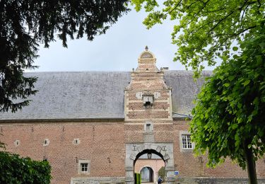
Tocht Te voet van 8,3 km beschikbaar op Limburg, Onbekend, Eijsden-Margraten. Deze tocht wordt voorgesteld door SityTrail - itinéraires balisés pédestres.
Beschrijving
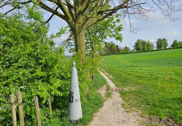
Symbol: blauwe palen
Plaatsbepaling
Land:
Netherlands
Regio :
Limburg
Departement/Provincie :
Onbekend
Gemeente :
Eijsden-Margraten
Locatie:
Unknown
Vertrek:(Dec)
Vertrek:(UTM)
697832 ; 5630054 (31U) N.
Opmerkingen
Wandeltochten in de omgeving
![Tocht Stappen Eijsden-Margraten - Gulpen - Hubertusmarkt - Photo](https://media.geolcdn.com/t/375/260/6a2a5595-eb93-4f0f-8c09-6c6ead7a7201.jpg&format=jpg&maxdim=2)
![Stappen Stappen](https://static1.geolcdn.com/sitytour/trail-icons/101.png)
Gulpen - Hubertusmarkt
Stappen
Medium
(1)
Eijsden-Margraten,
Limburg,
Onbekend,
Netherlands
![](/images/other/stat-length.png)
11,5 km | 13,3 km-effort
3h 1min
![](https://static1.geolcdn.com/siteimages/upload/files/16400158638029165_repeat_loop_refresh_sync_direction_icon.png)
Ja
![Tocht Stappen Eijsden-Margraten - Mheer - Banholt - Hoogbos - Photo](https://media.geolcdn.com/t/375/260/1f70cdf1-9a0b-4d25-acc7-7c75993bbb86.jpg&format=jpg&maxdim=2)
![Stappen Stappen](https://static1.geolcdn.com/sitytour/trail-icons/101.png)
Mheer - Banholt - Hoogbos
Stappen
Medium
(1)
Eijsden-Margraten,
Limburg,
Onbekend,
Netherlands
![](/images/other/stat-length.png)
12,5 km | 14,5 km-effort
3h 4min
![](https://static1.geolcdn.com/siteimages/upload/files/16400158638029165_repeat_loop_refresh_sync_direction_icon.png)
Ja
![Tocht Stappen Voeren - Amstel Gold Race 2024 🚲 - Photo](https://media.geolcdn.com/t/375/260/bca146f7-0c03-4970-a3ca-ea328283e994.jpg&format=jpg&maxdim=2)
![Stappen Stappen](https://static1.geolcdn.com/sitytour/trail-icons/101.png)
Amstel Gold Race 2024 🚲
Stappen
Medium
(1)
Voeren,
Vlaanderen,
Limburg,
Belgium
![](/images/other/stat-length.png)
11,7 km | 14,9 km-effort
3h 23min
![](https://static1.geolcdn.com/siteimages/upload/files/16400158638029165_repeat_loop_refresh_sync_direction_icon.png)
Ja
![Tocht Stappen Voeren - Ulvend - La Planck - Noorbeek - Photo](https://media.geolcdn.com/t/375/260/1b8a3af4-c436-4943-b8e2-3197209c6144.jpg&format=jpg&maxdim=2)
![Stappen Stappen](https://static1.geolcdn.com/sitytour/trail-icons/101.png)
Ulvend - La Planck - Noorbeek
Stappen
Gemakkelijk
(1)
Voeren,
Vlaanderen,
Limburg,
Belgium
![](/images/other/stat-length.png)
17 km | 22 km-effort
4h 57min
![](https://static1.geolcdn.com/siteimages/upload/files/16400158638029165_repeat_loop_refresh_sync_direction_icon.png)
Ja
![Tocht Stappen Voeren - 2022-11-11_17h35m36_wandelroute-de-voerstreek-mooiste - Photo](https://media.geolcdn.com/t/375/260/3df743f8-88e4-4c10-a47a-c05fdf0072fe.jpg&format=jpg&maxdim=2)
![Stappen Stappen](https://static1.geolcdn.com/sitytour/trail-icons/101.png)
2022-11-11_17h35m36_wandelroute-de-voerstreek-mooiste
Stappen
Medium
(1)
Voeren,
Vlaanderen,
Limburg,
Belgium
![](/images/other/stat-length.png)
9,3 km | 12,5 km-effort
2h 49min
![](https://static1.geolcdn.com/siteimages/upload/files/16400158638029165_repeat_loop_refresh_sync_direction_icon.png)
Ja
![Tocht Stappen Voeren - 2021-10-13_17h01m13_fouron-le-comte - Photo](https://media.geolcdn.com/t/375/260/e05bdacf-e910-4818-b0aa-de5529cdf1e8.jpg&format=jpg&maxdim=2)
![Stappen Stappen](https://static1.geolcdn.com/sitytour/trail-icons/101.png)
2021-10-13_17h01m13_fouron-le-comte
Stappen
Gemakkelijk
(1)
Voeren,
Vlaanderen,
Limburg,
Belgium
![](/images/other/stat-length.png)
14,5 km | 16,9 km-effort
3h 50min
![](https://static1.geolcdn.com/siteimages/upload/files/16400158638029165_repeat_loop_refresh_sync_direction_icon.png)
Ja
![Tocht Stappen Eijsden-Margraten - 2021-06-19_19h26m43_031 - Photo](https://media.geolcdn.com/t/375/260/136c3226-85ca-4638-b449-da2a119d703c.jpg&format=jpg&maxdim=2)
![Stappen Stappen](https://static1.geolcdn.com/sitytour/trail-icons/101.png)
2021-06-19_19h26m43_031
Stappen
Gemakkelijk
(1)
Eijsden-Margraten,
Limburg,
Onbekend,
Netherlands
![](/images/other/stat-length.png)
13,3 km | 15,7 km-effort
3h 34min
![](https://static1.geolcdn.com/siteimages/upload/files/16400158638029165_repeat_loop_refresh_sync_direction_icon.png)
Ja
![Tocht Stappen Gulpen-Wittem - 2021-06-07_20h39m29_1049 - Photo](https://media.geolcdn.com/t/375/260/5452331d-e6b6-4009-a659-a148ef85d520.jpg&format=jpg&maxdim=2)
![Stappen Stappen](https://static1.geolcdn.com/sitytour/trail-icons/101.png)
2021-06-07_20h39m29_1049
Stappen
Gemakkelijk
(1)
Gulpen-Wittem,
Limburg,
Onbekend,
Netherlands
![](/images/other/stat-length.png)
14,7 km | 18,7 km-effort
4h 15min
![](https://static1.geolcdn.com/siteimages/upload/files/16400158638029165_repeat_loop_refresh_sync_direction_icon.png)
Ja
![Tocht Stappen Gulpen-Wittem - 2021-03-30_19h30m42_1141 - Photo](https://media.geolcdn.com/t/375/260/4eff2d95-7f9b-4081-a7dd-49c9945fbab4.jpg&format=jpg&maxdim=2)
![Stappen Stappen](https://static1.geolcdn.com/sitytour/trail-icons/101.png)
2021-03-30_19h30m42_1141
Stappen
Gemakkelijk
(2)
Gulpen-Wittem,
Limburg,
Onbekend,
Netherlands
![](/images/other/stat-length.png)
12,5 km | 16,1 km-effort
3h 38min
![](https://static1.geolcdn.com/siteimages/upload/files/16400158638029165_repeat_loop_refresh_sync_direction_icon.png)
Ja