


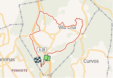

4,1 km | 5,4 km-effort

Tous les sentiers balisés d’Europe GUIDE+


Gratisgps-wandelapplicatie
 SityTrail
IGN / Geografische instituten
SityTrail World
De wereld gaat voor u open
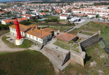
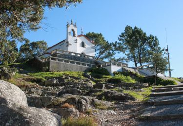
Tocht Te voet van 9,5 km beschikbaar op Norte, Braga, Vila Chã. Deze tocht wordt voorgesteld door SityTrail - itinéraires balisés pédestres.
Website: https://www.visitesposende.com/pt/fazer/percursos/pr6-eps-castro-de-s-lourenco


Te voet
Te voet
Te voet
Te voet
Te voet

Stappen


sport
Stappen