![](/images/other/stat-length.png)
![Tocht Te voet Porqueres - Ruta de Can Morgat i Puig Clarà - Photo](https://media.geolcdn.com/t/1900/400/ext.pjpeg?maxdim=2&url=https%3A%2F%2Fmedia.geolcdn.com%2Ff%2F0be58f3b-c2a3-43d0-8a6a-41e39edace92.jpeg)
Ruta de Can Morgat i Puig Clarà
SityTrail - itinéraires balisés pédestres
Tous les sentiers balisés d’Europe PRO
![Lengte](/images/other/stat-length.png)
Lengte
5,6 km
![Max. hoogte](https://static1.geolcdn.com/siteimages/upload/files/1508320355ic_sort_altitude_max_24dp.png)
Max. hoogte
293 m
![Positief hoogteverschil](https://static1.geolcdn.com/siteimages/upload/files/1508320355ic_sort_den_pos_24dp.png)
Positief hoogteverschil
147 m
![Km-Effort](/images/other/stat-length.png)
Km-Effort
7,4 km
![Min. hoogte](https://static1.geolcdn.com/siteimages/upload/files/1508320355ic_sort_altitude_min_24dp.png)
Min. hoogte
176 m
![Negatief hoogteverschil](https://static1.geolcdn.com/siteimages/upload/files/1508320355ic_sort_den_neg_24dp.png)
Negatief hoogteverschil
100 m
![Boucle](https://static1.geolcdn.com/siteimages/upload/files/16400158638029165_repeat_loop_refresh_sync_direction_icon.png)
Boucle
Neen
Markering
Datum van aanmaak :
2022-02-14 14:47:36.288
Laatste wijziging :
2022-02-14 14:47:36.288
![Te voet](https://static1.geolcdn.com/sitytour/trail-icons/100.png)
1h41
Moeilijkheid : Gemakkelijk
![Scan deze QR-code om de tocht te openen in de SityTrail-applicatie](https://capi.geolives.com/qq0zvz2zws4bq2lad0pu/sitytour/trails/3109266/qr.png?size=200)
Gratisgps-wandelapplicatie
Over ons
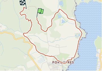
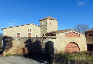
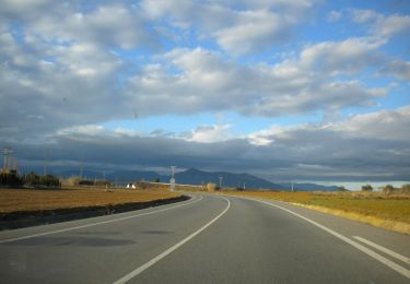
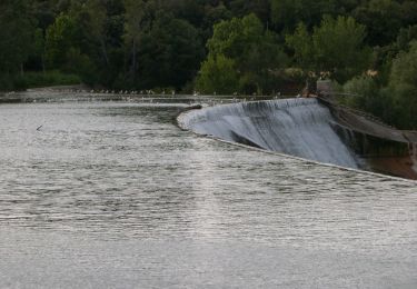
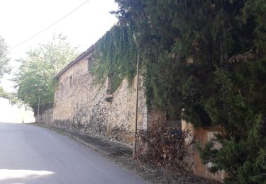
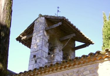
Tocht Te voet van 5,6 km beschikbaar op Catalonië, Gerona, Porqueres. Deze tocht wordt voorgesteld door SityTrail - itinéraires balisés pédestres.
Beschrijving
Trail created by Ajuntament de Banyoles.
Website: http://turisme.banyoles.cat/Portals/0/Documents/RutaCanMorgatCAT.pdf?ver=2016-02-18-111402-270
Plaatsbepaling
Land:
Spain
Regio :
Catalonië
Departement/Provincie :
Gerona
Gemeente :
Porqueres
Locatie:
Porqueres
Vertrek:(Dec)
Vertrek:(UTM)
478507 ; 4664405 (31T) N.
Opmerkingen
Wandeltochten in de omgeving
![Tocht Te voet Serinyà - Itinerari Mitjà - Serinyà - Photo](https://media.geolcdn.com/t/375/260/ext.jpg?maxdim=2&url=https%3A%2F%2Fmedia.geolcdn.com%2Ff%2F5db1764c-cfad-4689-8bf0-466d4a67092f.jpeg)
![Te voet Te voet](https://static1.geolcdn.com/sitytour/trail-icons/100.png)
Itinerari Mitjà - Serinyà
Te voet
Gemakkelijk
Serinyà,
Catalonië,
Gerona,
Spain
![](/images/other/stat-length.png)
4 km | 4,6 km-effort
1h 2min
![](https://static1.geolcdn.com/siteimages/upload/files/16400158638029165_repeat_loop_refresh_sync_direction_icon.png)
Ja
![Tocht Te voet Serinyà - Itinerari Llarg - Serinyà - Photo](https://media.geolcdn.com/t/375/260/ext.jpg?maxdim=2&url=https%3A%2F%2Fmedia.geolcdn.com%2Ff%2Fdc157c92-fc6d-468a-8d4d-11d6001e0514.jpeg)
![Te voet Te voet](https://static1.geolcdn.com/sitytour/trail-icons/100.png)
Itinerari Llarg - Serinyà
Te voet
Gemakkelijk
Serinyà,
Catalonië,
Gerona,
Spain
![](/images/other/stat-length.png)
6,1 km | 6,8 km-effort
1h 33min
![](https://static1.geolcdn.com/siteimages/upload/files/16400158638029165_repeat_loop_refresh_sync_direction_icon.png)
Ja
![Tocht Te voet Fontcoberta - Itinerari Mitjà - Fontcoberta - Photo](https://media.geolcdn.com/t/375/260/ext.jpg?maxdim=2&url=https%3A%2F%2Fmedia.geolcdn.com%2Ff%2F3a50dc6f-a7ba-41a9-a9d5-33599dc651b3.jpeg)
![Te voet Te voet](https://static1.geolcdn.com/sitytour/trail-icons/100.png)
Itinerari Mitjà - Fontcoberta
Te voet
Gemakkelijk
Fontcoberta,
Catalonië,
Gerona,
Spain
![](/images/other/stat-length.png)
4,9 km | 6 km-effort
1h 22min
![](https://static1.geolcdn.com/siteimages/upload/files/16400158638029165_repeat_loop_refresh_sync_direction_icon.png)
Ja
![Tocht Te voet Fontcoberta - Itinerari Llarg - Fontcoberta - Photo](https://media.geolcdn.com/t/375/260/ext.jpg?maxdim=2&url=https%3A%2F%2Fmedia.geolcdn.com%2Ff%2F3723e66b-0129-4439-9875-6515162a7c96.jpeg)
![Te voet Te voet](https://static1.geolcdn.com/sitytour/trail-icons/100.png)
Itinerari Llarg - Fontcoberta
Te voet
Gemakkelijk
Fontcoberta,
Catalonië,
Gerona,
Spain
![](/images/other/stat-length.png)
5,8 km | 7 km-effort
1h 35min
![](https://static1.geolcdn.com/siteimages/upload/files/16400158638029165_repeat_loop_refresh_sync_direction_icon.png)
Ja
![Tocht Te voet Serinyà - Pla de Martís i Fluvià - Photo](https://media.geolcdn.com/t/375/260/ext.jpg?maxdim=2&url=https%3A%2F%2Fmedia.geolcdn.com%2Ff%2F50065d0a-cf30-42ce-aae7-26cf203acadb.jpeg)
![Te voet Te voet](https://static1.geolcdn.com/sitytour/trail-icons/100.png)
Pla de Martís i Fluvià
Te voet
Gemakkelijk
Serinyà,
Catalonië,
Gerona,
Spain
![](/images/other/stat-length.png)
9,5 km | 11,4 km-effort
2h 34min
![](https://static1.geolcdn.com/siteimages/upload/files/16400158638029165_repeat_loop_refresh_sync_direction_icon.png)
Ja
![Tocht Te voet Serinyà - Font de Caselles - Photo](https://media.geolcdn.com/t/375/260/ext.jpg?maxdim=2&url=https%3A%2F%2Fmedia.geolcdn.com%2Ff%2Fd8b3ab24-af9c-4dc4-b31f-c90e0a60eb01.jpeg)
![Te voet Te voet](https://static1.geolcdn.com/sitytour/trail-icons/100.png)
Font de Caselles
Te voet
Gemakkelijk
Serinyà,
Catalonië,
Gerona,
Spain
![](/images/other/stat-length.png)
9 km | 12,3 km-effort
2h 47min
![](https://static1.geolcdn.com/siteimages/upload/files/16400158638029165_repeat_loop_refresh_sync_direction_icon.png)
Ja
![Tocht Te voet Serinyà - Mossoga - Photo](https://media.geolcdn.com/t/375/260/ext.jpg?maxdim=2&url=https%3A%2F%2Fmedia.geolcdn.com%2Ff%2F7dd26220-3984-4d0b-9cf8-3c431ceaacd5.jpeg)
![Te voet Te voet](https://static1.geolcdn.com/sitytour/trail-icons/100.png)
![Tocht Te voet Serinyà - Font de Perduts - Photo](https://media.geolcdn.com/t/375/260/ext.jpg?maxdim=2&url=https%3A%2F%2Fmedia.geolcdn.com%2Ff%2F0352d876-131b-4871-900d-6d97b863e61c.jpeg)
![Te voet Te voet](https://static1.geolcdn.com/sitytour/trail-icons/100.png)
Font de Perduts
Te voet
Gemakkelijk
Serinyà,
Catalonië,
Gerona,
Spain
![](/images/other/stat-length.png)
9,3 km | 12,4 km-effort
2h 49min
![](https://static1.geolcdn.com/siteimages/upload/files/16400158638029165_repeat_loop_refresh_sync_direction_icon.png)
Ja
![Tocht Te voet Serinyà - Prop del nucli - Photo](https://media.geolcdn.com/t/375/260/ext.jpg?maxdim=2&url=https%3A%2F%2Fmedia.geolcdn.com%2Ff%2F4c1174ef-54b6-465f-8202-c30866eebbc6.jpeg)
![Te voet Te voet](https://static1.geolcdn.com/sitytour/trail-icons/100.png)
Prop del nucli
Te voet
Gemakkelijk
Serinyà,
Catalonië,
Gerona,
Spain
![](/images/other/stat-length.png)
4,8 km | 6,4 km-effort
1h 27min
![](https://static1.geolcdn.com/siteimages/upload/files/16400158638029165_repeat_loop_refresh_sync_direction_icon.png)
Ja