


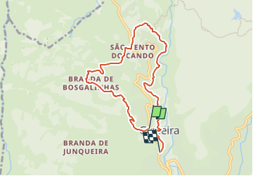

4,3 km | 10,8 km-effort

Tous les sentiers balisés d’Europe GUIDE+


Gratisgps-wandelapplicatie
 SityTrail
IGN / Geografische instituten
SityTrail World
De wereld gaat voor u open
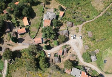
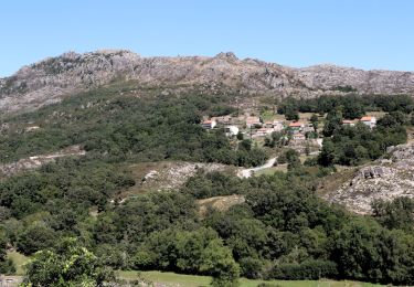
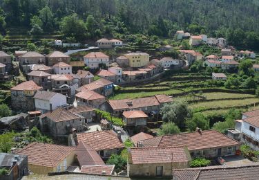
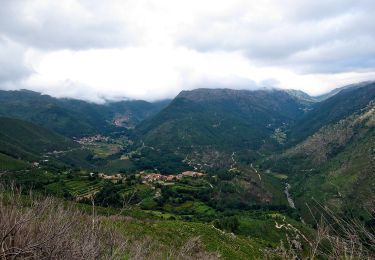
Tocht Te voet van 8,1 km beschikbaar op Norte, Viana do Castelo, Gavieira. Deze tocht wordt voorgesteld door SityTrail - itinéraires balisés pédestres.
Website: http://trilhos.arcosdevaldevez.pt/activities/trilho-pertinho-do-ceu/

Te voet
Te voet
Te voet
Te voet
Te voet
Te voet