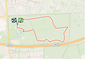
![](/images/other/stat-length.png)
![Tocht Te voet Ede - Welkom op Hoekelum! - Photo](https://media.geolcdn.com/t/1900/400/672e2f7a-b825-4566-8c62-177cc00a7bd5.jpeg&format=pjpeg&maxdim=2)
Welkom op Hoekelum!
SityTrail - itinéraires balisés pédestres
Tous les sentiers balisés d’Europe GUIDE+
![Lengte](/images/other/stat-length.png)
![Max. hoogte](https://static1.geolcdn.com/siteimages/upload/files/1508320355ic_sort_altitude_max_24dp.png)
![Positief hoogteverschil](https://static1.geolcdn.com/siteimages/upload/files/1508320355ic_sort_den_pos_24dp.png)
![Km-Effort](/images/other/stat-length.png)
![Min. hoogte](https://static1.geolcdn.com/siteimages/upload/files/1508320355ic_sort_altitude_min_24dp.png)
![Negatief hoogteverschil](https://static1.geolcdn.com/siteimages/upload/files/1508320355ic_sort_den_neg_24dp.png)
![Boucle](https://static1.geolcdn.com/siteimages/upload/files/16400158638029165_repeat_loop_refresh_sync_direction_icon.png)
![Te voet](https://static1.geolcdn.com/sitytour/trail-icons/100.png)
57m
Moeilijkheid : Gemakkelijk
![Scan deze QR-code om de tocht te openen in de SityTrail-applicatie](https://capi.geolives.com/qq0zvz2zws4bq2lad0pu/sitytour/trails/3108749/qr.png?size=200)
Gratisgps-wandelapplicatie
Over ons
Tocht Te voet van 3,7 km beschikbaar op Gelderland, Onbekend, Ede. Deze tocht wordt voorgesteld door SityTrail - itinéraires balisés pédestres.
Beschrijving
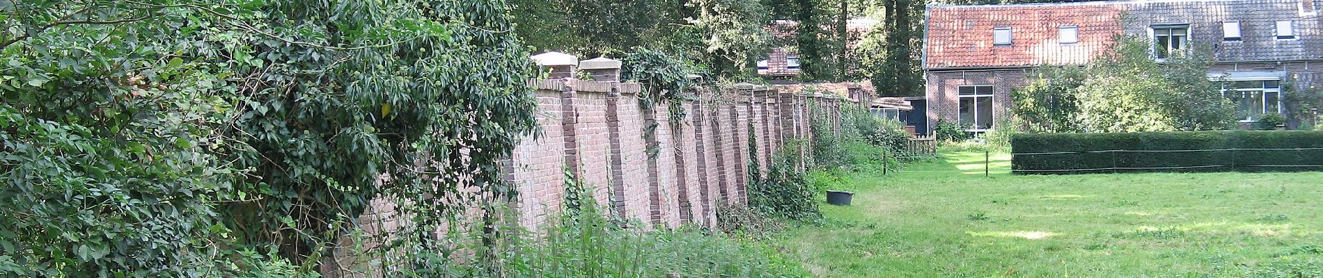
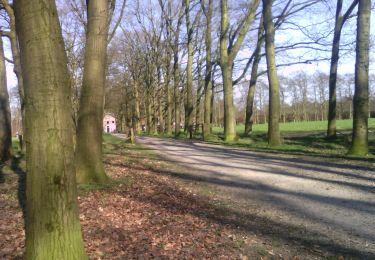
Landgoed Hoekelum is een oude buitenplaats met een sfeervol 18e-eeuws huis. Het wordt omringd door een prachtige vijverpartij en bijzondere gebouwen z
Website: https://www.glk.nl/82/locatie/?locatie=22
Plaatsbepaling
Opmerkingen
Wandeltochten in de omgeving
![Tocht Te voet Renkum - Rondje Beekdal - Photo](https://media.geolcdn.com/t/375/260/7f45de1d-bdc1-4def-be6b-ac60cd7374f4.jpeg&format=jpg&maxdim=2)
![Te voet Te voet](https://static1.geolcdn.com/sitytour/trail-icons/100.png)
Te voet
![](/images/other/stat-length.png)
![](https://static1.geolcdn.com/siteimages/upload/files/16400158638029165_repeat_loop_refresh_sync_direction_icon.png)
![Tocht Te voet Wageningen - Wageningse Engpad - Photo](https://media.geolcdn.com/t/375/260/05e42583-2751-467e-af20-187bb32912a3.jpeg&format=jpg&maxdim=2)
![Te voet Te voet](https://static1.geolcdn.com/sitytour/trail-icons/100.png)
Te voet
![](/images/other/stat-length.png)
![](https://static1.geolcdn.com/siteimages/upload/files/16400158638029165_repeat_loop_refresh_sync_direction_icon.png)
![Tocht Te voet Renkum - Hartensepad - Photo](https://media.geolcdn.com/t/375/260/f9f23e43-b1f3-43b2-9f81-0268301ab451.jpeg&format=jpg&maxdim=2)
![Te voet Te voet](https://static1.geolcdn.com/sitytour/trail-icons/100.png)
Te voet
![](/images/other/stat-length.png)
![](https://static1.geolcdn.com/siteimages/upload/files/16400158638029165_repeat_loop_refresh_sync_direction_icon.png)
![Tocht Te voet Ede - Demobos route - Photo](https://media.geolcdn.com/t/375/260/b6ccf5e9-300a-4988-a72b-39660a383bef.jpeg&format=jpg&maxdim=2)
![Te voet Te voet](https://static1.geolcdn.com/sitytour/trail-icons/100.png)
Te voet
![](/images/other/stat-length.png)
![](https://static1.geolcdn.com/siteimages/upload/files/16400158638029165_repeat_loop_refresh_sync_direction_icon.png)
![Tocht Te voet Ede - Edese Bos route - Photo](https://media.geolcdn.com/t/375/260/7bc895f8-0b06-4068-8c54-7bd3ea961123.jpeg&format=jpg&maxdim=2)
![Te voet Te voet](https://static1.geolcdn.com/sitytour/trail-icons/100.png)
Te voet
![](/images/other/stat-length.png)
![](https://static1.geolcdn.com/siteimages/upload/files/16400158638029165_repeat_loop_refresh_sync_direction_icon.png)
![Tocht Te voet Ede - Welkom op de Sysselt! - Photo](https://media.geolcdn.com/t/375/260/cc4b5a33-943d-4108-95f6-d1e8f71175a8.jpeg&format=jpg&maxdim=2)
![Te voet Te voet](https://static1.geolcdn.com/sitytour/trail-icons/100.png)
Te voet
![](/images/other/stat-length.png)
![](https://static1.geolcdn.com/siteimages/upload/files/16400158638029165_repeat_loop_refresh_sync_direction_icon.png)
![Tocht Te voet Ede - NS-wandeltocht Belmonte - Photo](https://media.geolcdn.com/t/375/260/3182c065-3415-40e5-b004-f3e9ed30979f.jpeg&format=jpg&maxdim=2)
![Te voet Te voet](https://static1.geolcdn.com/sitytour/trail-icons/100.png)
Te voet
![](/images/other/stat-length.png)
![](https://static1.geolcdn.com/siteimages/upload/files/16400158638029165_repeat_loop_refresh_sync_direction_icon.png)
![Tocht Te voet Ede - Driesprong Route - Photo](https://media.geolcdn.com/t/375/260/f249edf4-2921-473a-b5f6-4666fdc9b72e.jpeg&format=jpg&maxdim=2)
![Te voet Te voet](https://static1.geolcdn.com/sitytour/trail-icons/100.png)
Te voet
![](/images/other/stat-length.png)
![](https://static1.geolcdn.com/siteimages/upload/files/16400158638029165_repeat_loop_refresh_sync_direction_icon.png)
![Tocht Te voet Ede - Kernhem - Photo](https://media.geolcdn.com/t/375/260/229fc6d8-0c41-49a0-8dc2-295b2ae7aba2.jpeg&format=jpg&maxdim=2)
![Te voet Te voet](https://static1.geolcdn.com/sitytour/trail-icons/100.png)
Te voet
![](/images/other/stat-length.png)
![](https://static1.geolcdn.com/siteimages/upload/files/16400158638029165_repeat_loop_refresh_sync_direction_icon.png)