![](/images/other/stat-length.png)
![Tocht Te voet La Orotava - S-16 Sanatorio - Photo](https://media.geolcdn.com/t/1900/400/00ef7c7d-fee0-4fcc-a865-07fed4a262cd.jpeg&format=pjpeg&maxdim=2)
S-16 Sanatorio
SityTrail - itinéraires balisés pédestres
Tous les sentiers balisés d’Europe GUIDE+
![Lengte](/images/other/stat-length.png)
Lengte
4,6 km
![Max. hoogte](https://static1.geolcdn.com/siteimages/upload/files/1508320355ic_sort_altitude_max_24dp.png)
Max. hoogte
2293 m
![Positief hoogteverschil](https://static1.geolcdn.com/siteimages/upload/files/1508320355ic_sort_den_pos_24dp.png)
Positief hoogteverschil
30 m
![Km-Effort](/images/other/stat-length.png)
Km-Effort
5,3 km
![Min. hoogte](https://static1.geolcdn.com/siteimages/upload/files/1508320355ic_sort_altitude_min_24dp.png)
Min. hoogte
2196 m
![Negatief hoogteverschil](https://static1.geolcdn.com/siteimages/upload/files/1508320355ic_sort_den_neg_24dp.png)
Negatief hoogteverschil
120 m
![Boucle](https://static1.geolcdn.com/siteimages/upload/files/16400158638029165_repeat_loop_refresh_sync_direction_icon.png)
Boucle
Neen
Markering
Datum van aanmaak :
2022-02-14 14:20:25.468
Laatste wijziging :
2022-02-14 14:20:25.468
![Te voet](https://static1.geolcdn.com/sitytour/trail-icons/100.png)
1h12
Moeilijkheid : Gemakkelijk
![Scan deze QR-code om de tocht te openen in de SityTrail-applicatie](https://capi.geolives.com/qq0zvz2zws4bq2lad0pu/sitytour/trails/3108259/qr.png?size=200)
Gratisgps-wandelapplicatie
Over ons
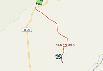
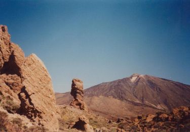
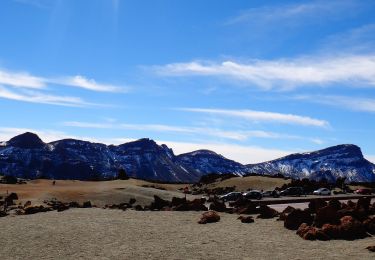
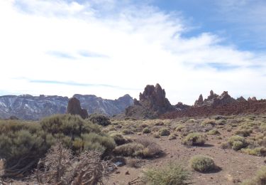
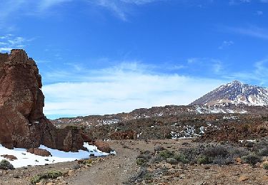
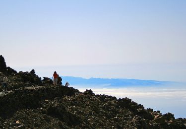
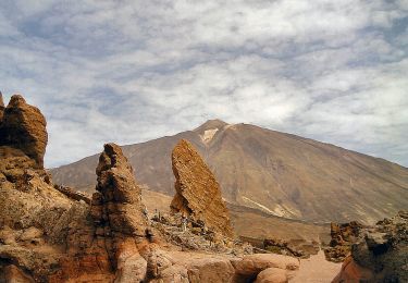
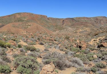
Tocht Te voet van 4,6 km beschikbaar op Canarische Eilanden, Santa Cruz de Tenerife, La Orotava. Deze tocht wordt voorgesteld door SityTrail - itinéraires balisés pédestres.
Beschrijving
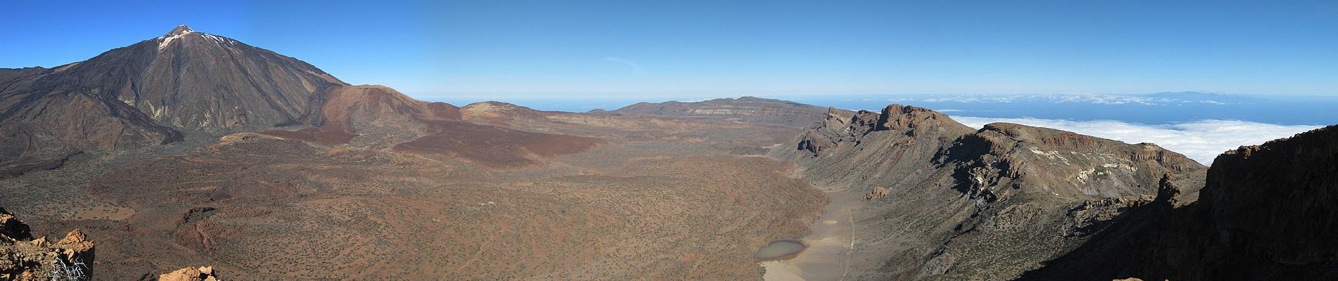
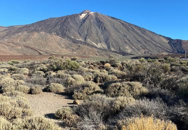
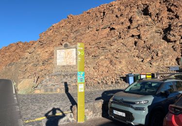
Trail created by Parque Nacional del Teide.
Plaatsbepaling
Land:
Spain
Regio :
Canarische Eilanden
Departement/Provincie :
Santa Cruz de Tenerife
Gemeente :
La Orotava
Locatie:
Unknown
Vertrek:(Dec)
Vertrek:(UTM)
340586 ; 3126372 (28R) N.
Opmerkingen
Wandeltochten in de omgeving
![Tocht Te voet La Orotava - Parador de Teide Alto Guajara caldeira de Teide - Photo](https://media.geolcdn.com/t/375/260/c8ab6db8-eb34-4747-a6d5-a22dfe02f5d8.jpg&format=jpg&maxdim=2)
![Te voet Te voet](https://static1.geolcdn.com/sitytour/trail-icons/100.png)
Parador de Teide Alto Guajara caldeira de Teide
Te voet
Gemakkelijk
(1)
La Orotava,
Canarische Eilanden,
Santa Cruz de Tenerife,
Spain
![](/images/other/stat-length.png)
11,3 km | 19,8 km-effort
4h 30min
![](https://static1.geolcdn.com/siteimages/upload/files/16400158638029165_repeat_loop_refresh_sync_direction_icon.png)
Ja
![Tocht Stappen La Orotava - Montana Blanca Refuge Altavista Forteleza La Rambletta Teide 3718 m - Photo](https://media.geolcdn.com/t/375/260/382576d2-1cef-40f9-b6a1-573ec62ffcb6.jpg&format=jpg&maxdim=2)
![Stappen Stappen](https://static1.geolcdn.com/sitytour/trail-icons/101.png)
Montana Blanca Refuge Altavista Forteleza La Rambletta Teide 3718 m
Stappen
Zeer moeilijk
La Orotava,
Canarische Eilanden,
Santa Cruz de Tenerife,
Spain
![](/images/other/stat-length.png)
18,4 km | 36 km-effort
8h 16min
![](https://static1.geolcdn.com/siteimages/upload/files/16400158638029165_repeat_loop_refresh_sync_direction_icon.png)
Ja
![Tocht Te voet La Orotava - S-40 Llano de Ucanca-Boca Tauce - Photo](https://media.geolcdn.com/t/375/260/26a075e1-cd2e-43ee-98e5-799dff01487c.jpeg&format=jpg&maxdim=2)
![Te voet Te voet](https://static1.geolcdn.com/sitytour/trail-icons/100.png)
S-40 Llano de Ucanca-Boca Tauce
Te voet
Gemakkelijk
La Orotava,
Canarische Eilanden,
Santa Cruz de Tenerife,
Spain
![](/images/other/stat-length.png)
4,8 km | 5,5 km-effort
1h 14min
![](https://static1.geolcdn.com/siteimages/upload/files/16400158638029165_repeat_loop_refresh_sync_direction_icon.png)
Neen
![Tocht Te voet La Orotava - S-39 Teleférico-Montaña Blanca-Minas de San José - Photo](https://media.geolcdn.com/t/375/260/267b1c13-9372-42a6-8012-3981efb7d145.jpeg&format=jpg&maxdim=2)
![Te voet Te voet](https://static1.geolcdn.com/sitytour/trail-icons/100.png)
S-39 Teleférico-Montaña Blanca-Minas de San José
Te voet
Gemakkelijk
La Orotava,
Canarische Eilanden,
Santa Cruz de Tenerife,
Spain
![](/images/other/stat-length.png)
6,7 km | 10 km-effort
2h 16min
![](https://static1.geolcdn.com/siteimages/upload/files/16400158638029165_repeat_loop_refresh_sync_direction_icon.png)
Neen
![Tocht Te voet La Orotava - S-19 Majúa - Photo](https://media.geolcdn.com/t/375/260/d6a20f91-115e-4381-9aad-2d7b4fc7f0d0.jpeg&format=jpg&maxdim=2)
![Te voet Te voet](https://static1.geolcdn.com/sitytour/trail-icons/100.png)
S-19 Majúa
Te voet
Gemakkelijk
La Orotava,
Canarische Eilanden,
Santa Cruz de Tenerife,
Spain
![](/images/other/stat-length.png)
4 km | 5,4 km-effort
1h 13min
![](https://static1.geolcdn.com/siteimages/upload/files/16400158638029165_repeat_loop_refresh_sync_direction_icon.png)
Neen
![Tocht Te voet La Orotava - S-30 Los Valles - Photo](https://media.geolcdn.com/t/375/260/281af76a-1e1a-4300-89ab-f6674754c3ad.jpeg&format=jpg&maxdim=2)
![Te voet Te voet](https://static1.geolcdn.com/sitytour/trail-icons/100.png)
S-30 Los Valles
Te voet
Gemakkelijk
La Orotava,
Canarische Eilanden,
Santa Cruz de Tenerife,
Spain
![](/images/other/stat-length.png)
4,9 km | 5,8 km-effort
1h 18min
![](https://static1.geolcdn.com/siteimages/upload/files/16400158638029165_repeat_loop_refresh_sync_direction_icon.png)
Neen
![Tocht Te voet La Orotava - S-9 Sendero Teide-Pico Viejo–Mirador de las Narices del Teide - Photo](https://media.geolcdn.com/t/375/260/14eb5da9-d94e-4348-a0b7-78e13331bd2b.jpeg&format=jpg&maxdim=2)
![Te voet Te voet](https://static1.geolcdn.com/sitytour/trail-icons/100.png)
S-9 Sendero Teide-Pico Viejo–Mirador de las Narices del Teide
Te voet
Gemakkelijk
La Orotava,
Canarische Eilanden,
Santa Cruz de Tenerife,
Spain
![](/images/other/stat-length.png)
9,4 km | 14,9 km-effort
3h 23min
![](https://static1.geolcdn.com/siteimages/upload/files/16400158638029165_repeat_loop_refresh_sync_direction_icon.png)
Neen
![Tocht Te voet La Orotava - S-7 Montaña Blanca-La Rambleta - Photo](https://media.geolcdn.com/t/375/260/2f181b8b-c0a2-49c0-9f60-b40365cab2be.jpeg&format=jpg&maxdim=2)
![Te voet Te voet](https://static1.geolcdn.com/sitytour/trail-icons/100.png)
S-7 Montaña Blanca-La Rambleta
Te voet
Gemakkelijk
La Orotava,
Canarische Eilanden,
Santa Cruz de Tenerife,
Spain
![](/images/other/stat-length.png)
8,2 km | 12,2 km-effort
2h 45min
![](https://static1.geolcdn.com/siteimages/upload/files/16400158638029165_repeat_loop_refresh_sync_direction_icon.png)
Neen
![Tocht Te voet La Orotava - S-2 Arenas Negras - Photo](https://media.geolcdn.com/t/375/260/f49c517d-d69d-4af9-a133-c8e757276ef3.jpeg&format=jpg&maxdim=2)
![Te voet Te voet](https://static1.geolcdn.com/sitytour/trail-icons/100.png)
S-2 Arenas Negras
Te voet
Medium
La Orotava,
Canarische Eilanden,
Santa Cruz de Tenerife,
Spain
![](/images/other/stat-length.png)
19,1 km | 25 km-effort
5h 39min
![](https://static1.geolcdn.com/siteimages/upload/files/16400158638029165_repeat_loop_refresh_sync_direction_icon.png)
Neen