![](/images/other/stat-length.png)
![Tocht Te voet Winterthur - Rundweg Winterthur - Etappe Leisental - Photo](https://media.geolcdn.com/t/1900/400/b46f637d-974f-48a1-98b4-7a6fcf478692.jpeg&format=pjpeg&maxdim=2)
Rundweg Winterthur - Etappe Leisental
SityTrail - itinéraires balisés pédestres
Tous les sentiers balisés d’Europe GUIDE+
![Lengte](/images/other/stat-length.png)
Lengte
6,3 km
![Max. hoogte](https://static1.geolcdn.com/siteimages/upload/files/1508320355ic_sort_altitude_max_24dp.png)
Max. hoogte
541 m
![Positief hoogteverschil](https://static1.geolcdn.com/siteimages/upload/files/1508320355ic_sort_den_pos_24dp.png)
Positief hoogteverschil
136 m
![Km-Effort](/images/other/stat-length.png)
Km-Effort
8,1 km
![Min. hoogte](https://static1.geolcdn.com/siteimages/upload/files/1508320355ic_sort_altitude_min_24dp.png)
Min. hoogte
454 m
![Negatief hoogteverschil](https://static1.geolcdn.com/siteimages/upload/files/1508320355ic_sort_den_neg_24dp.png)
Negatief hoogteverschil
144 m
![Boucle](https://static1.geolcdn.com/siteimages/upload/files/16400158638029165_repeat_loop_refresh_sync_direction_icon.png)
Boucle
Neen
Markering
Datum van aanmaak :
2022-02-14 09:09:14.677
Laatste wijziging :
2022-02-14 09:09:14.677
![Te voet](https://static1.geolcdn.com/sitytour/trail-icons/100.png)
1h50
Moeilijkheid : Gemakkelijk
![Scan deze QR-code om de tocht te openen in de SityTrail-applicatie](https://capi.geolives.com/qq0zvz2zws4bq2lad0pu/sitytour/trails/3107674/qr.png?size=200)
Gratisgps-wandelapplicatie
Over ons
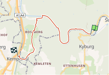
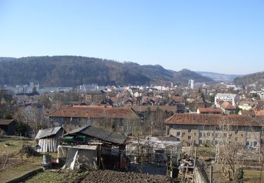
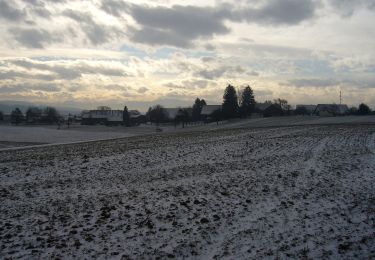
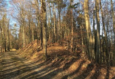
Tocht Te voet van 6,3 km beschikbaar op Zürich, Bezirk Winterthur, Winterthur. Deze tocht wordt voorgesteld door SityTrail - itinéraires balisés pédestres.
Beschrijving
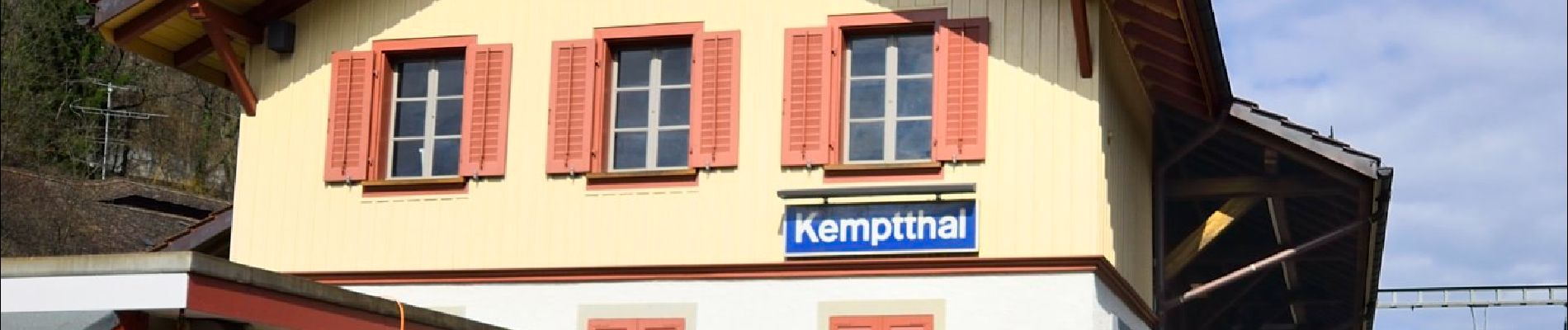
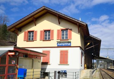
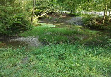
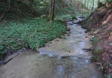
Etappe Leisental: Sennhof Kemptthal
Website: https://www.rundweg.winterthur.ch/index.php?ref=search&refid=3344446&apid=8407894
Plaatsbepaling
Land:
Switzerland
Regio :
Zürich
Departement/Provincie :
Bezirk Winterthur
Gemeente :
Winterthur
Locatie:
Mattenbach
Vertrek:(Dec)
Vertrek:(UTM)
480911 ; 5256500 (32T) N.
Opmerkingen
Wandeltochten in de omgeving
![Tocht Te voet Lindau - Kempthal - Winterthur - Photo](https://media.geolcdn.com/t/375/260/b46f637d-974f-48a1-98b4-7a6fcf478692.jpeg&format=jpg&maxdim=2)
![Te voet Te voet](https://static1.geolcdn.com/sitytour/trail-icons/100.png)
Kempthal - Winterthur
Te voet
Gemakkelijk
Lindau,
Zürich,
Bezirk Pfäffikon,
Switzerland
![](/images/other/stat-length.png)
4,9 km | 7,6 km-effort
1h 43min
![](https://static1.geolcdn.com/siteimages/upload/files/16400158638029165_repeat_loop_refresh_sync_direction_icon.png)
Neen
![Tocht Te voet Lindau - Kempthal - Sennhof - Photo](https://media.geolcdn.com/t/375/260/b46f637d-974f-48a1-98b4-7a6fcf478692.jpeg&format=jpg&maxdim=2)
![Te voet Te voet](https://static1.geolcdn.com/sitytour/trail-icons/100.png)
Kempthal - Sennhof
Te voet
Gemakkelijk
Lindau,
Zürich,
Bezirk Pfäffikon,
Switzerland
![](/images/other/stat-length.png)
8,1 km | 10,4 km-effort
2h 21min
![](https://static1.geolcdn.com/siteimages/upload/files/16400158638029165_repeat_loop_refresh_sync_direction_icon.png)
Neen
![Tocht Te voet Illnau-Effretikon - Effretikon - Winterthur - Photo](https://media.geolcdn.com/t/375/260/63404b86-8121-4e1e-949e-dd67169d2de0.jpeg&format=jpg&maxdim=2)
![Te voet Te voet](https://static1.geolcdn.com/sitytour/trail-icons/100.png)
Effretikon - Winterthur
Te voet
Gemakkelijk
Illnau-Effretikon,
Zürich,
Bezirk Pfäffikon,
Switzerland
![](/images/other/stat-length.png)
8,5 km | 10,7 km-effort
2h 25min
![](https://static1.geolcdn.com/siteimages/upload/files/16400158638029165_repeat_loop_refresh_sync_direction_icon.png)
Neen
![Tocht Te voet Winterthur - Brunibrugg - Kyburgerbrugg - Photo](https://media.geolcdn.com/t/375/260/9b0fa434-55c2-423a-913e-72b1327bfe19.jpeg&format=jpg&maxdim=2)
![Te voet Te voet](https://static1.geolcdn.com/sitytour/trail-icons/100.png)
Brunibrugg - Kyburgerbrugg
Te voet
Gemakkelijk
Winterthur,
Zürich,
Bezirk Winterthur,
Switzerland
![](/images/other/stat-length.png)
3,4 km | 4 km-effort
54min
![](https://static1.geolcdn.com/siteimages/upload/files/16400158638029165_repeat_loop_refresh_sync_direction_icon.png)
Neen
![Tocht Te voet Winterthur - Ritplatz - Chämleten - Photo](https://media.geolcdn.com/t/375/260/76f7eae9-adf9-478d-a972-b8ace6f07a39.jpeg&format=jpg&maxdim=2)
![Te voet Te voet](https://static1.geolcdn.com/sitytour/trail-icons/100.png)
Ritplatz - Chämleten
Te voet
Gemakkelijk
Winterthur,
Zürich,
Bezirk Winterthur,
Switzerland
![](/images/other/stat-length.png)
3,6 km | 5,5 km-effort
1h 14min
![](https://static1.geolcdn.com/siteimages/upload/files/16400158638029165_repeat_loop_refresh_sync_direction_icon.png)
Neen
![Tocht Te voet Illnau-Effretikon - Effretikon - Oberillnau - Photo](https://media.geolcdn.com/t/375/260/63404b86-8121-4e1e-949e-dd67169d2de0.jpeg&format=jpg&maxdim=2)
![Te voet Te voet](https://static1.geolcdn.com/sitytour/trail-icons/100.png)
Effretikon - Oberillnau
Te voet
Gemakkelijk
Illnau-Effretikon,
Zürich,
Bezirk Pfäffikon,
Switzerland
![](/images/other/stat-length.png)
3,4 km | 4,3 km-effort
58min
![](https://static1.geolcdn.com/siteimages/upload/files/16400158638029165_repeat_loop_refresh_sync_direction_icon.png)
Neen
![Tocht Te voet Winterthur - Sennhof - Winterthur - Photo](https://media.geolcdn.com/t/375/260/6b98930b-4675-4823-904a-18a6989af0aa.jpeg&format=jpg&maxdim=2)
![Te voet Te voet](https://static1.geolcdn.com/sitytour/trail-icons/100.png)
Sennhof - Winterthur
Te voet
Gemakkelijk
Winterthur,
Zürich,
Bezirk Winterthur,
Switzerland
![](/images/other/stat-length.png)
6,5 km | 8,8 km-effort
1h 59min
![](https://static1.geolcdn.com/siteimages/upload/files/16400158638029165_repeat_loop_refresh_sync_direction_icon.png)
Neen
![Tocht Te voet Lindau - Kempthal - Rorbas - Photo](https://media.geolcdn.com/t/375/260/0952e2e4-f3ce-4b1a-8752-5684d81500cc.jpeg&format=jpg&maxdim=2)
![Te voet Te voet](https://static1.geolcdn.com/sitytour/trail-icons/100.png)
Kempthal - Rorbas
Te voet
Gemakkelijk
Lindau,
Zürich,
Bezirk Pfäffikon,
Switzerland
![](/images/other/stat-length.png)
13,8 km | 17,1 km-effort
3h 53min
![](https://static1.geolcdn.com/siteimages/upload/files/16400158638029165_repeat_loop_refresh_sync_direction_icon.png)
Neen
![Tocht Te voet Winterthur - Winterthur Töss - Pfungen - Photo](https://media.geolcdn.com/t/375/260/64d1243c-eecf-47bc-8037-a387c6e3e4be.jpeg&format=jpg&maxdim=2)
![Te voet Te voet](https://static1.geolcdn.com/sitytour/trail-icons/100.png)
Winterthur Töss - Pfungen
Te voet
Gemakkelijk
Winterthur,
Zürich,
Bezirk Winterthur,
Switzerland
![](/images/other/stat-length.png)
8,3 km | 12,8 km-effort
2h 54min
![](https://static1.geolcdn.com/siteimages/upload/files/16400158638029165_repeat_loop_refresh_sync_direction_icon.png)
Neen