![](/images/other/stat-length.png)
![Tocht Te voet Oberbuchsiten - Tiefmatt - Roggenflue - Photo](https://media.geolcdn.com/t/1900/400/3f59204a-1bee-4fa0-81f3-653424361e4f.jpeg&format=pjpeg&maxdim=2)
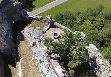
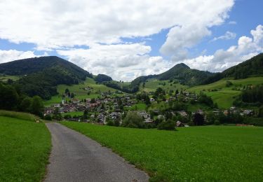
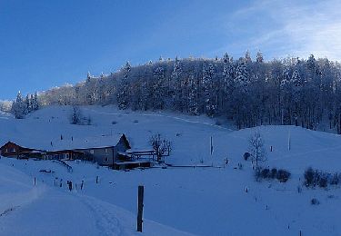
Tiefmatt - Roggenflue
SityTrail - itinéraires balisés pédestres
Tous les sentiers balisés d’Europe GUIDE+
![Lengte](/images/other/stat-length.png)
Lengte
3,4 km
![Max. hoogte](https://static1.geolcdn.com/siteimages/upload/files/1508320355ic_sort_altitude_max_24dp.png)
Max. hoogte
997 m
![Positief hoogteverschil](https://static1.geolcdn.com/siteimages/upload/files/1508320355ic_sort_den_pos_24dp.png)
Positief hoogteverschil
220 m
![Km-Effort](/images/other/stat-length.png)
Km-Effort
5,7 km
![Min. hoogte](https://static1.geolcdn.com/siteimages/upload/files/1508320355ic_sort_altitude_min_24dp.png)
Min. hoogte
810 m
![Negatief hoogteverschil](https://static1.geolcdn.com/siteimages/upload/files/1508320355ic_sort_den_neg_24dp.png)
Negatief hoogteverschil
51 m
![Boucle](https://static1.geolcdn.com/siteimages/upload/files/16400158638029165_repeat_loop_refresh_sync_direction_icon.png)
Boucle
Neen
Markering
Datum van aanmaak :
2022-02-14 08:54:03.145
Laatste wijziging :
2022-02-14 08:54:03.145
![Te voet](https://static1.geolcdn.com/sitytour/trail-icons/100.png)
1h18
Moeilijkheid : Gemakkelijk
![Scan deze QR-code om de tocht te openen in de SityTrail-applicatie](https://capi.geolives.com/qq0zvz2zws4bq2lad0pu/sitytour/trails/3106661/qr.png?size=200)
Gratisgps-wandelapplicatie
Over ons
Tocht Te voet van 3,4 km beschikbaar op Solothurn, Bezirk Gäu, Oberbuchsiten. Deze tocht wordt voorgesteld door SityTrail - itinéraires balisés pédestres.
Beschrijving
Symbol: gelbe Raute
Plaatsbepaling
Land:
Switzerland
Regio :
Solothurn
Departement/Provincie :
Bezirk Gäu
Gemeente :
Oberbuchsiten
Locatie:
Unknown
Vertrek:(Dec)
Vertrek:(UTM)
405586 ; 5242103 (32T) N.
Opmerkingen
Wandeltochten in de omgeving
![Tocht Te voet Oensingen - Oensingen - Kestenholz - Photo](https://media.geolcdn.com/t/375/260/5b60ec1a-eb37-46f7-99b8-2a401a97b8d1.jpeg&format=jpg&maxdim=2)
![Te voet Te voet](https://static1.geolcdn.com/sitytour/trail-icons/100.png)
Oensingen - Kestenholz
Te voet
Gemakkelijk
Oensingen,
Solothurn,
Bezirk Gäu,
Switzerland
![](/images/other/stat-length.png)
5,3 km | 6 km-effort
1h 22min
![](https://static1.geolcdn.com/siteimages/upload/files/16400158638029165_repeat_loop_refresh_sync_direction_icon.png)
Neen
![Tocht Te voet Kestenholz - Kestenholz - Wolfwil - Photo](https://media.geolcdn.com/t/375/260/4b060923-797b-4e46-83b0-7b8a0c93a493.jpeg&format=jpg&maxdim=2)
![Te voet Te voet](https://static1.geolcdn.com/sitytour/trail-icons/100.png)
Kestenholz - Wolfwil
Te voet
Gemakkelijk
Kestenholz,
Solothurn,
Bezirk Gäu,
Switzerland
![](/images/other/stat-length.png)
5,2 km | 6,2 km-effort
1h 24min
![](https://static1.geolcdn.com/siteimages/upload/files/16400158638029165_repeat_loop_refresh_sync_direction_icon.png)
Neen
![Tocht Te voet Egerkingen - Egerkingen - Hägendorf - Photo](https://media.geolcdn.com/t/375/260/2f646f3a-f3b9-4dfb-bd44-9885ccdf8916.jpeg&format=jpg&maxdim=2)
![Te voet Te voet](https://static1.geolcdn.com/sitytour/trail-icons/100.png)
Egerkingen - Hägendorf
Te voet
Gemakkelijk
Egerkingen,
Solothurn,
Bezirk Gäu,
Switzerland
![](/images/other/stat-length.png)
4,4 km | 5,9 km-effort
1h 21min
![](https://static1.geolcdn.com/siteimages/upload/files/16400158638029165_repeat_loop_refresh_sync_direction_icon.png)
Neen
![Tocht Te voet Egerkingen - Egerkingen Bahnhof - Fulenbach - Photo](https://media.geolcdn.com/t/375/260/3a9d55d7-4098-447d-a490-a73a27333df3.jpeg&format=jpg&maxdim=2)
![Te voet Te voet](https://static1.geolcdn.com/sitytour/trail-icons/100.png)
Egerkingen Bahnhof - Fulenbach
Te voet
Gemakkelijk
Egerkingen,
Solothurn,
Bezirk Gäu,
Switzerland
![](/images/other/stat-length.png)
6,6 km | 7,3 km-effort
1h 39min
![](https://static1.geolcdn.com/siteimages/upload/files/16400158638029165_repeat_loop_refresh_sync_direction_icon.png)
Neen
![Tocht Te voet Balsthal - Schwängimatt - Klus - Photo](https://media.geolcdn.com/t/375/260/ea154bb4-d362-4d48-9d1c-7903c26c9663.jpeg&format=jpg&maxdim=2)
![Te voet Te voet](https://static1.geolcdn.com/sitytour/trail-icons/100.png)
Schwängimatt - Klus
Te voet
Gemakkelijk
Balsthal,
Solothurn,
Bezirk Thal,
Switzerland
![](/images/other/stat-length.png)
4,1 km | 9,3 km-effort
2h 7min
![](https://static1.geolcdn.com/siteimages/upload/files/16400158638029165_repeat_loop_refresh_sync_direction_icon.png)
Neen
![Tocht Te voet Holderbank (SO) - Bereten Linde - Holderbank - Photo](https://media.geolcdn.com/t/375/260/6553f28c-7f26-4220-a5cc-4d625de86627.jpeg&format=jpg&maxdim=2)
![Te voet Te voet](https://static1.geolcdn.com/sitytour/trail-icons/100.png)
Bereten Linde - Holderbank
Te voet
Gemakkelijk
Holderbank (SO),
Solothurn,
Bezirk Thal,
Switzerland
![](/images/other/stat-length.png)
4,5 km | 6 km-effort
1h 21min
![](https://static1.geolcdn.com/siteimages/upload/files/16400158638029165_repeat_loop_refresh_sync_direction_icon.png)
Neen
![Tocht Te voet Holderbank (SO) - Bereten Linde - fixme - Photo](https://media.geolcdn.com/t/375/260/c3094905-f8ed-4ba0-8039-2f99801712fe.jpeg&format=jpg&maxdim=2)
![Te voet Te voet](https://static1.geolcdn.com/sitytour/trail-icons/100.png)
Bereten Linde - fixme
Te voet
Gemakkelijk
Holderbank (SO),
Solothurn,
Bezirk Thal,
Switzerland
![](/images/other/stat-length.png)
4 km | 5,5 km-effort
1h 14min
![](https://static1.geolcdn.com/siteimages/upload/files/16400158638029165_repeat_loop_refresh_sync_direction_icon.png)
Neen
![Tocht Te voet Balsthal - St. Wolfgang - Langenbruck - Photo](https://media.geolcdn.com/t/375/260/d32f68a0-9763-42b1-a4bc-d975a8149f4d.jpeg&format=jpg&maxdim=2)
![Te voet Te voet](https://static1.geolcdn.com/sitytour/trail-icons/100.png)
St. Wolfgang - Langenbruck
Te voet
Gemakkelijk
Balsthal,
Solothurn,
Bezirk Thal,
Switzerland
![](/images/other/stat-length.png)
6,5 km | 10,3 km-effort
2h 20min
![](https://static1.geolcdn.com/siteimages/upload/files/16400158638029165_repeat_loop_refresh_sync_direction_icon.png)
Neen
![Tocht Te voet Mümliswil-Ramiswil - Wasserfallen Rochus Kapelle - Mümliswil - Photo](https://media.geolcdn.com/t/375/260/6f67bbaf-75f7-4a8b-9716-50801b2f8d89.jpeg&format=jpg&maxdim=2)
![Te voet Te voet](https://static1.geolcdn.com/sitytour/trail-icons/100.png)
Wasserfallen Rochus Kapelle - Mümliswil
Te voet
Gemakkelijk
Mümliswil-Ramiswil,
Solothurn,
Bezirk Thal,
Switzerland
![](/images/other/stat-length.png)
4,2 km | 5,9 km-effort
1h 20min
![](https://static1.geolcdn.com/siteimages/upload/files/16400158638029165_repeat_loop_refresh_sync_direction_icon.png)
Neen