![](/images/other/stat-length.png)
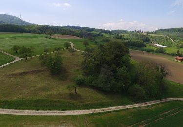
![Tocht Te voet Wölflinswil - Eisenweg - Photo](https://media.geolcdn.com/t/1900/400/9bcf9ac6-b1d9-4caf-b16f-7f9888483edd.jpeg&format=pjpeg&maxdim=2)
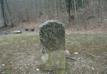
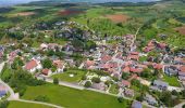
Eisenweg
SityTrail - itinéraires balisés pédestres
Tous les sentiers balisés d’Europe GUIDE+
![Lengte](/images/other/stat-length.png)
Lengte
4,9 km
![Max. hoogte](https://static1.geolcdn.com/siteimages/upload/files/1508320355ic_sort_altitude_max_24dp.png)
Max. hoogte
554 m
![Positief hoogteverschil](https://static1.geolcdn.com/siteimages/upload/files/1508320355ic_sort_den_pos_24dp.png)
Positief hoogteverschil
165 m
![Km-Effort](/images/other/stat-length.png)
Km-Effort
6,9 km
![Min. hoogte](https://static1.geolcdn.com/siteimages/upload/files/1508320355ic_sort_altitude_min_24dp.png)
Min. hoogte
437 m
![Negatief hoogteverschil](https://static1.geolcdn.com/siteimages/upload/files/1508320355ic_sort_den_neg_24dp.png)
Negatief hoogteverschil
92 m
![Boucle](https://static1.geolcdn.com/siteimages/upload/files/16400158638029165_repeat_loop_refresh_sync_direction_icon.png)
Boucle
Neen
Markering
Datum van aanmaak :
2022-02-14 08:44:27.123
Laatste wijziging :
2022-02-14 08:44:27.123
![Te voet](https://static1.geolcdn.com/sitytour/trail-icons/100.png)
1h34
Moeilijkheid : Gemakkelijk
![Scan deze QR-code om de tocht te openen in de SityTrail-applicatie](https://capi.geolives.com/qq0zvz2zws4bq2lad0pu/sitytour/trails/3105786/qr.png?size=200)
Gratisgps-wandelapplicatie
Over ons
Tocht Te voet van 4,9 km beschikbaar op Aargau, Bezirk Laufenburg, Wölflinswil. Deze tocht wordt voorgesteld door SityTrail - itinéraires balisés pédestres.
Beschrijving
Eisenweg
Symbol: brauner Wegweiser
Plaatsbepaling
Land:
Switzerland
Regio :
Aargau
Departement/Provincie :
Bezirk Laufenburg
Gemeente :
Wölflinswil
Locatie:
Unknown
Vertrek:(Dec)
Vertrek:(UTM)
424485 ; 5256914 (32T) N.
Opmerkingen
Wandeltochten in de omgeving
![Tocht Te voet Kienberg - Kienberg - Saalhöhe - Photo](https://media.geolcdn.com/t/375/260/94735ea1-0d35-483f-a24c-b1b67aa73858.jpeg&format=jpg&maxdim=2)
![Te voet Te voet](https://static1.geolcdn.com/sitytour/trail-icons/100.png)
Kienberg - Saalhöhe
Te voet
Gemakkelijk
Kienberg,
Solothurn,
Bezirk Gösgen,
Switzerland
![](/images/other/stat-length.png)
4,8 km | 8,4 km-effort
1h 54min
![](https://static1.geolcdn.com/siteimages/upload/files/16400158638029165_repeat_loop_refresh_sync_direction_icon.png)
Neen
![Tocht Te voet Herznach - fixme - fixme - Photo](https://media.geolcdn.com/t/375/260/ccbe76e3-4b0b-4cf8-921b-1aa93c0437b1.jpeg&format=jpg&maxdim=2)
![Te voet Te voet](https://static1.geolcdn.com/sitytour/trail-icons/100.png)
fixme - fixme
Te voet
Gemakkelijk
Herznach,
Aargau,
Bezirk Laufenburg,
Switzerland
![](/images/other/stat-length.png)
4 km | 5,3 km-effort
1h 12min
![](https://static1.geolcdn.com/siteimages/upload/files/16400158638029165_repeat_loop_refresh_sync_direction_icon.png)
Neen
![Tocht Te voet Erlinsbach (AG) - Breitmis - Hinterfeld - Photo](https://media.geolcdn.com/t/375/260/935f15c7-2966-4595-9f14-16c84fb69989.jpeg&format=jpg&maxdim=2)
![Te voet Te voet](https://static1.geolcdn.com/sitytour/trail-icons/100.png)
Breitmis - Hinterfeld
Te voet
Gemakkelijk
Erlinsbach (AG),
Aargau,
Bezirk Aarau,
Switzerland
![](/images/other/stat-length.png)
3,8 km | 5 km-effort
1h 8min
![](https://static1.geolcdn.com/siteimages/upload/files/16400158638029165_repeat_loop_refresh_sync_direction_icon.png)
Neen
![Tocht Te voet Küttigen - Alpenzeiger- Brunnenberg - Photo](https://media.geolcdn.com/t/375/260/3bcc4ea6-2572-4534-9b5b-3d9e5bc12ed5.jpeg&format=jpg&maxdim=2)
![Te voet Te voet](https://static1.geolcdn.com/sitytour/trail-icons/100.png)
Alpenzeiger- Brunnenberg
Te voet
Gemakkelijk
Küttigen,
Aargau,
Bezirk Aarau,
Switzerland
![](/images/other/stat-length.png)
3,2 km | 4,4 km-effort
1h 0min
![](https://static1.geolcdn.com/siteimages/upload/files/16400158638029165_repeat_loop_refresh_sync_direction_icon.png)
Neen
![Tocht Te voet Erlinsbach (AG) - Barmelweid - Laurenzenbad - Photo](https://media.geolcdn.com/t/375/260/807e6718-5173-4c28-8984-7ee5ab481a76.jpeg&format=jpg&maxdim=2)
![Te voet Te voet](https://static1.geolcdn.com/sitytour/trail-icons/100.png)
Barmelweid - Laurenzenbad
Te voet
Gemakkelijk
Erlinsbach (AG),
Aargau,
Bezirk Aarau,
Switzerland
![](/images/other/stat-length.png)
3,4 km | 6 km-effort
1h 21min
![](https://static1.geolcdn.com/siteimages/upload/files/16400158638029165_repeat_loop_refresh_sync_direction_icon.png)
Neen
![Tocht Te voet Oberhof - Zwei Dörfer-Rundweg - Photo](https://media.geolcdn.com/t/375/260/9bcf9ac6-b1d9-4caf-b16f-7f9888483edd.jpeg&format=jpg&maxdim=2)
![Te voet Te voet](https://static1.geolcdn.com/sitytour/trail-icons/100.png)
Zwei Dörfer-Rundweg
Te voet
Gemakkelijk
Oberhof,
Aargau,
Bezirk Laufenburg,
Switzerland
![](/images/other/stat-length.png)
3,9 km | 7,3 km-effort
1h 38min
![](https://static1.geolcdn.com/siteimages/upload/files/16400158638029165_repeat_loop_refresh_sync_direction_icon.png)
Neen
![Tocht Te voet Anwil - Ächtelmatt - Wittnau - Photo](https://media.geolcdn.com/t/375/260/faeb47e4-d5ec-4d94-9b3d-e3d93091e218.jpeg&format=jpg&maxdim=2)
![Te voet Te voet](https://static1.geolcdn.com/sitytour/trail-icons/100.png)
Ächtelmatt - Wittnau
Te voet
Gemakkelijk
Anwil,
Bazel-Land,
Bezirk Sissach,
Switzerland
![](/images/other/stat-length.png)
4 km | 4,8 km-effort
1h 5min
![](https://static1.geolcdn.com/siteimages/upload/files/16400158638029165_repeat_loop_refresh_sync_direction_icon.png)
Neen
![Tocht Te voet Wittnau - Wittnau - Buschberg - Photo](https://media.geolcdn.com/t/375/260/5b085102-6be2-4304-9f45-bdc9d5b9ab9c.jpeg&format=jpg&maxdim=2)
![Te voet Te voet](https://static1.geolcdn.com/sitytour/trail-icons/100.png)
Wittnau - Buschberg
Te voet
Gemakkelijk
Wittnau,
Aargau,
Bezirk Laufenburg,
Switzerland
![](/images/other/stat-length.png)
3,3 km | 6,5 km-effort
1h 29min
![](https://static1.geolcdn.com/siteimages/upload/files/16400158638029165_repeat_loop_refresh_sync_direction_icon.png)
Neen
![Tocht Te voet Schupfart - Tiersteinerberg - Schupfart Postauto - Photo](https://media.geolcdn.com/t/375/260/ext.jpg?maxdim=2&url=https%3A%2F%2Fstatic1.geolcdn.com%2Fsiteimages%2Fupload%2Ffiles%2F1545311037marcheuse_200dpi.jpg)
![Te voet Te voet](https://static1.geolcdn.com/sitytour/trail-icons/100.png)
Tiersteinerberg - Schupfart Postauto
Te voet
Gemakkelijk
Schupfart,
Aargau,
Bezirk Rheinfelden,
Switzerland
![](/images/other/stat-length.png)
3,3 km | 4,4 km-effort
1h 0min
![](https://static1.geolcdn.com/siteimages/upload/files/16400158638029165_repeat_loop_refresh_sync_direction_icon.png)
Neen