


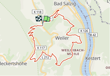

3,6 km | 4,4 km-effort


Tous les sentiers balisés d’Europe GUIDE+


Gratisgps-wandelapplicatie
 SityTrail
IGN / Geografische instituten
SityTrail World
De wereld gaat voor u open
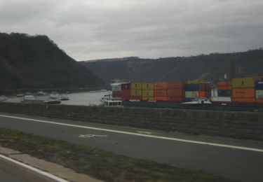
Tocht Te voet van 10,9 km beschikbaar op Rijnland-Palts, Rhein-Hunsrück-Kreis, Boppard. Deze tocht wordt voorgesteld door SityTrail - itinéraires balisés pédestres.
Symbol: weiß auf violett: Von den Zinnen eines Burgturmes gekröntes R
Te voet
Te voet
Te voet
Te voet
Te voet
Te voet
Te voet
![Tocht Te voet Kestert - Rheinsteig [Kestert - St. Goarshausen] - Photo](https://media.geolcdn.com/t/375/260/ext.jpg?maxdim=2&url=https%3A%2F%2Fstatic1.geolcdn.com%2Fsiteimages%2Fupload%2Ffiles%2F1545311037marcheuse_200dpi.jpg)
Te voet
Te voet