![](/images/other/stat-length.png)
![Tocht Te voet Asbach - [B1] Barger Heck Weg - Photo](https://media.geolcdn.com/t/1900/400/ext.pjpeg?maxdim=2&url=https%3A%2F%2Fstatic1.geolcdn.com%2Fsiteimages%2Fupload%2Ffiles%2F1545311037marcheuse_200dpi.jpg)
[B1] Barger Heck Weg
SityTrail - itinéraires balisés pédestres
Tous les sentiers balisés d’Europe GUIDE+
![Lengte](/images/other/stat-length.png)
Lengte
11,6 km
![Max. hoogte](https://static1.geolcdn.com/siteimages/upload/files/1508320355ic_sort_altitude_max_24dp.png)
Max. hoogte
316 m
![Positief hoogteverschil](https://static1.geolcdn.com/siteimages/upload/files/1508320355ic_sort_den_pos_24dp.png)
Positief hoogteverschil
172 m
![Km-Effort](/images/other/stat-length.png)
Km-Effort
13,9 km
![Min. hoogte](https://static1.geolcdn.com/siteimages/upload/files/1508320355ic_sort_altitude_min_24dp.png)
Min. hoogte
236 m
![Negatief hoogteverschil](https://static1.geolcdn.com/siteimages/upload/files/1508320355ic_sort_den_neg_24dp.png)
Negatief hoogteverschil
171 m
![Boucle](https://static1.geolcdn.com/siteimages/upload/files/16400158638029165_repeat_loop_refresh_sync_direction_icon.png)
Boucle
Ja
Markering
Datum van aanmaak :
2022-02-11 19:59:54.039
Laatste wijziging :
2022-02-11 19:59:54.039
![Te voet](https://static1.geolcdn.com/sitytour/trail-icons/100.png)
3h08
Moeilijkheid : Gemakkelijk
![Scan deze QR-code om de tocht te openen in de SityTrail-applicatie](https://capi.geolives.com/qq0zvz2zws4bq2lad0pu/sitytour/trails/3101293/qr.png?size=200)
Gratisgps-wandelapplicatie
Over ons
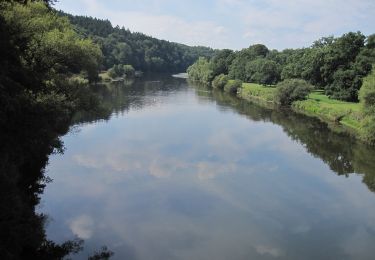
Tocht Te voet van 11,6 km beschikbaar op Rijnland-Palts, Landkreis Neuwied, Asbach. Deze tocht wordt voorgesteld door SityTrail - itinéraires balisés pédestres.
Beschrijving
Trail created by Verbandsgemeinde Asbach.
Symbol: Weißer Text B1 auf rotem Grund
Plaatsbepaling
Land:
Germany
Regio :
Rijnland-Palts
Departement/Provincie :
Landkreis Neuwied
Gemeente :
Asbach
Locatie:
Unknown
Vertrek:(Dec)
Vertrek:(UTM)
389234 ; 5617057 (32U) N.
Opmerkingen
Wandeltochten in de omgeving
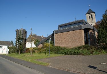
![Tocht Te voet Asbach - [A4] Mühlenweg - Photo](https://media.geolcdn.com/t/375/260/17f9fb3a-b4a7-45d7-a2b4-ea773ee9f1e5.jpeg&format=jpg&maxdim=2)
![Te voet Te voet](https://static1.geolcdn.com/sitytour/trail-icons/100.png)
[A4] Mühlenweg
Te voet
Gemakkelijk
Asbach,
Rijnland-Palts,
Landkreis Neuwied,
Germany
![](/images/other/stat-length.png)
12,8 km | 16,2 km-effort
3h 40min
![](https://static1.geolcdn.com/siteimages/upload/files/16400158638029165_repeat_loop_refresh_sync_direction_icon.png)
Ja
![Tocht Te voet Asbach - [A3] Kirchspielweg - Photo](https://media.geolcdn.com/t/375/260/17f9fb3a-b4a7-45d7-a2b4-ea773ee9f1e5.jpeg&format=jpg&maxdim=2)
![Te voet Te voet](https://static1.geolcdn.com/sitytour/trail-icons/100.png)
[A3] Kirchspielweg
Te voet
Gemakkelijk
Asbach,
Rijnland-Palts,
Landkreis Neuwied,
Germany
![](/images/other/stat-length.png)
13,2 km | 16,6 km-effort
3h 45min
![](https://static1.geolcdn.com/siteimages/upload/files/16400158638029165_repeat_loop_refresh_sync_direction_icon.png)
Ja
![Tocht Te voet Asbach - [A1] Basaltweg - Photo](https://media.geolcdn.com/t/375/260/17f9fb3a-b4a7-45d7-a2b4-ea773ee9f1e5.jpeg&format=jpg&maxdim=2)
![Te voet Te voet](https://static1.geolcdn.com/sitytour/trail-icons/100.png)
[A1] Basaltweg
Te voet
Gemakkelijk
Asbach,
Rijnland-Palts,
Landkreis Neuwied,
Germany
![](/images/other/stat-length.png)
10,1 km | 11,6 km-effort
2h 38min
![](https://static1.geolcdn.com/siteimages/upload/files/16400158638029165_repeat_loop_refresh_sync_direction_icon.png)
Ja
![Tocht Te voet Buchholz (Westerwald) - [B2] Dreiherrensteinweg - Photo](https://media.geolcdn.com/t/375/260/aecd4644-6921-4b4a-8659-a9cc70680b9b.jpeg&format=jpg&maxdim=2)
![Te voet Te voet](https://static1.geolcdn.com/sitytour/trail-icons/100.png)
[B2] Dreiherrensteinweg
Te voet
Gemakkelijk
Buchholz (Westerwald),
Rijnland-Palts,
Landkreis Neuwied,
Germany
![](/images/other/stat-length.png)
12,4 km | 14,8 km-effort
3h 22min
![](https://static1.geolcdn.com/siteimages/upload/files/16400158638029165_repeat_loop_refresh_sync_direction_icon.png)
Ja
![Tocht Te voet Buchholz (Westerwald) - [B3] Silberbergweg - Photo](https://media.geolcdn.com/t/375/260/26598f31-7aa1-441d-a048-772ec0888cec.jpeg&format=jpg&maxdim=2)
![Te voet Te voet](https://static1.geolcdn.com/sitytour/trail-icons/100.png)
[B3] Silberbergweg
Te voet
Gemakkelijk
Buchholz (Westerwald),
Rijnland-Palts,
Landkreis Neuwied,
Germany
![](/images/other/stat-length.png)
11,1 km | 13,9 km-effort
3h 10min
![](https://static1.geolcdn.com/siteimages/upload/files/16400158638029165_repeat_loop_refresh_sync_direction_icon.png)
Ja
![Tocht Te voet Eitorf - Försterweg (Erlebnisweg Sieg Nr. 10) - Photo](https://media.geolcdn.com/t/375/260/6bd5c806-91bc-480d-94f3-68798dfb443e.jpeg&format=jpg&maxdim=2)
![Te voet Te voet](https://static1.geolcdn.com/sitytour/trail-icons/100.png)
Försterweg (Erlebnisweg Sieg Nr. 10)
Te voet
Medium
Eitorf,
Noordrijn-Westfalen,
Rhein-Sieg-Kreis,
Germany
![](/images/other/stat-length.png)
16,6 km | 22 km-effort
5h 3min
![](https://static1.geolcdn.com/siteimages/upload/files/16400158638029165_repeat_loop_refresh_sync_direction_icon.png)
Ja
![Tocht Te voet Hennef (Sieg) - Uckerath Rundweg A1 - Photo](https://media.geolcdn.com/t/375/260/475ecaf0-d4e4-4b52-9567-44dc4769e42f.jpeg&format=jpg&maxdim=2)
![Te voet Te voet](https://static1.geolcdn.com/sitytour/trail-icons/100.png)
Uckerath Rundweg A1
Te voet
Gemakkelijk
Hennef (Sieg),
Noordrijn-Westfalen,
Rhein-Sieg-Kreis,
Germany
![](/images/other/stat-length.png)
3,6 km | 4,6 km-effort
1h 3min
![](https://static1.geolcdn.com/siteimages/upload/files/16400158638029165_repeat_loop_refresh_sync_direction_icon.png)
Neen