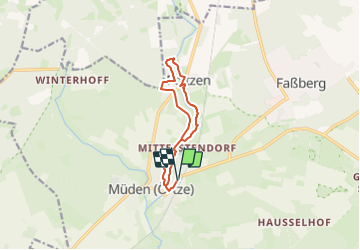
![](/images/other/stat-length.png)
![Tocht Te voet Faßberg - Südheide 'Fluss-Wald-Erlebnispfad' W3m (mittlere Tour) - Photo](https://media.geolcdn.com/t/1900/400/e6ff56c7-dcbf-4425-b35d-aa8c3da55c03.jpeg&format=pjpeg&maxdim=2)
Südheide 'Fluss-Wald-Erlebnispfad' W3m (mittlere Tour)
SityTrail - itinéraires balisés pédestres
Tous les sentiers balisés d’Europe GUIDE+
![Lengte](/images/other/stat-length.png)
![Max. hoogte](https://static1.geolcdn.com/siteimages/upload/files/1508320355ic_sort_altitude_max_24dp.png)
![Positief hoogteverschil](https://static1.geolcdn.com/siteimages/upload/files/1508320355ic_sort_den_pos_24dp.png)
![Km-Effort](/images/other/stat-length.png)
![Min. hoogte](https://static1.geolcdn.com/siteimages/upload/files/1508320355ic_sort_altitude_min_24dp.png)
![Negatief hoogteverschil](https://static1.geolcdn.com/siteimages/upload/files/1508320355ic_sort_den_neg_24dp.png)
![Boucle](https://static1.geolcdn.com/siteimages/upload/files/16400158638029165_repeat_loop_refresh_sync_direction_icon.png)
![Te voet](https://static1.geolcdn.com/sitytour/trail-icons/100.png)
2h16
Moeilijkheid : Gemakkelijk
![Scan deze QR-code om de tocht te openen in de SityTrail-applicatie](https://capi.geolives.com/qq0zvz2zws4bq2lad0pu/sitytour/trails/3101138/qr.png?size=200)
Gratisgps-wandelapplicatie
Over ons
Tocht Te voet van 9 km beschikbaar op Nedersaksen, Landkreis Celle, Faßberg. Deze tocht wordt voorgesteld door SityTrail - itinéraires balisés pédestres.
Beschrijving
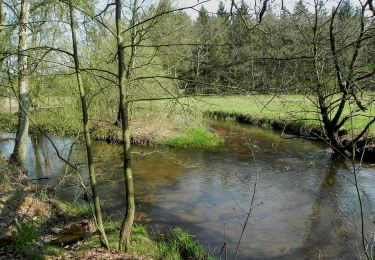
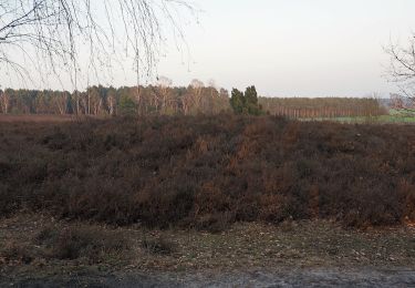
Zwischen Hermannsburg, Müden (Örtze) und Poitzen erschließt der Fluss-Wald-Erlebnispfad die Landschaft des Örtzetals (Rundweg)
Website: https://www.lueneburger-heide.de/9142
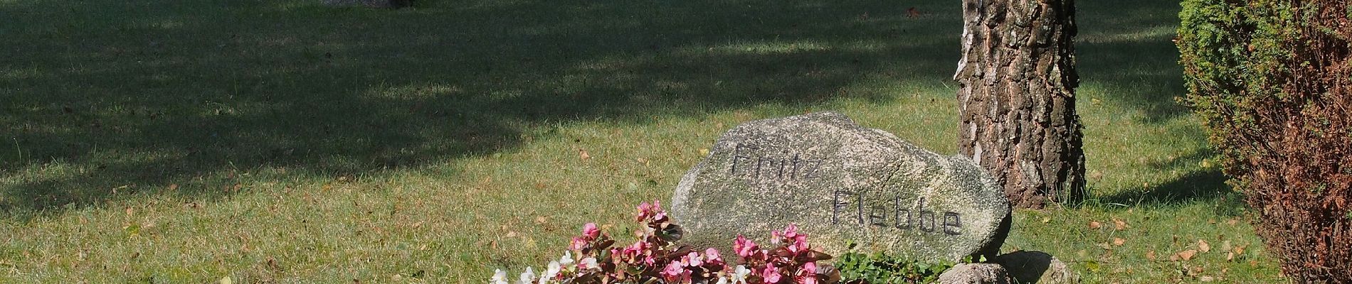
Plaatsbepaling
Opmerkingen
Wandeltochten in de omgeving
![Tocht Te voet Munster - Kartoffelweg - Photo](https://media.geolcdn.com/t/375/260/f36a72c8-90a0-4b20-af32-a7401c392de2.jpeg&format=jpg&maxdim=2)
![Te voet Te voet](https://static1.geolcdn.com/sitytour/trail-icons/100.png)
Te voet
![](/images/other/stat-length.png)
![](https://static1.geolcdn.com/siteimages/upload/files/16400158638029165_repeat_loop_refresh_sync_direction_icon.png)
![Tocht Te voet Faßberg - Südheide 'Sagenhafte Sicht im Elfenland' W4m (mittlere Tour) - Photo](https://media.geolcdn.com/t/375/260/4e30d838-04bc-4601-82d4-810b6abda2cd.jpeg&format=jpg&maxdim=2)
![Te voet Te voet](https://static1.geolcdn.com/sitytour/trail-icons/100.png)
Te voet
![](/images/other/stat-length.png)
![](https://static1.geolcdn.com/siteimages/upload/files/16400158638029165_repeat_loop_refresh_sync_direction_icon.png)
![Tocht Te voet Faßberg - Südheide 'Sagenhafte Sicht im Elfenland' W4k (kurze Tour) - Photo](https://media.geolcdn.com/t/375/260/e6ff56c7-dcbf-4425-b35d-aa8c3da55c03.jpeg&format=jpg&maxdim=2)
![Te voet Te voet](https://static1.geolcdn.com/sitytour/trail-icons/100.png)
Te voet
![](/images/other/stat-length.png)
![](https://static1.geolcdn.com/siteimages/upload/files/16400158638029165_repeat_loop_refresh_sync_direction_icon.png)
![Tocht Te voet Faßberg - Südheide 'Sagenhafte Sicht im Elfenland' W4l (lange Tour) - Photo](https://media.geolcdn.com/t/375/260/e6ff56c7-dcbf-4425-b35d-aa8c3da55c03.jpeg&format=jpg&maxdim=2)
![Te voet Te voet](https://static1.geolcdn.com/sitytour/trail-icons/100.png)
Te voet
![](/images/other/stat-length.png)
![](https://static1.geolcdn.com/siteimages/upload/files/16400158638029165_repeat_loop_refresh_sync_direction_icon.png)
![Tocht Te voet Faßberg - Südheide 'Wo der Wald mit der Heide kuselt' W2k (kurze Tour) - Photo](https://media.geolcdn.com/t/375/260/fa23967d-b9cd-48de-89d6-a3e53fa4cf9b.jpeg&format=jpg&maxdim=2)
![Te voet Te voet](https://static1.geolcdn.com/sitytour/trail-icons/100.png)
Te voet
![](/images/other/stat-length.png)
![](https://static1.geolcdn.com/siteimages/upload/files/16400158638029165_repeat_loop_refresh_sync_direction_icon.png)
![Tocht Te voet Faßberg - Südheide 'Wo der Wald mit der Heide kuselt' W2m (mittlere Tour) - Photo](https://media.geolcdn.com/t/375/260/fa23967d-b9cd-48de-89d6-a3e53fa4cf9b.jpeg&format=jpg&maxdim=2)
![Te voet Te voet](https://static1.geolcdn.com/sitytour/trail-icons/100.png)
Te voet
![](/images/other/stat-length.png)
![](https://static1.geolcdn.com/siteimages/upload/files/16400158638029165_repeat_loop_refresh_sync_direction_icon.png)
![Tocht Te voet Faßberg - Südheide 'Wo der Wald mit der Heide kuselt' W2l (lange Tour) - Photo](https://media.geolcdn.com/t/375/260/fa23967d-b9cd-48de-89d6-a3e53fa4cf9b.jpeg&format=jpg&maxdim=2)
![Te voet Te voet](https://static1.geolcdn.com/sitytour/trail-icons/100.png)
Te voet
![](/images/other/stat-length.png)
![](https://static1.geolcdn.com/siteimages/upload/files/16400158638029165_repeat_loop_refresh_sync_direction_icon.png)
![Tocht Te voet Faßberg - Südheide 'Fluss-Wald-Erlebnispfad' W3l (lange Tour) - Photo](https://media.geolcdn.com/t/375/260/9a835367-8efe-4d8a-bfa0-b6a1d20079cf.jpeg&format=jpg&maxdim=2)
![Te voet Te voet](https://static1.geolcdn.com/sitytour/trail-icons/100.png)
Te voet
![](/images/other/stat-length.png)
![](https://static1.geolcdn.com/siteimages/upload/files/16400158638029165_repeat_loop_refresh_sync_direction_icon.png)
![Tocht Te voet Faßberg - Südheide 'Fluss-Wald-Erlebnispfad' W3k (kurze Tour) - Photo](https://media.geolcdn.com/t/375/260/e6ff56c7-dcbf-4425-b35d-aa8c3da55c03.jpeg&format=jpg&maxdim=2)
![Te voet Te voet](https://static1.geolcdn.com/sitytour/trail-icons/100.png)
Te voet
![](/images/other/stat-length.png)
![](https://static1.geolcdn.com/siteimages/upload/files/16400158638029165_repeat_loop_refresh_sync_direction_icon.png)