![](/images/other/stat-length.png)
![Tocht Te voet Kiedrich - Kiedrich 7: - Photo](https://media.geolcdn.com/t/1900/400/2c023441-fc39-40c2-b5a2-5f669c44ef98.jpeg&format=pjpeg&maxdim=2)
Kiedrich 7:
SityTrail - itinéraires balisés pédestres
Tous les sentiers balisés d’Europe GUIDE+
![Lengte](/images/other/stat-length.png)
Lengte
5,8 km
![Max. hoogte](https://static1.geolcdn.com/siteimages/upload/files/1508320355ic_sort_altitude_max_24dp.png)
Max. hoogte
355 m
![Positief hoogteverschil](https://static1.geolcdn.com/siteimages/upload/files/1508320355ic_sort_den_pos_24dp.png)
Positief hoogteverschil
127 m
![Km-Effort](/images/other/stat-length.png)
Km-Effort
7,7 km
![Min. hoogte](https://static1.geolcdn.com/siteimages/upload/files/1508320355ic_sort_altitude_min_24dp.png)
Min. hoogte
170 m
![Negatief hoogteverschil](https://static1.geolcdn.com/siteimages/upload/files/1508320355ic_sort_den_neg_24dp.png)
Negatief hoogteverschil
188 m
![Boucle](https://static1.geolcdn.com/siteimages/upload/files/16400158638029165_repeat_loop_refresh_sync_direction_icon.png)
Boucle
Neen
Markering
Datum van aanmaak :
2022-02-11 18:45:32.718
Laatste wijziging :
2022-02-11 18:45:32.718
![Te voet](https://static1.geolcdn.com/sitytour/trail-icons/100.png)
1h45
Moeilijkheid : Gemakkelijk
![Scan deze QR-code om de tocht te openen in de SityTrail-applicatie](https://capi.geolives.com/qq0zvz2zws4bq2lad0pu/sitytour/trails/3099800/qr.png?size=200)
Gratisgps-wandelapplicatie
Over ons
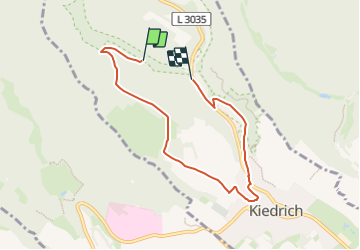
Tocht Te voet van 5,8 km beschikbaar op Hessen, Rheingau-Taunus-Kreis, Kiedrich. Deze tocht wordt voorgesteld door SityTrail - itinéraires balisés pédestres.
Beschrijving
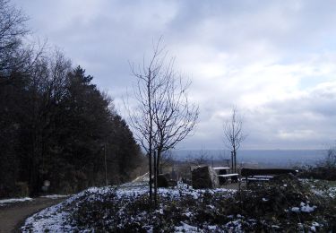
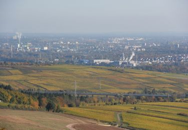
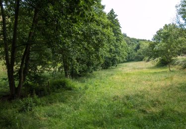
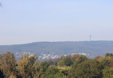
Symbol: oranges, rechteckiges Schild mit einer weißen 7
Plaatsbepaling
Land:
Germany
Regio :
Hessen
Departement/Provincie :
Rheingau-Taunus-Kreis
Gemeente :
Kiedrich
Locatie:
Unknown
Vertrek:(Dec)
Vertrek:(UTM)
432840 ; 5545360 (32U) N.
Opmerkingen
Wandeltochten in de omgeving
![Tocht Te voet Eltville am Rhein - Gutenbergweg - Photo](https://media.geolcdn.com/t/375/260/cd0c3ee6-7087-46a1-8c63-f960173d82e9.jpeg&format=jpg&maxdim=2)
![Te voet Te voet](https://static1.geolcdn.com/sitytour/trail-icons/100.png)
Gutenbergweg
Te voet
Medium
Eltville am Rhein,
Hessen,
Rheingau-Taunus-Kreis,
Germany
![](/images/other/stat-length.png)
24 km | 30 km-effort
6h 46min
![](https://static1.geolcdn.com/siteimages/upload/files/16400158638029165_repeat_loop_refresh_sync_direction_icon.png)
Ja
![Tocht Te voet Schlangenbad - Glaabacher Almauftrieb - Photo](https://media.geolcdn.com/t/375/260/049417cf-441f-4e72-9098-4b7831623d7a.jpeg&format=jpg&maxdim=2)
![Te voet Te voet](https://static1.geolcdn.com/sitytour/trail-icons/100.png)
Glaabacher Almauftrieb
Te voet
Medium
Schlangenbad,
Hessen,
Rheingau-Taunus-Kreis,
Germany
![](/images/other/stat-length.png)
18,8 km | 27 km-effort
6h 6min
![](https://static1.geolcdn.com/siteimages/upload/files/16400158638029165_repeat_loop_refresh_sync_direction_icon.png)
Ja
![Tocht Te voet Eltville am Rhein - Rheinsteig-Zuweg Eltville - Photo](https://media.geolcdn.com/t/375/260/27ade83c-c43d-4b74-8817-38b2f29ada10.jpeg&format=jpg&maxdim=2)
![Te voet Te voet](https://static1.geolcdn.com/sitytour/trail-icons/100.png)
Rheinsteig-Zuweg Eltville
Te voet
Gemakkelijk
Eltville am Rhein,
Hessen,
Rheingau-Taunus-Kreis,
Germany
![](/images/other/stat-length.png)
3,2 km | 3,6 km-effort
48min
![](https://static1.geolcdn.com/siteimages/upload/files/16400158638029165_repeat_loop_refresh_sync_direction_icon.png)
Neen
![Tocht Te voet Kiedrich - Kiedrich 8: - Photo](https://media.geolcdn.com/t/375/260/2c023441-fc39-40c2-b5a2-5f669c44ef98.jpeg&format=jpg&maxdim=2)
![Te voet Te voet](https://static1.geolcdn.com/sitytour/trail-icons/100.png)
Kiedrich 8:
Te voet
Gemakkelijk
Kiedrich,
Hessen,
Rheingau-Taunus-Kreis,
Germany
![](/images/other/stat-length.png)
5,7 km | 7,2 km-effort
1h 38min
![](https://static1.geolcdn.com/siteimages/upload/files/16400158638029165_repeat_loop_refresh_sync_direction_icon.png)
Neen
![Tocht Te voet Eltville am Rhein - Rheinsteig-Zuweg Niederwalluf (West) - Photo](https://media.geolcdn.com/t/375/260/37c3ad44-bffd-4d35-9f40-789cd2c4f541.jpeg&format=jpg&maxdim=2)
![Te voet Te voet](https://static1.geolcdn.com/sitytour/trail-icons/100.png)
Rheinsteig-Zuweg Niederwalluf (West)
Te voet
Gemakkelijk
Eltville am Rhein,
Hessen,
Rheingau-Taunus-Kreis,
Germany
![](/images/other/stat-length.png)
5,8 km | 8,2 km-effort
1h 51min
![](https://static1.geolcdn.com/siteimages/upload/files/16400158638029165_repeat_loop_refresh_sync_direction_icon.png)
Neen
![Tocht Te voet Eltville am Rhein - Rheinsteig Rundtour: Rauenthaler Spange - Photo](https://media.geolcdn.com/t/375/260/f17f7bce-e902-429b-8a92-95a9e738d243.jpeg&format=jpg&maxdim=2)
![Te voet Te voet](https://static1.geolcdn.com/sitytour/trail-icons/100.png)
Rheinsteig Rundtour: Rauenthaler Spange
Te voet
Gemakkelijk
Eltville am Rhein,
Hessen,
Rheingau-Taunus-Kreis,
Germany
![](/images/other/stat-length.png)
7,5 km | 9,8 km-effort
2h 13min
![](https://static1.geolcdn.com/siteimages/upload/files/16400158638029165_repeat_loop_refresh_sync_direction_icon.png)
Neen
![Tocht Te voet Oestrich-Winkel - Rheinsteig-Zuweg Oestrich - Photo](https://media.geolcdn.com/t/375/260/cd091fed-3575-471c-85b8-e8e4faab10a4.jpeg&format=jpg&maxdim=2)
![Te voet Te voet](https://static1.geolcdn.com/sitytour/trail-icons/100.png)
Rheinsteig-Zuweg Oestrich
Te voet
Gemakkelijk
Oestrich-Winkel,
Hessen,
Rheingau-Taunus-Kreis,
Germany
![](/images/other/stat-length.png)
3,1 km | 3,4 km-effort
46min
![](https://static1.geolcdn.com/siteimages/upload/files/16400158638029165_repeat_loop_refresh_sync_direction_icon.png)
Neen
![Tocht Te voet Eltville am Rhein - Wanderweg 2 Pfeile - Photo](https://media.geolcdn.com/t/375/260/7f050105-329f-4490-aedd-e05ef6c47d1b.jpeg&format=jpg&maxdim=2)
![Te voet Te voet](https://static1.geolcdn.com/sitytour/trail-icons/100.png)
Wanderweg 2 Pfeile
Te voet
Gemakkelijk
Eltville am Rhein,
Hessen,
Rheingau-Taunus-Kreis,
Germany
![](/images/other/stat-length.png)
3,9 km | 5,1 km-effort
1h 9min
![](https://static1.geolcdn.com/siteimages/upload/files/16400158638029165_repeat_loop_refresh_sync_direction_icon.png)
Ja
![Tocht Te voet Oestrich-Winkel - Oestricher Flötenweg - Photo](https://media.geolcdn.com/t/375/260/1d02bcef-020c-43bf-8f6f-996adca7a9a9.jpeg&format=jpg&maxdim=2)
![Te voet Te voet](https://static1.geolcdn.com/sitytour/trail-icons/100.png)
Oestricher Flötenweg
Te voet
Gemakkelijk
Oestrich-Winkel,
Hessen,
Rheingau-Taunus-Kreis,
Germany
![](/images/other/stat-length.png)
3,4 km | 3,9 km-effort
52min
![](https://static1.geolcdn.com/siteimages/upload/files/16400158638029165_repeat_loop_refresh_sync_direction_icon.png)
Neen