![](/images/other/stat-length.png)
![Tocht Te voet Dornburg-Camburg - Stöben-Schmiedehausen - Photo](https://media.geolcdn.com/t/1900/400/c30cb827-2bee-48b1-a8b5-08bc0fa2c2f4.jpeg&format=pjpeg&maxdim=2)
Stöben-Schmiedehausen
SityTrail - itinéraires balisés pédestres
Tous les sentiers balisés d’Europe GUIDE+
![Lengte](/images/other/stat-length.png)
Lengte
5,3 km
![Max. hoogte](https://static1.geolcdn.com/siteimages/upload/files/1508320355ic_sort_altitude_max_24dp.png)
Max. hoogte
271 m
![Positief hoogteverschil](https://static1.geolcdn.com/siteimages/upload/files/1508320355ic_sort_den_pos_24dp.png)
Positief hoogteverschil
149 m
![Km-Effort](/images/other/stat-length.png)
Km-Effort
7,3 km
![Min. hoogte](https://static1.geolcdn.com/siteimages/upload/files/1508320355ic_sort_altitude_min_24dp.png)
Min. hoogte
124 m
![Negatief hoogteverschil](https://static1.geolcdn.com/siteimages/upload/files/1508320355ic_sort_den_neg_24dp.png)
Negatief hoogteverschil
147 m
![Boucle](https://static1.geolcdn.com/siteimages/upload/files/16400158638029165_repeat_loop_refresh_sync_direction_icon.png)
Boucle
Ja
Markering
Datum van aanmaak :
2022-02-11 18:11:21.133
Laatste wijziging :
2022-02-11 18:11:21.133
![Te voet](https://static1.geolcdn.com/sitytour/trail-icons/100.png)
1h39
Moeilijkheid : Gemakkelijk
![Scan deze QR-code om de tocht te openen in de SityTrail-applicatie](https://capi.geolives.com/qq0zvz2zws4bq2lad0pu/sitytour/trails/3099124/qr.png?size=200)
Gratisgps-wandelapplicatie
Over ons
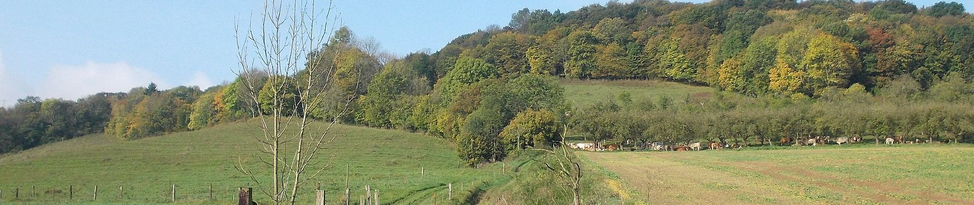
Tocht Te voet van 5,3 km beschikbaar op Thüringen, Saale-Holzland-Kreis, Dornburg-Camburg. Deze tocht wordt voorgesteld door SityTrail - itinéraires balisés pédestres.
Beschrijving
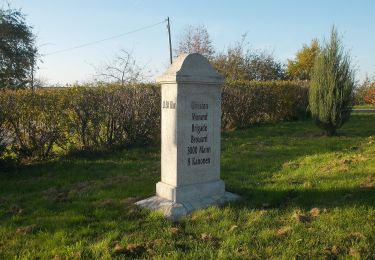
Wegweiser nur nördlich des Bachse
Plaatsbepaling
Land:
Germany
Regio :
Thüringen
Departement/Provincie :
Saale-Holzland-Kreis
Gemeente :
Dornburg-Camburg
Locatie:
Unknown
Vertrek:(Dec)
Vertrek:(UTM)
688740 ; 5661640 (32U) N.
Opmerkingen
Wandeltochten in de omgeving
![Tocht Te voet Bad Sulza - Weinwanderweg Bad Sulza - Photo](https://media.geolcdn.com/t/375/260/546476e3-25ce-483e-b2e9-a05d647513d4.jpeg&format=jpg&maxdim=2)
![Te voet Te voet](https://static1.geolcdn.com/sitytour/trail-icons/100.png)
Weinwanderweg Bad Sulza
Te voet
Gemakkelijk
Bad Sulza,
Thüringen,
Landkreis Weimarer Land,
Germany
![](/images/other/stat-length.png)
8,4 km | 10,8 km-effort
2h 27min
![](https://static1.geolcdn.com/siteimages/upload/files/16400158638029165_repeat_loop_refresh_sync_direction_icon.png)
Ja
![Tocht Te voet Dornburg-Camburg - Rundweg Camburg-Stöbnitz - Photo](https://media.geolcdn.com/t/375/260/132f0129-ed9a-4cb3-9157-e2d24199bb72.jpeg&format=jpg&maxdim=2)
![Te voet Te voet](https://static1.geolcdn.com/sitytour/trail-icons/100.png)
Rundweg Camburg-Stöbnitz
Te voet
Gemakkelijk
Dornburg-Camburg,
Thüringen,
Saale-Holzland-Kreis,
Germany
![](/images/other/stat-length.png)
5,7 km | 8,3 km-effort
1h 53min
![](https://static1.geolcdn.com/siteimages/upload/files/16400158638029165_repeat_loop_refresh_sync_direction_icon.png)
Ja
![Tocht Te voet Großheringen - Rundweg Kaatschen-Tultewitz - Photo](https://media.geolcdn.com/t/375/260/0da118d8-23e7-4f66-86b2-2f57f098cdb1.jpeg&format=jpg&maxdim=2)
![Te voet Te voet](https://static1.geolcdn.com/sitytour/trail-icons/100.png)
Rundweg Kaatschen-Tultewitz
Te voet
Gemakkelijk
Großheringen,
Thüringen,
Landkreis Weimarer Land,
Germany
![](/images/other/stat-length.png)
5 km | 6,7 km-effort
1h 31min
![](https://static1.geolcdn.com/siteimages/upload/files/16400158638029165_repeat_loop_refresh_sync_direction_icon.png)
Ja
![Tocht Te voet Naumburg (Saale) - Rudelsburgweg - Photo](https://media.geolcdn.com/t/375/260/efb2cd93-b239-4dee-8100-c274a4197a7c.jpeg&format=jpg&maxdim=2)
![Te voet Te voet](https://static1.geolcdn.com/sitytour/trail-icons/100.png)
Rudelsburgweg
Te voet
Gemakkelijk
Naumburg (Saale),
Saksen-Anhalt,
Burgenlandkreis,
Germany
![](/images/other/stat-length.png)
3,4 km | 3,8 km-effort
52min
![](https://static1.geolcdn.com/siteimages/upload/files/16400158638029165_repeat_loop_refresh_sync_direction_icon.png)
Neen
![Tocht Te voet Bad Sulza - Im Brühlgrund - Photo](https://media.geolcdn.com/t/375/260/8819969a-a5b6-4421-a096-ec5464803ff6.jpeg&format=jpg&maxdim=2)
![Te voet Te voet](https://static1.geolcdn.com/sitytour/trail-icons/100.png)
Im Brühlgrund
Te voet
Gemakkelijk
Bad Sulza,
Thüringen,
Landkreis Weimarer Land,
Germany
![](/images/other/stat-length.png)
3,1 km | 3,7 km-effort
51min
![](https://static1.geolcdn.com/siteimages/upload/files/16400158638029165_repeat_loop_refresh_sync_direction_icon.png)
Ja
![Tocht Te voet Bad Sulza - Schlachtfelder Bad Sulza - Photo](https://media.geolcdn.com/t/375/260/cbfb1c52-a17d-4f84-b71b-5f785beb0f9d.jpeg&format=jpg&maxdim=2)
![Te voet Te voet](https://static1.geolcdn.com/sitytour/trail-icons/100.png)
Schlachtfelder Bad Sulza
Te voet
Gemakkelijk
Bad Sulza,
Thüringen,
Landkreis Weimarer Land,
Germany
![](/images/other/stat-length.png)
11,8 km | 15,7 km-effort
3h 34min
![](https://static1.geolcdn.com/siteimages/upload/files/16400158638029165_repeat_loop_refresh_sync_direction_icon.png)
Neen
![Tocht Te voet Bad Sulza - Himmelreich Rundweg Bad Sulza - Photo](https://media.geolcdn.com/t/375/260/ea54403f-f3af-4d92-a3f2-340d70a02da5.jpeg&format=jpg&maxdim=2)
![Te voet Te voet](https://static1.geolcdn.com/sitytour/trail-icons/100.png)
Himmelreich Rundweg Bad Sulza
Te voet
Gemakkelijk
Bad Sulza,
Thüringen,
Landkreis Weimarer Land,
Germany
![](/images/other/stat-length.png)
13,4 km | 17,6 km-effort
3h 59min
![](https://static1.geolcdn.com/siteimages/upload/files/16400158638029165_repeat_loop_refresh_sync_direction_icon.png)
Ja
![Tocht Te voet Bad Sulza - Panorama Rundweg - Photo](https://media.geolcdn.com/t/375/260/d890ab57-cf55-4034-9612-7555cf97d79f.jpeg&format=jpg&maxdim=2)
![Te voet Te voet](https://static1.geolcdn.com/sitytour/trail-icons/100.png)
Panorama Rundweg
Te voet
Gemakkelijk
Bad Sulza,
Thüringen,
Landkreis Weimarer Land,
Germany
![](/images/other/stat-length.png)
3,1 km | 4,4 km-effort
59min
![](https://static1.geolcdn.com/siteimages/upload/files/16400158638029165_repeat_loop_refresh_sync_direction_icon.png)
Neen