![](/images/other/stat-length.png)
![Tocht Te voet Nebra (Unstrut) - Triastor Geopfad Route West - Photo](https://media.geolcdn.com/t/1900/400/e406c940-40ef-4ea0-8f55-aae290492fc5.jpeg&format=pjpeg&maxdim=2)
Triastor Geopfad Route West
SityTrail - itinéraires balisés pédestres
Tous les sentiers balisés d’Europe GUIDE+
![Lengte](/images/other/stat-length.png)
Lengte
21 km
![Max. hoogte](https://static1.geolcdn.com/siteimages/upload/files/1508320355ic_sort_altitude_max_24dp.png)
Max. hoogte
279 m
![Positief hoogteverschil](https://static1.geolcdn.com/siteimages/upload/files/1508320355ic_sort_den_pos_24dp.png)
Positief hoogteverschil
389 m
![Km-Effort](/images/other/stat-length.png)
Km-Effort
27 km
![Min. hoogte](https://static1.geolcdn.com/siteimages/upload/files/1508320355ic_sort_altitude_min_24dp.png)
Min. hoogte
111 m
![Negatief hoogteverschil](https://static1.geolcdn.com/siteimages/upload/files/1508320355ic_sort_den_neg_24dp.png)
Negatief hoogteverschil
388 m
![Boucle](https://static1.geolcdn.com/siteimages/upload/files/16400158638029165_repeat_loop_refresh_sync_direction_icon.png)
Boucle
Ja
Markering
Datum van aanmaak :
2022-02-11 18:10:00.457
Laatste wijziging :
2022-02-11 18:10:00.457
![Te voet](https://static1.geolcdn.com/sitytour/trail-icons/100.png)
6h03
Moeilijkheid : Medium
![Scan deze QR-code om de tocht te openen in de SityTrail-applicatie](https://capi.geolives.com/qq0zvz2zws4bq2lad0pu/sitytour/trails/3099097/qr.png?size=200)
Gratisgps-wandelapplicatie
Over ons
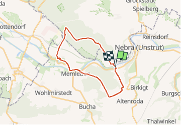
Tocht Te voet van 21 km beschikbaar op Saksen-Anhalt, Burgenlandkreis, Nebra (Unstrut). Deze tocht wordt voorgesteld door SityTrail - itinéraires balisés pédestres.
Beschrijving
Trail created by Geo- Naturpark SUT.
Website: http://www.naturpark-saale-unstrut.de/de/trias.html
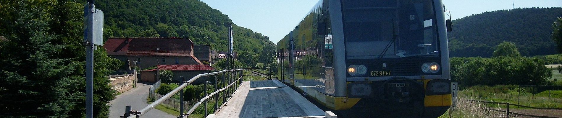
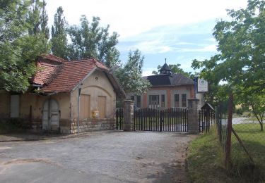
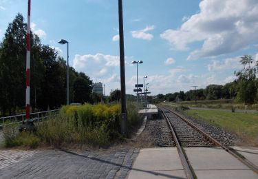
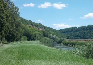
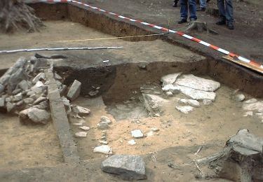
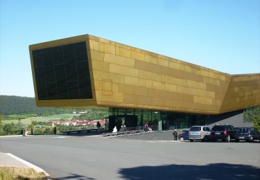
Plaatsbepaling
Land:
Germany
Regio :
Saksen-Anhalt
Departement/Provincie :
Burgenlandkreis
Gemeente :
Nebra (Unstrut)
Locatie:
Unknown
Vertrek:(Dec)
Vertrek:(UTM)
677586 ; 5682991 (32U) N.
Opmerkingen
Wandeltochten in de omgeving
![Tocht Te voet Nebra (Unstrut) - Triastor Geopfad Route Ost - Photo](https://media.geolcdn.com/t/375/260/a1f061a6-f362-4fb0-b1e6-123453fbb631.jpeg&format=jpg&maxdim=2)
![Te voet Te voet](https://static1.geolcdn.com/sitytour/trail-icons/100.png)
Triastor Geopfad Route Ost
Te voet
Gemakkelijk
Nebra (Unstrut),
Saksen-Anhalt,
Burgenlandkreis,
Germany
![](/images/other/stat-length.png)
10,8 km | 14,4 km-effort
3h 16min
![](https://static1.geolcdn.com/siteimages/upload/files/16400158638029165_repeat_loop_refresh_sync_direction_icon.png)
Ja
![Tocht Te voet Nebra (Unstrut) - Weinweg Reinsdorf-Steigra-Karsdorf - Photo](https://media.geolcdn.com/t/375/260/030336d4-5fcd-4592-9124-62525e35df0d.jpeg&format=jpg&maxdim=2)
![Te voet Te voet](https://static1.geolcdn.com/sitytour/trail-icons/100.png)
Weinweg Reinsdorf-Steigra-Karsdorf
Te voet
Gemakkelijk
Nebra (Unstrut),
Saksen-Anhalt,
Burgenlandkreis,
Germany
![](/images/other/stat-length.png)
5,2 km | 6,3 km-effort
1h 25min
![](https://static1.geolcdn.com/siteimages/upload/files/16400158638029165_repeat_loop_refresh_sync_direction_icon.png)
Neen
![Tocht Te voet Kaiserpfalz - Bahnwanderweg - Photo](https://media.geolcdn.com/t/375/260/57a8e049-07cb-4b8d-9151-53c3bc960250.jpeg&format=jpg&maxdim=2)
![Te voet Te voet](https://static1.geolcdn.com/sitytour/trail-icons/100.png)
Bahnwanderweg
Te voet
Gemakkelijk
Kaiserpfalz,
Saksen-Anhalt,
Burgenlandkreis,
Germany
![](/images/other/stat-length.png)
5,5 km | 6,7 km-effort
1h 31min
![](https://static1.geolcdn.com/siteimages/upload/files/16400158638029165_repeat_loop_refresh_sync_direction_icon.png)
Neen
![Tocht Te voet Nebra (Unstrut) - Arche-Rundweg - Photo](https://media.geolcdn.com/t/375/260/10de6a28-a8c0-47fe-a79d-7e3097057602.jpeg&format=jpg&maxdim=2)
![Te voet Te voet](https://static1.geolcdn.com/sitytour/trail-icons/100.png)
Arche-Rundweg
Te voet
Gemakkelijk
Nebra (Unstrut),
Saksen-Anhalt,
Burgenlandkreis,
Germany
![](/images/other/stat-length.png)
5,5 km | 7,6 km-effort
1h 43min
![](https://static1.geolcdn.com/siteimages/upload/files/16400158638029165_repeat_loop_refresh_sync_direction_icon.png)
Ja
![Tocht Te voet Kaiserpfalz - Roßleben-Arche-Nebra - Photo](https://media.geolcdn.com/t/375/260/22c2e0be-854d-42f8-a5d0-8ca76e974fef.jpeg&format=jpg&maxdim=2)
![Te voet Te voet](https://static1.geolcdn.com/sitytour/trail-icons/100.png)
Roßleben-Arche-Nebra
Te voet
Gemakkelijk
Kaiserpfalz,
Saksen-Anhalt,
Burgenlandkreis,
Germany
![](/images/other/stat-length.png)
4,1 km | 5,1 km-effort
1h 9min
![](https://static1.geolcdn.com/siteimages/upload/files/16400158638029165_repeat_loop_refresh_sync_direction_icon.png)
Neen