![](/images/other/stat-length.png)
![Tocht Te voet Ronshausen - Extratour Ronshausen - Photo](https://media.geolcdn.com/t/1900/400/ext.pjpeg?maxdim=2&url=https%3A%2F%2Fstatic1.geolcdn.com%2Fsiteimages%2Fupload%2Ffiles%2F1545311037marcheuse_200dpi.jpg)
Extratour Ronshausen
SityTrail - itinéraires balisés pédestres
Tous les sentiers balisés d’Europe GUIDE+
![Lengte](/images/other/stat-length.png)
![Max. hoogte](https://static1.geolcdn.com/siteimages/upload/files/1508320355ic_sort_altitude_max_24dp.png)
![Positief hoogteverschil](https://static1.geolcdn.com/siteimages/upload/files/1508320355ic_sort_den_pos_24dp.png)
![Km-Effort](/images/other/stat-length.png)
![Min. hoogte](https://static1.geolcdn.com/siteimages/upload/files/1508320355ic_sort_altitude_min_24dp.png)
![Negatief hoogteverschil](https://static1.geolcdn.com/siteimages/upload/files/1508320355ic_sort_den_neg_24dp.png)
![Boucle](https://static1.geolcdn.com/siteimages/upload/files/16400158638029165_repeat_loop_refresh_sync_direction_icon.png)
![Te voet](https://static1.geolcdn.com/sitytour/trail-icons/100.png)
5h24
Moeilijkheid : Medium
![Scan deze QR-code om de tocht te openen in de SityTrail-applicatie](https://capi.geolives.com/qq0zvz2zws4bq2lad0pu/sitytour/trails/3098346/qr.png?size=200)
Gratisgps-wandelapplicatie
Over ons
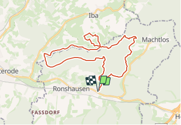
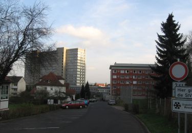
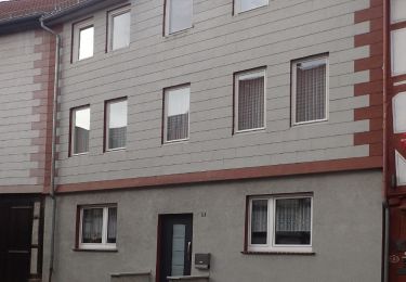
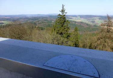
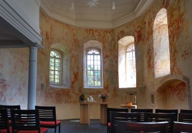
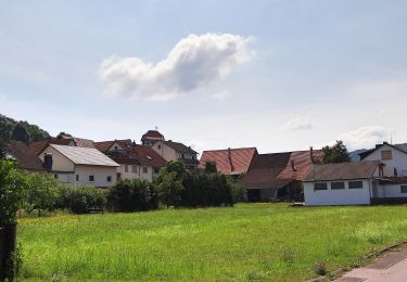
Tocht Te voet van 17,7 km beschikbaar op Hessen, Landkreis Hersfeld-Rotenburg, Ronshausen. Deze tocht wordt voorgesteld door SityTrail - itinéraires balisés pédestres.
Beschrijving
Symbol: gelbes R in gelben Kreis auf rotem Grund
Website: https://www.ronshausen-touristik.de/aktivurlaub/erlebniswege/premium_rundweg_hessen_extratour_ronshausen/premium_rundweg_hessen_extratour_ronshausen.html
Plaatsbepaling
Opmerkingen
Wandeltochten in de omgeving
![Tocht Te voet Haunetal - Turmweg - Kurzvariante - Photo](https://media.geolcdn.com/t/375/260/570c5804-2c02-4f4f-b6e0-2405b75b7cad.jpeg&format=jpg&maxdim=2)
![Te voet Te voet](https://static1.geolcdn.com/sitytour/trail-icons/100.png)
Te voet
![](/images/other/stat-length.png)
![](https://static1.geolcdn.com/siteimages/upload/files/16400158638029165_repeat_loop_refresh_sync_direction_icon.png)
![Tocht Te voet Rotenburg an der Fulda - Heienbach-Tour - Photo](https://media.geolcdn.com/t/375/260/68477b14-fe23-47de-9435-6f88bc7fbc30.jpeg&format=jpg&maxdim=2)
![Te voet Te voet](https://static1.geolcdn.com/sitytour/trail-icons/100.png)
Te voet
![](/images/other/stat-length.png)
![](https://static1.geolcdn.com/siteimages/upload/files/16400158638029165_repeat_loop_refresh_sync_direction_icon.png)
![Tocht Te voet Rotenburg an der Fulda - Rotenburg Wanderweg R3 - Photo](https://media.geolcdn.com/t/375/260/bf2c482b-fc47-4c45-b5dc-933ad3a0d025.jpeg&format=jpg&maxdim=2)
![Te voet Te voet](https://static1.geolcdn.com/sitytour/trail-icons/100.png)
Te voet
![](/images/other/stat-length.png)
![](https://static1.geolcdn.com/siteimages/upload/files/16400158638029165_repeat_loop_refresh_sync_direction_icon.png)
![Tocht Te voet Rotenburg an der Fulda - Rotenburg Wanderweg R2 - Photo](https://media.geolcdn.com/t/375/260/ed5ee080-03e4-406d-b675-6e7dafc277ac.jpeg&format=jpg&maxdim=2)
![Te voet Te voet](https://static1.geolcdn.com/sitytour/trail-icons/100.png)
Te voet
![](/images/other/stat-length.png)
![](https://static1.geolcdn.com/siteimages/upload/files/16400158638029165_repeat_loop_refresh_sync_direction_icon.png)
![Tocht Te voet Rotenburg an der Fulda - Rotenburg Wanderweg R1 - Photo](https://media.geolcdn.com/t/375/260/1b095363-56d5-4f85-a348-d07d4ce97920.jpeg&format=jpg&maxdim=2)
![Te voet Te voet](https://static1.geolcdn.com/sitytour/trail-icons/100.png)
Te voet
![](/images/other/stat-length.png)
![](https://static1.geolcdn.com/siteimages/upload/files/16400158638029165_repeat_loop_refresh_sync_direction_icon.png)
![Tocht Te voet Alheim - Niedergude Rundweg N5 - Photo](https://media.geolcdn.com/t/375/260/76bc2c08-a47e-439f-ba1c-f03ce7c5abbb.jpeg&format=jpg&maxdim=2)
![Te voet Te voet](https://static1.geolcdn.com/sitytour/trail-icons/100.png)
Te voet
![](/images/other/stat-length.png)
![](https://static1.geolcdn.com/siteimages/upload/files/16400158638029165_repeat_loop_refresh_sync_direction_icon.png)
![Tocht Te voet Ringgau - Premiumweg P 19 Datterode, Gänsekerleweg - Photo](https://media.geolcdn.com/t/375/260/0af8dc96-5daf-43df-90dc-ace3edc5afd9.jpeg&format=jpg&maxdim=2)
![Te voet Te voet](https://static1.geolcdn.com/sitytour/trail-icons/100.png)
Te voet
![](/images/other/stat-length.png)
![](https://static1.geolcdn.com/siteimages/upload/files/16400158638029165_repeat_loop_refresh_sync_direction_icon.png)
![Tocht Te voet Morschen - Altmorschen-Herzblumenplatz - Photo](https://media.geolcdn.com/t/375/260/96edb2f4-4b5d-4374-8ad1-1adb585cbd9b.jpeg&format=jpg&maxdim=2)
![Te voet Te voet](https://static1.geolcdn.com/sitytour/trail-icons/100.png)
Te voet
![](/images/other/stat-length.png)
![](https://static1.geolcdn.com/siteimages/upload/files/16400158638029165_repeat_loop_refresh_sync_direction_icon.png)
![Tocht Te voet Ringgau - Premiumweg P20 Ulfener Karst - Photo](https://media.geolcdn.com/t/375/260/7e86ca89-e4a6-4631-b354-ae61be01e804.jpeg&format=jpg&maxdim=2)
![Te voet Te voet](https://static1.geolcdn.com/sitytour/trail-icons/100.png)
Te voet
![](/images/other/stat-length.png)
![](https://static1.geolcdn.com/siteimages/upload/files/16400158638029165_repeat_loop_refresh_sync_direction_icon.png)