![](/images/other/stat-length.png)
![Tocht Te voet Beelitz - Rundwanderweg Riebener See - Photo](https://media.geolcdn.com/t/1900/400/ext.pjpeg?maxdim=2&url=https%3A%2F%2Fmedia.geolcdn.com%2Ff%2F6f2b508c-84ec-4809-846a-308a9c1c0447.jpeg)
Rundwanderweg Riebener See
SityTrail - itinéraires balisés pédestres
Tous les sentiers balisés d’Europe PRO
![Lengte](/images/other/stat-length.png)
Lengte
5 km
![Max. hoogte](https://static1.geolcdn.com/siteimages/upload/files/1508320355ic_sort_altitude_max_24dp.png)
Max. hoogte
48 m
![Positief hoogteverschil](https://static1.geolcdn.com/siteimages/upload/files/1508320355ic_sort_den_pos_24dp.png)
Positief hoogteverschil
45 m
![Km-Effort](/images/other/stat-length.png)
Km-Effort
5,6 km
![Min. hoogte](https://static1.geolcdn.com/siteimages/upload/files/1508320355ic_sort_altitude_min_24dp.png)
Min. hoogte
33 m
![Negatief hoogteverschil](https://static1.geolcdn.com/siteimages/upload/files/1508320355ic_sort_den_neg_24dp.png)
Negatief hoogteverschil
45 m
![Boucle](https://static1.geolcdn.com/siteimages/upload/files/16400158638029165_repeat_loop_refresh_sync_direction_icon.png)
Boucle
Ja
Markering
Datum van aanmaak :
2022-02-11 16:45:17.791
Laatste wijziging :
2022-02-11 16:45:17.791
![Te voet](https://static1.geolcdn.com/sitytour/trail-icons/100.png)
1h16
Moeilijkheid : Gemakkelijk
![Scan deze QR-code om de tocht te openen in de SityTrail-applicatie](https://capi.geolives.com/qq0zvz2zws4bq2lad0pu/sitytour/trails/3096784/qr.png?size=200)
Gratisgps-wandelapplicatie
Over ons
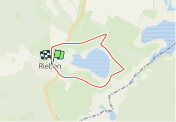
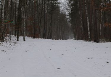
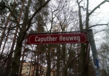
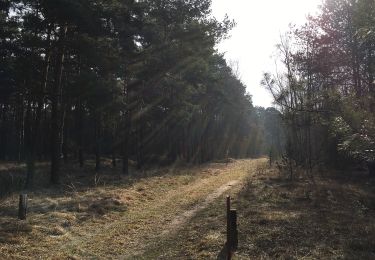
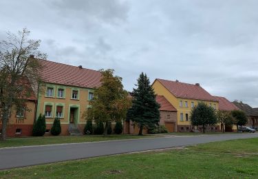
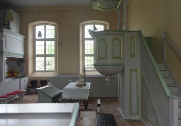
Tocht Te voet van 5 km beschikbaar op Brandenburg, Potsdam-Mittelmark, Beelitz. Deze tocht wordt voorgesteld door SityTrail - itinéraires balisés pédestres.
Beschrijving
Trail created by Naturpark Nuthe-Nieplitz.
Plaatsbepaling
Land:
Germany
Regio :
Brandenburg
Departement/Provincie :
Potsdam-Mittelmark
Gemeente :
Beelitz
Locatie:
Unknown
Vertrek:(Dec)
Vertrek:(UTM)
365941 ; 5784138 (33U) N.
Opmerkingen
Wandeltochten in de omgeving
![Tocht Te voet Brück - Rundwanderweg B 10 - Photo](https://media.geolcdn.com/t/375/260/ext.jpg?maxdim=2&url=https%3A%2F%2Fmedia.geolcdn.com%2Ff%2F28e809bb-e9eb-405f-8161-766825693003.jpeg)
![Te voet Te voet](https://static1.geolcdn.com/sitytour/trail-icons/100.png)
Rundwanderweg B 10
Te voet
Medium
Brück,
Brandenburg,
Potsdam-Mittelmark,
Germany
![](/images/other/stat-length.png)
25 km | 27 km-effort
6h 9min
![](https://static1.geolcdn.com/siteimages/upload/files/16400158638029165_repeat_loop_refresh_sync_direction_icon.png)
Ja
![Tocht Te voet Michendorf - Rundweg um Wilhelmshorst - Photo](https://media.geolcdn.com/t/375/260/ext.jpg?maxdim=2&url=https%3A%2F%2Fmedia.geolcdn.com%2Ff%2Fdd34d416-1a54-43fd-b4be-b6e9b6fe4694.jpeg)
![Te voet Te voet](https://static1.geolcdn.com/sitytour/trail-icons/100.png)
Rundweg um Wilhelmshorst
Te voet
Gemakkelijk
Michendorf,
Brandenburg,
Potsdam-Mittelmark,
Germany
![](/images/other/stat-length.png)
8,6 km | 9,8 km-effort
2h 13min
![](https://static1.geolcdn.com/siteimages/upload/files/16400158638029165_repeat_loop_refresh_sync_direction_icon.png)
Ja
![Tocht Te voet Michendorf - Balken grün Caputh - Lienewitzseen - Photo](https://media.geolcdn.com/t/375/260/ext.jpg?maxdim=2&url=https%3A%2F%2Fmedia.geolcdn.com%2Ff%2F6757b860-b8b5-4914-9ac2-b5c8f61652e1.jpeg)
![Te voet Te voet](https://static1.geolcdn.com/sitytour/trail-icons/100.png)
Balken grün Caputh - Lienewitzseen
Te voet
Gemakkelijk
Michendorf,
Brandenburg,
Potsdam-Mittelmark,
Germany
![](/images/other/stat-length.png)
3,7 km | 4,2 km-effort
57min
![](https://static1.geolcdn.com/siteimages/upload/files/16400158638029165_repeat_loop_refresh_sync_direction_icon.png)
Neen
![Tocht Te voet - Naturlehrpfad Ravensberge - Photo](https://media.geolcdn.com/t/375/260/ext.jpg?maxdim=2&url=https%3A%2F%2Fmedia.geolcdn.com%2Ff%2Fe98c381a-fe7e-452b-8846-79bcc6732d8c.jpeg)
![Te voet Te voet](https://static1.geolcdn.com/sitytour/trail-icons/100.png)
Naturlehrpfad Ravensberge
Te voet
Gemakkelijk
,
Brandenburg,
Potsdam,
Germany
![](/images/other/stat-length.png)
6 km | 7,6 km-effort
1h 43min
![](https://static1.geolcdn.com/siteimages/upload/files/16400158638029165_repeat_loop_refresh_sync_direction_icon.png)
Neen
![Tocht Te voet Nuthe-Urstromtal - Rundwanderweg Frankenförde - Photo](https://media.geolcdn.com/t/375/260/ext.jpg?maxdim=2&url=https%3A%2F%2Fmedia.geolcdn.com%2Ff%2Ff5cd21a2-6fde-4518-9353-7a0a908eeeb9.jpeg)
![Te voet Te voet](https://static1.geolcdn.com/sitytour/trail-icons/100.png)
Rundwanderweg Frankenförde
Te voet
Gemakkelijk
Nuthe-Urstromtal,
Brandenburg,
Teltow-Fläming,
Germany
![](/images/other/stat-length.png)
4,5 km | 4,9 km-effort
1h 6min
![](https://static1.geolcdn.com/siteimages/upload/files/16400158638029165_repeat_loop_refresh_sync_direction_icon.png)
Neen
![Tocht Te voet Nuthe-Urstromtal - Rundwanderweg Felgentreu - Photo](https://media.geolcdn.com/t/375/260/ext.jpg?maxdim=2&url=https%3A%2F%2Fmedia.geolcdn.com%2Ff%2Fae5954d1-b460-45f5-a2d8-816d3b09a70d.jpeg)
![Te voet Te voet](https://static1.geolcdn.com/sitytour/trail-icons/100.png)
Rundwanderweg Felgentreu
Te voet
Gemakkelijk
Nuthe-Urstromtal,
Brandenburg,
Teltow-Fläming,
Germany
![](/images/other/stat-length.png)
3,6 km | 3,9 km-effort
52min
![](https://static1.geolcdn.com/siteimages/upload/files/16400158638029165_repeat_loop_refresh_sync_direction_icon.png)
Ja
![Tocht Te voet Treuenbrietzen - Tour04 Landschaftstour - Photo](https://media.geolcdn.com/t/375/260/ext.jpg?maxdim=2&url=https%3A%2F%2Fmedia.geolcdn.com%2Ff%2F82927095-deff-46f9-84c0-d63d1ae846c1.jpeg)
![Te voet Te voet](https://static1.geolcdn.com/sitytour/trail-icons/100.png)
Tour04 Landschaftstour
Te voet
Gemakkelijk
Treuenbrietzen,
Brandenburg,
Potsdam-Mittelmark,
Germany
![](/images/other/stat-length.png)
6,7 km | 7,4 km-effort
1h 40min
![](https://static1.geolcdn.com/siteimages/upload/files/16400158638029165_repeat_loop_refresh_sync_direction_icon.png)
Neen
![Tocht Te voet Nuthetal - Nudow Rundweg - Photo](https://media.geolcdn.com/t/375/260/ext.jpg?maxdim=2&url=https%3A%2F%2Fmedia.geolcdn.com%2Ff%2Fedc0aa73-aaa6-4bbf-9217-0d0daaf01074.jpeg)
![Te voet Te voet](https://static1.geolcdn.com/sitytour/trail-icons/100.png)
Nudow Rundweg
Te voet
Gemakkelijk
Nuthetal,
Brandenburg,
Potsdam-Mittelmark,
Germany
![](/images/other/stat-length.png)
3,6 km | 4 km-effort
54min
![](https://static1.geolcdn.com/siteimages/upload/files/16400158638029165_repeat_loop_refresh_sync_direction_icon.png)
Ja
![Tocht Te voet Treuenbrietzen - Tour03 Steintour - Photo](https://media.geolcdn.com/t/375/260/ext.jpg?maxdim=2&url=https%3A%2F%2Fmedia.geolcdn.com%2Ff%2F37392b35-cf43-4e80-a4b4-9c20cced2e9d.jpeg)
![Te voet Te voet](https://static1.geolcdn.com/sitytour/trail-icons/100.png)
Tour03 Steintour
Te voet
Gemakkelijk
Treuenbrietzen,
Brandenburg,
Potsdam-Mittelmark,
Germany
![](/images/other/stat-length.png)
8,3 km | 9,5 km-effort
2h 9min
![](https://static1.geolcdn.com/siteimages/upload/files/16400158638029165_repeat_loop_refresh_sync_direction_icon.png)
Neen