![](/images/other/stat-length.png)
![Tocht Te voet Teugn - S 04 Teugn - Haselspitz (Blaues Rechteck) - Photo](https://media.geolcdn.com/t/1900/400/406fc710-ab50-4db4-ab75-c30961e9bbfb.jpeg&format=pjpeg&maxdim=2)
S 04 Teugn - Haselspitz (Blaues Rechteck)
SityTrail - itinéraires balisés pédestres
Tous les sentiers balisés d’Europe GUIDE+
![Lengte](/images/other/stat-length.png)
Lengte
3,4 km
![Max. hoogte](https://static1.geolcdn.com/siteimages/upload/files/1508320355ic_sort_altitude_max_24dp.png)
Max. hoogte
473 m
![Positief hoogteverschil](https://static1.geolcdn.com/siteimages/upload/files/1508320355ic_sort_den_pos_24dp.png)
Positief hoogteverschil
111 m
![Km-Effort](/images/other/stat-length.png)
Km-Effort
4,6 km
![Min. hoogte](https://static1.geolcdn.com/siteimages/upload/files/1508320355ic_sort_altitude_min_24dp.png)
Min. hoogte
370 m
![Negatief hoogteverschil](https://static1.geolcdn.com/siteimages/upload/files/1508320355ic_sort_den_neg_24dp.png)
Negatief hoogteverschil
35 m
![Boucle](https://static1.geolcdn.com/siteimages/upload/files/16400158638029165_repeat_loop_refresh_sync_direction_icon.png)
Boucle
Neen
Markering
Datum van aanmaak :
2022-02-11 15:56:09.053
Laatste wijziging :
2022-02-11 15:56:09.053
![Te voet](https://static1.geolcdn.com/sitytour/trail-icons/100.png)
1h02
Moeilijkheid : Gemakkelijk
![Scan deze QR-code om de tocht te openen in de SityTrail-applicatie](https://capi.geolives.com/qq0zvz2zws4bq2lad0pu/sitytour/trails/3095467/qr.png?size=200)
Gratisgps-wandelapplicatie
Over ons
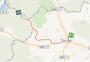
Tocht Te voet van 3,4 km beschikbaar op Beieren, Landkreis Kelheim, Teugn. Deze tocht wordt voorgesteld door SityTrail - itinéraires balisés pédestres.
Beschrijving
Trail created by Waldverein Regensburg.
FIXME: Weg geht vielleicht an der Kreuzung Suedlich vom Haselspitz nach Osten und nicht nach Sueden
Symbol: Blaues Rechteck auf weißem Grund
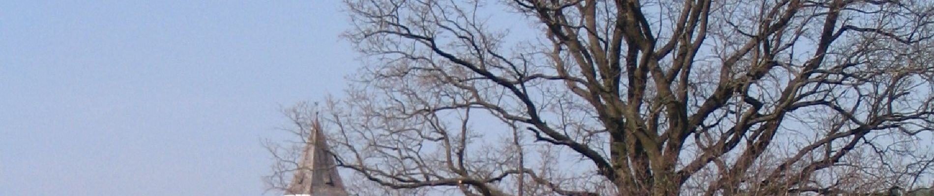
Plaatsbepaling
Land:
Germany
Regio :
Beieren
Departement/Provincie :
Landkreis Kelheim
Gemeente :
Teugn
Locatie:
Unknown
Vertrek:(Dec)
Vertrek:(UTM)
281045 ; 5419906 (33U) N.
Opmerkingen
Wandeltochten in de omgeving
![Tocht Te voet Bad Abbach - S 03 Saal Bf - Bad Abbach Bf (Rotes Rechteck) - Photo](https://media.geolcdn.com/t/375/260/638f45b1-c4af-4aaf-8968-1e05d82aae5e.jpeg&format=jpg&maxdim=2)
![Te voet Te voet](https://static1.geolcdn.com/sitytour/trail-icons/100.png)
S 03 Saal Bf - Bad Abbach Bf (Rotes Rechteck)
Te voet
Gemakkelijk
Bad Abbach,
Beieren,
Landkreis Kelheim,
Germany
![](/images/other/stat-length.png)
5,9 km | 8,1 km-effort
1h 50min
![](https://static1.geolcdn.com/siteimages/upload/files/16400158638029165_repeat_loop_refresh_sync_direction_icon.png)
Neen
![Tocht Te voet Bad Abbach - Jurasteig Kaiser-Thermen-Schlaufe - Photo](https://media.geolcdn.com/t/375/260/27f4600e-3894-4d3f-adca-d509f5df95eb.jpeg&format=jpg&maxdim=2)
![Te voet Te voet](https://static1.geolcdn.com/sitytour/trail-icons/100.png)
Jurasteig Kaiser-Thermen-Schlaufe
Te voet
Gemakkelijk
Bad Abbach,
Beieren,
Landkreis Kelheim,
Germany
![](/images/other/stat-length.png)
12,5 km | 16,6 km-effort
3h 46min
![](https://static1.geolcdn.com/siteimages/upload/files/16400158638029165_repeat_loop_refresh_sync_direction_icon.png)
Neen
![Tocht Te voet Bad Abbach - S 07 Bad Abbach - Teugn (Grünes Rechteck) - Photo](https://media.geolcdn.com/t/375/260/a412762b-d0a7-42a0-81d4-fdc6325ef686.jpeg&format=jpg&maxdim=2)
![Te voet Te voet](https://static1.geolcdn.com/sitytour/trail-icons/100.png)
S 07 Bad Abbach - Teugn (Grünes Rechteck)
Te voet
Gemakkelijk
Bad Abbach,
Beieren,
Landkreis Kelheim,
Germany
![](/images/other/stat-length.png)
7,7 km | 10,3 km-effort
2h 21min
![](https://static1.geolcdn.com/siteimages/upload/files/16400158638029165_repeat_loop_refresh_sync_direction_icon.png)
Neen
![Tocht Te voet Pentling - S 09 Hohengebraching - Peising (Rotes Dreieck) - Photo](https://media.geolcdn.com/t/375/260/ext.jpg?maxdim=2&url=https%3A%2F%2Fstatic1.geolcdn.com%2Fsiteimages%2Fupload%2Ffiles%2F1545311037marcheuse_200dpi.jpg)
![Te voet Te voet](https://static1.geolcdn.com/sitytour/trail-icons/100.png)
S 09 Hohengebraching - Peising (Rotes Dreieck)
Te voet
Gemakkelijk
Pentling,
Beieren,
Landkreis Regensburg,
Germany
![](/images/other/stat-length.png)
3,6 km | 4,3 km-effort
58min
![](https://static1.geolcdn.com/siteimages/upload/files/16400158638029165_repeat_loop_refresh_sync_direction_icon.png)
Neen