![](/images/other/stat-length.png)
![Tocht Te voet Räbke - Zielwanderweg Schöningen Schunterquelle - Photo](https://media.geolcdn.com/t/1900/400/12247816-37b7-43cb-8585-e0c954f32e78.jpeg&format=pjpeg&maxdim=2)
Zielwanderweg Schöningen Schunterquelle
SityTrail - itinéraires balisés pédestres
Tous les sentiers balisés d’Europe GUIDE+
![Lengte](/images/other/stat-length.png)
![Max. hoogte](https://static1.geolcdn.com/siteimages/upload/files/1508320355ic_sort_altitude_max_24dp.png)
![Positief hoogteverschil](https://static1.geolcdn.com/siteimages/upload/files/1508320355ic_sort_den_pos_24dp.png)
![Km-Effort](/images/other/stat-length.png)
![Min. hoogte](https://static1.geolcdn.com/siteimages/upload/files/1508320355ic_sort_altitude_min_24dp.png)
![Negatief hoogteverschil](https://static1.geolcdn.com/siteimages/upload/files/1508320355ic_sort_den_neg_24dp.png)
![Boucle](https://static1.geolcdn.com/siteimages/upload/files/16400158638029165_repeat_loop_refresh_sync_direction_icon.png)
![Te voet](https://static1.geolcdn.com/sitytour/trail-icons/100.png)
2h48
Moeilijkheid : Gemakkelijk
![Scan deze QR-code om de tocht te openen in de SityTrail-applicatie](https://capi.geolives.com/qq0zvz2zws4bq2lad0pu/sitytour/trails/3095024/qr.png?size=200)
Gratisgps-wandelapplicatie
Over ons
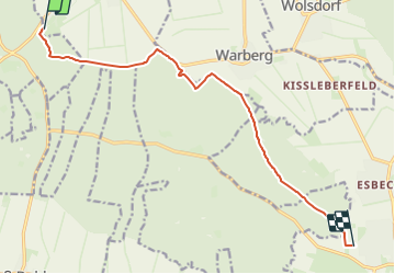
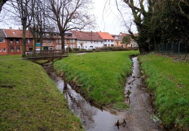
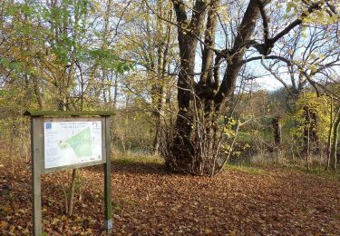
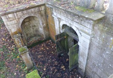
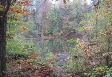
Tocht Te voet van 10,1 km beschikbaar op Nedersaksen, Landkreis Helmstedt, Räbke. Deze tocht wordt voorgesteld door SityTrail - itinéraires balisés pédestres.
Beschrijving
Trail created by Naturpark Elm-Lappwald.
Symbol: stylisierte Wassermühle (rotes Dach [Dreieck mit Schornstein], schwarzer Kreis als Wasserrad, blau-schwarze Welle)
Plaatsbepaling
Opmerkingen
Wandeltochten in de omgeving
![Tocht Te voet Schöningen - Elmkreisel - Photo](https://media.geolcdn.com/t/375/260/12247816-37b7-43cb-8585-e0c954f32e78.jpeg&format=jpg&maxdim=2)
![Te voet Te voet](https://static1.geolcdn.com/sitytour/trail-icons/100.png)
Te voet
![](/images/other/stat-length.png)
![](https://static1.geolcdn.com/siteimages/upload/files/16400158638029165_repeat_loop_refresh_sync_direction_icon.png)
![Tocht Te voet Räbke - Zielwanderweg Königslutter Schunterquelle - Photo](https://media.geolcdn.com/t/375/260/99229cce-47ed-471a-825b-63f657e5f92e.jpeg&format=jpg&maxdim=2)
![Te voet Te voet](https://static1.geolcdn.com/sitytour/trail-icons/100.png)
Te voet
![](/images/other/stat-length.png)
![](https://static1.geolcdn.com/siteimages/upload/files/16400158638029165_repeat_loop_refresh_sync_direction_icon.png)
![Tocht Te voet Schöppenstedt - Elm Rundwanderweg 33 - Photo](https://media.geolcdn.com/t/375/260/488dd085-e77b-4089-99fa-15a6a0f9c4b7.jpeg&format=jpg&maxdim=2)
![Te voet Te voet](https://static1.geolcdn.com/sitytour/trail-icons/100.png)
Te voet
![](/images/other/stat-length.png)
![](https://static1.geolcdn.com/siteimages/upload/files/16400158638029165_repeat_loop_refresh_sync_direction_icon.png)
![Tocht Te voet Königslutter am Elm - Zielwanderweg Erkerode-Heinrichsruh - Photo](https://media.geolcdn.com/t/375/260/d149467e-e9a7-4319-beea-c6db868f7f50.jpeg&format=jpg&maxdim=2)
![Te voet Te voet](https://static1.geolcdn.com/sitytour/trail-icons/100.png)
Te voet
![](/images/other/stat-length.png)
![](https://static1.geolcdn.com/siteimages/upload/files/16400158638029165_repeat_loop_refresh_sync_direction_icon.png)
![Tocht Te voet Am Großen Rhode - Elm Rundwanderweg 15 - Photo](https://media.geolcdn.com/t/375/260/d1ac1001-cf9a-4030-9535-6b6497ab8f57.jpeg&format=jpg&maxdim=2)
![Te voet Te voet](https://static1.geolcdn.com/sitytour/trail-icons/100.png)
Te voet
![](/images/other/stat-length.png)
![](https://static1.geolcdn.com/siteimages/upload/files/16400158638029165_repeat_loop_refresh_sync_direction_icon.png)
![Tocht Te voet Räbke - Elm Rundwanderweg 12 - Photo](https://media.geolcdn.com/t/375/260/12247816-37b7-43cb-8585-e0c954f32e78.jpeg&format=jpg&maxdim=2)
![Te voet Te voet](https://static1.geolcdn.com/sitytour/trail-icons/100.png)
Te voet
![](/images/other/stat-length.png)
![](https://static1.geolcdn.com/siteimages/upload/files/16400158638029165_repeat_loop_refresh_sync_direction_icon.png)
![Tocht Te voet Räbke - Elm Rundwanderweg 28 - Photo](https://media.geolcdn.com/t/375/260/12247816-37b7-43cb-8585-e0c954f32e78.jpeg&format=jpg&maxdim=2)
![Te voet Te voet](https://static1.geolcdn.com/sitytour/trail-icons/100.png)
Te voet
![](/images/other/stat-length.png)
![](https://static1.geolcdn.com/siteimages/upload/files/16400158638029165_repeat_loop_refresh_sync_direction_icon.png)
![Tocht Te voet Königslutter - Elm Rundwanderweg 17 - Photo](https://media.geolcdn.com/t/375/260/d149467e-e9a7-4319-beea-c6db868f7f50.jpeg&format=jpg&maxdim=2)
![Te voet Te voet](https://static1.geolcdn.com/sitytour/trail-icons/100.png)
Te voet
![](/images/other/stat-length.png)
![](https://static1.geolcdn.com/siteimages/upload/files/16400158638029165_repeat_loop_refresh_sync_direction_icon.png)
![Tocht Te voet Schöningen - Warburg Rundwanderweg - Photo](https://media.geolcdn.com/t/375/260/e5a274b0-1612-4f63-89e9-36e1f5efec5b.jpeg&format=jpg&maxdim=2)
![Te voet Te voet](https://static1.geolcdn.com/sitytour/trail-icons/100.png)
Te voet
![](/images/other/stat-length.png)
![](https://static1.geolcdn.com/siteimages/upload/files/16400158638029165_repeat_loop_refresh_sync_direction_icon.png)