![](/images/other/stat-length.png)
![Tocht Te voet Albstadt - Traufgang Felsenmeersteig - Photo](https://media.geolcdn.com/t/1900/400/c3fa43d8-6e5c-4ad3-9154-e138f66b44b1.jpeg&format=pjpeg&maxdim=2)
Traufgang Felsenmeersteig
SityTrail - itinéraires balisés pédestres
Tous les sentiers balisés d’Europe GUIDE+
![Lengte](/images/other/stat-length.png)
![Max. hoogte](https://static1.geolcdn.com/siteimages/upload/files/1508320355ic_sort_altitude_max_24dp.png)
![Positief hoogteverschil](https://static1.geolcdn.com/siteimages/upload/files/1508320355ic_sort_den_pos_24dp.png)
![Km-Effort](/images/other/stat-length.png)
![Min. hoogte](https://static1.geolcdn.com/siteimages/upload/files/1508320355ic_sort_altitude_min_24dp.png)
![Negatief hoogteverschil](https://static1.geolcdn.com/siteimages/upload/files/1508320355ic_sort_den_neg_24dp.png)
![Boucle](https://static1.geolcdn.com/siteimages/upload/files/16400158638029165_repeat_loop_refresh_sync_direction_icon.png)
![Te voet](https://static1.geolcdn.com/sitytour/trail-icons/100.png)
5h49
Moeilijkheid : Medium
![Scan deze QR-code om de tocht te openen in de SityTrail-applicatie](https://capi.geolives.com/qq0zvz2zws4bq2lad0pu/sitytour/trails/3094482/qr.png?size=200)
Gratisgps-wandelapplicatie
Over ons
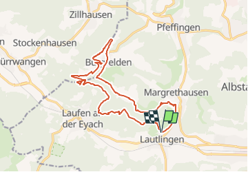
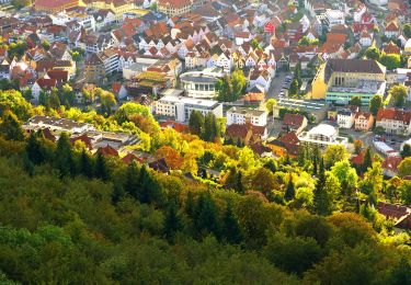
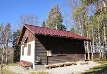
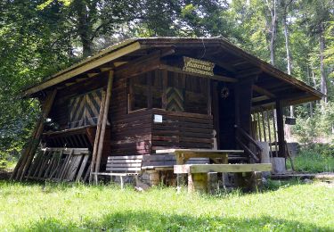
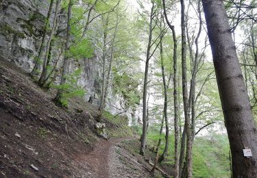
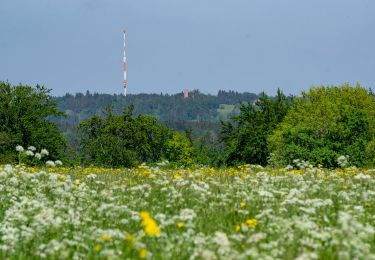
Tocht Te voet van 16,7 km beschikbaar op Baden-Württemberg, Zollernalbkreis, Albstadt. Deze tocht wordt voorgesteld door SityTrail - itinéraires balisés pédestres.
Beschrijving
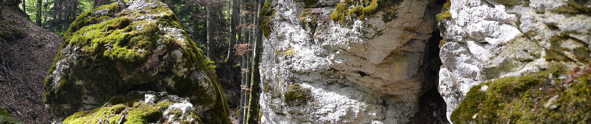
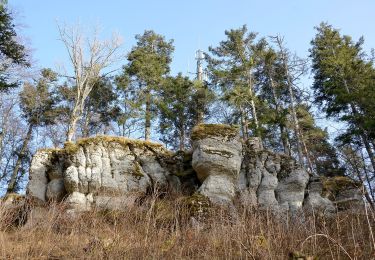
Wandern für Traufgänger. Sieben ausgezeichnete Premiumwege und ein Premium-Winterwanderweg sind es, die Sie auf der Schwäbischen Alb erwandern, erleben und genießen können.
Website: http://www.traufgaenge.de/
Plaatsbepaling
Opmerkingen
Wandeltochten in de omgeving
![Tocht Te voet Gomadingen - Querweg - Oberdigisheim - Weg Nr. 1 - Oberdigisheim - Baienberg - bis zur Weggabelung - Photo](https://media.geolcdn.com/t/375/260/23da1132-2897-4f59-bd40-1df9632ce0bd.jpeg&format=jpg&maxdim=2)
![Te voet Te voet](https://static1.geolcdn.com/sitytour/trail-icons/100.png)
Te voet
![](/images/other/stat-length.png)
![](https://static1.geolcdn.com/siteimages/upload/files/16400158638029165_repeat_loop_refresh_sync_direction_icon.png)
![Tocht Te voet Gomadingen - Nebenweg - Ebingen - Weg Nr. 1 - Engesboch - Waldheim - Schloßfelsen - Ebingen - Holzhalde - Photo](https://media.geolcdn.com/t/375/260/06159a0f-2772-4aa7-a618-9fabfa9ea2ec.jpeg&format=jpg&maxdim=2)
![Te voet Te voet](https://static1.geolcdn.com/sitytour/trail-icons/100.png)
Te voet
![](/images/other/stat-length.png)
![](https://static1.geolcdn.com/siteimages/upload/files/16400158638029165_repeat_loop_refresh_sync_direction_icon.png)
![Tocht Te voet Albstadt - Querweg des Schwäbischen Albvereins (rote Raute) - Photo](https://media.geolcdn.com/t/375/260/dbee4a72-02d3-42cd-b79d-c993244f0bff.jpeg&format=jpg&maxdim=2)
![Te voet Te voet](https://static1.geolcdn.com/sitytour/trail-icons/100.png)
Te voet
![](/images/other/stat-length.png)
![](https://static1.geolcdn.com/siteimages/upload/files/16400158638029165_repeat_loop_refresh_sync_direction_icon.png)
![Tocht Te voet Gomadingen - Traufgänge - Ochsenbergtour - Photo](https://media.geolcdn.com/t/375/260/f799f360-6ede-4294-be03-71c02a76c7c7.jpeg&format=jpg&maxdim=2)
![Te voet Te voet](https://static1.geolcdn.com/sitytour/trail-icons/100.png)
Te voet
![](/images/other/stat-length.png)
![](https://static1.geolcdn.com/siteimages/upload/files/16400158638029165_repeat_loop_refresh_sync_direction_icon.png)
![Tocht Te voet Gomadingen - Traufgang Hossinger Leiter - Photo](https://media.geolcdn.com/t/375/260/e4f11c6e-8d23-4b96-b9cd-e82b39a426ff.jpeg&format=jpg&maxdim=2)
![Te voet Te voet](https://static1.geolcdn.com/sitytour/trail-icons/100.png)
Te voet
![](/images/other/stat-length.png)
![](https://static1.geolcdn.com/siteimages/upload/files/16400158638029165_repeat_loop_refresh_sync_direction_icon.png)
![Tocht Te voet Gomadingen - Traufgang Wiesenrunde - Photo](https://media.geolcdn.com/t/375/260/5bb63e25-5aae-499e-b30a-c74c46066b77.jpeg&format=jpg&maxdim=2)
![Te voet Te voet](https://static1.geolcdn.com/sitytour/trail-icons/100.png)
Te voet
![](/images/other/stat-length.png)
![](https://static1.geolcdn.com/siteimages/upload/files/16400158638029165_repeat_loop_refresh_sync_direction_icon.png)
![Tocht Te voet Gomadingen - Querweg - Ebingen - Weg Nr. 6 - Bahnhof Ebingen - Kugelwäldle - Photo](https://media.geolcdn.com/t/375/260/ext.jpg?maxdim=2&url=https%3A%2F%2Fstatic1.geolcdn.com%2Fsiteimages%2Fupload%2Ffiles%2F1545311037marcheuse_200dpi.jpg)
![Te voet Te voet](https://static1.geolcdn.com/sitytour/trail-icons/100.png)
Te voet
![](/images/other/stat-length.png)
![](https://static1.geolcdn.com/siteimages/upload/files/16400158638029165_repeat_loop_refresh_sync_direction_icon.png)