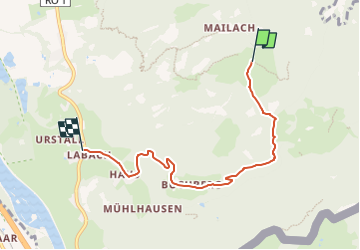
![](/images/other/stat-length.png)
![Tocht Te voet Nußdorf am Inn - Buchberg - Euzenau - Heuberg - Photo](https://media.geolcdn.com/t/1900/400/5186e337-950b-4dbd-8039-3b01edb2b748.jpeg&format=pjpeg&maxdim=2)
Buchberg - Euzenau - Heuberg
SityTrail - itinéraires balisés pédestres
Tous les sentiers balisés d’Europe GUIDE+
![Lengte](/images/other/stat-length.png)
![Max. hoogte](https://static1.geolcdn.com/siteimages/upload/files/1508320355ic_sort_altitude_max_24dp.png)
![Positief hoogteverschil](https://static1.geolcdn.com/siteimages/upload/files/1508320355ic_sort_den_pos_24dp.png)
![Km-Effort](/images/other/stat-length.png)
![Min. hoogte](https://static1.geolcdn.com/siteimages/upload/files/1508320355ic_sort_altitude_min_24dp.png)
![Negatief hoogteverschil](https://static1.geolcdn.com/siteimages/upload/files/1508320355ic_sort_den_neg_24dp.png)
![Boucle](https://static1.geolcdn.com/siteimages/upload/files/16400158638029165_repeat_loop_refresh_sync_direction_icon.png)
![Te voet](https://static1.geolcdn.com/sitytour/trail-icons/100.png)
1h39
Moeilijkheid : Gemakkelijk
![Scan deze QR-code om de tocht te openen in de SityTrail-applicatie](https://capi.geolives.com/qq0zvz2zws4bq2lad0pu/sitytour/trails/3092438/qr.png?size=200)
Gratisgps-wandelapplicatie
Over ons
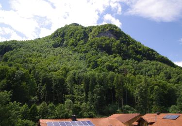
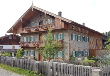
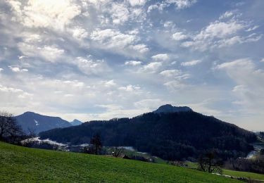
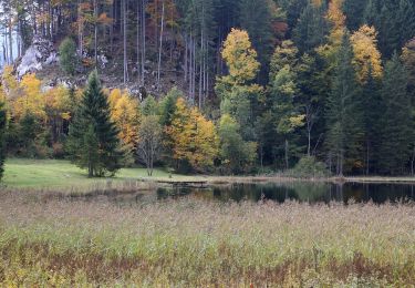
Tocht Te voet van 5,2 km beschikbaar op Beieren, Landkreis Rosenheim, Nußdorf am Inn. Deze tocht wordt voorgesteld door SityTrail - itinéraires balisés pédestres.
Beschrijving
Beschilderung ist alt und nicht mehr durchgängig. Weg ist NICHT identisch mit Wanderweg 9-Nußdorf (Grüne Schilder mit weißer Zahl)
Symbol: Rot-Weiß-Rot mit schwarzer Zahl
Plaatsbepaling
Opmerkingen
Wandeltochten in de omgeving
![Tocht Te voet Gemeinde Erl - Scheiben-Runde - Photo](https://media.geolcdn.com/t/375/260/56087dc7-ffa6-4102-a9bb-c8ee2599a932.jpeg&format=jpg&maxdim=2)
![Te voet Te voet](https://static1.geolcdn.com/sitytour/trail-icons/100.png)
Te voet
![](/images/other/stat-length.png)
![](https://static1.geolcdn.com/siteimages/upload/files/16400158638029165_repeat_loop_refresh_sync_direction_icon.png)
![Tocht Te voet Nußdorf am Inn - Kranzhorn über Bubenaualm - Photo](https://media.geolcdn.com/t/375/260/e3c5b70e-000e-4248-8f68-0461d1126b7e.jpeg&format=jpg&maxdim=2)
![Te voet Te voet](https://static1.geolcdn.com/sitytour/trail-icons/100.png)
Te voet
![](/images/other/stat-length.png)
![](https://static1.geolcdn.com/siteimages/upload/files/16400158638029165_repeat_loop_refresh_sync_direction_icon.png)
![Tocht Te voet Nußdorf am Inn - Wanderweg 4 - Kranzhorn - Photo](https://media.geolcdn.com/t/375/260/e3c5b70e-000e-4248-8f68-0461d1126b7e.jpeg&format=jpg&maxdim=2)
![Te voet Te voet](https://static1.geolcdn.com/sitytour/trail-icons/100.png)
Te voet
![](/images/other/stat-length.png)
![](https://static1.geolcdn.com/siteimages/upload/files/16400158638029165_repeat_loop_refresh_sync_direction_icon.png)
![Tocht Te voet Flintsbach am Inn - Wanderweg FL2 - Flintsbach - Photo](https://media.geolcdn.com/t/375/260/8271d66b-41b0-4bb8-a062-bef7c7529e5b.jpeg&format=jpg&maxdim=2)
![Te voet Te voet](https://static1.geolcdn.com/sitytour/trail-icons/100.png)
Te voet
![](/images/other/stat-length.png)
![](https://static1.geolcdn.com/siteimages/upload/files/16400158638029165_repeat_loop_refresh_sync_direction_icon.png)
![Tocht Te voet Nußdorf am Inn - SalzAlpenZugweg Nußdorf/Daffnerwald-Almen - Photo](https://media.geolcdn.com/t/375/260/5e1c3d1c-01bf-4b0c-b23e-ae95a6e5f146.jpeg&format=jpg&maxdim=2)
![Te voet Te voet](https://static1.geolcdn.com/sitytour/trail-icons/100.png)
Te voet
![](/images/other/stat-length.png)
![](https://static1.geolcdn.com/siteimages/upload/files/16400158638029165_repeat_loop_refresh_sync_direction_icon.png)
![Tocht Te voet Samerberg - Wanderweg 51 - Samerberg - Photo](https://media.geolcdn.com/t/375/260/8e570050-b69c-402d-8110-7056f739b2ca.jpeg&format=jpg&maxdim=2)
![Te voet Te voet](https://static1.geolcdn.com/sitytour/trail-icons/100.png)
Te voet
![](/images/other/stat-length.png)
![](https://static1.geolcdn.com/siteimages/upload/files/16400158638029165_repeat_loop_refresh_sync_direction_icon.png)
![Tocht Te voet Samerberg - Wanderweg 54 - Samerberg - Photo](https://media.geolcdn.com/t/375/260/fc7575ce-b7e0-4759-bfc8-7d94e25cd2d0.jpeg&format=jpg&maxdim=2)
![Te voet Te voet](https://static1.geolcdn.com/sitytour/trail-icons/100.png)
Te voet
![](/images/other/stat-length.png)
![](https://static1.geolcdn.com/siteimages/upload/files/16400158638029165_repeat_loop_refresh_sync_direction_icon.png)
![Tocht Te voet Samerberg - Wanderweg 78 - Samerberg - Photo](https://media.geolcdn.com/t/375/260/6871fcd9-6e31-44a6-80fb-d4d548812be5.jpeg&format=jpg&maxdim=2)
![Te voet Te voet](https://static1.geolcdn.com/sitytour/trail-icons/100.png)
Te voet
![](/images/other/stat-length.png)
![](https://static1.geolcdn.com/siteimages/upload/files/16400158638029165_repeat_loop_refresh_sync_direction_icon.png)
![Tocht Te voet Oberaudorf - Wanderweg 5d - Oberaudorf - Photo](https://media.geolcdn.com/t/375/260/c8f43682-0c41-4988-ae5e-461032357082.jpeg&format=jpg&maxdim=2)
![Te voet Te voet](https://static1.geolcdn.com/sitytour/trail-icons/100.png)
Te voet
![](/images/other/stat-length.png)
![](https://static1.geolcdn.com/siteimages/upload/files/16400158638029165_repeat_loop_refresh_sync_direction_icon.png)