![](/images/other/stat-length.png)
![Tocht Te voet Friedrichshafen - Ortsrundweg Kluftern - Nordrunde - Photo](https://media.geolcdn.com/t/1900/400/a2a346b3-6d0a-41ec-bf52-3be9d53c8492.jpeg&format=pjpeg&maxdim=2)
Ortsrundweg Kluftern - Nordrunde
SityTrail - itinéraires balisés pédestres
Tous les sentiers balisés d’Europe GUIDE+
![Lengte](/images/other/stat-length.png)
Lengte
5,3 km
![Max. hoogte](https://static1.geolcdn.com/siteimages/upload/files/1508320355ic_sort_altitude_max_24dp.png)
Max. hoogte
446 m
![Positief hoogteverschil](https://static1.geolcdn.com/siteimages/upload/files/1508320355ic_sort_den_pos_24dp.png)
Positief hoogteverschil
63 m
![Km-Effort](/images/other/stat-length.png)
Km-Effort
6,2 km
![Min. hoogte](https://static1.geolcdn.com/siteimages/upload/files/1508320355ic_sort_altitude_min_24dp.png)
Min. hoogte
416 m
![Negatief hoogteverschil](https://static1.geolcdn.com/siteimages/upload/files/1508320355ic_sort_den_neg_24dp.png)
Negatief hoogteverschil
65 m
![Boucle](https://static1.geolcdn.com/siteimages/upload/files/16400158638029165_repeat_loop_refresh_sync_direction_icon.png)
Boucle
Ja
Markering
Datum van aanmaak :
2022-02-11 13:25:46.583
Laatste wijziging :
2022-02-11 13:25:46.583
![Te voet](https://static1.geolcdn.com/sitytour/trail-icons/100.png)
1h24
Moeilijkheid : Gemakkelijk
![Scan deze QR-code om de tocht te openen in de SityTrail-applicatie](https://capi.geolives.com/qq0zvz2zws4bq2lad0pu/sitytour/trails/3090284/qr.png?size=200)
Gratisgps-wandelapplicatie
Over ons
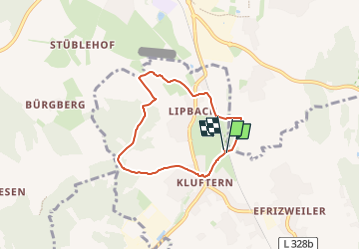
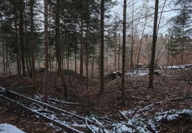
Tocht Te voet van 5,3 km beschikbaar op Baden-Württemberg, Bodenseekreis, Friedrichshafen. Deze tocht wordt voorgesteld door SityTrail - itinéraires balisés pédestres.
Beschrijving
Symbol: schwarzer Buchstabe K in einem durch eine Pfeil unterbrochenen Kreis
Plaatsbepaling
Land:
Germany
Regio :
Baden-Württemberg
Departement/Provincie :
Bodenseekreis
Gemeente :
Friedrichshafen
Locatie:
Unknown
Vertrek:(Dec)
Vertrek:(UTM)
530361 ; 5282554 (32T) N.
Opmerkingen
Wandeltochten in de omgeving
![Tocht Te voet Friedrichshafen - Planetenweg Kluftern - Photo](https://media.geolcdn.com/t/375/260/46733009-a77d-469a-8bf1-fb80e19f2d17.jpeg&format=jpg&maxdim=2)
![Te voet Te voet](https://static1.geolcdn.com/sitytour/trail-icons/100.png)
Planetenweg Kluftern
Te voet
Gemakkelijk
Friedrichshafen,
Baden-Württemberg,
Bodenseekreis,
Germany
![](/images/other/stat-length.png)
5,5 km | 6,5 km-effort
1h 28min
![](https://static1.geolcdn.com/siteimages/upload/files/16400158638029165_repeat_loop_refresh_sync_direction_icon.png)
Ja
![Tocht Te voet Bermatingen - Rundweg B5 - Photo](https://media.geolcdn.com/t/375/260/5fa6ab2f-fb20-4449-9ac8-ef50196935f6.jpeg&format=jpg&maxdim=2)
![Te voet Te voet](https://static1.geolcdn.com/sitytour/trail-icons/100.png)
Rundweg B5
Te voet
Gemakkelijk
Bermatingen,
Baden-Württemberg,
Bodenseekreis,
Germany
![](/images/other/stat-length.png)
12,3 km | 15,6 km-effort
3h 32min
![](https://static1.geolcdn.com/siteimages/upload/files/16400158638029165_repeat_loop_refresh_sync_direction_icon.png)
Ja
![Tocht Te voet Bermatingen - Rundweg B4 - Photo](https://media.geolcdn.com/t/375/260/ab7b3cca-1476-48a6-afce-358eba7428e2.jpeg&format=jpg&maxdim=2)
![Te voet Te voet](https://static1.geolcdn.com/sitytour/trail-icons/100.png)
Rundweg B4
Te voet
Gemakkelijk
Bermatingen,
Baden-Württemberg,
Bodenseekreis,
Germany
![](/images/other/stat-length.png)
7,2 km | 9,5 km-effort
2h 8min
![](https://static1.geolcdn.com/siteimages/upload/files/16400158638029165_repeat_loop_refresh_sync_direction_icon.png)
Ja
![Tocht Te voet Bermatingen - Rundweg B3 - Photo](https://media.geolcdn.com/t/375/260/ba1a7fea-e706-4424-b12c-59b17b649f8e.jpeg&format=jpg&maxdim=2)
![Te voet Te voet](https://static1.geolcdn.com/sitytour/trail-icons/100.png)
Rundweg B3
Te voet
Gemakkelijk
Bermatingen,
Baden-Württemberg,
Bodenseekreis,
Germany
![](/images/other/stat-length.png)
4,2 km | 5,5 km-effort
1h 14min
![](https://static1.geolcdn.com/siteimages/upload/files/16400158638029165_repeat_loop_refresh_sync_direction_icon.png)
Ja
![Tocht Te voet Bermatingen - Rundweg B2 - Photo](https://media.geolcdn.com/t/375/260/cd072049-360e-431c-bd2c-80671c66591d.jpeg&format=jpg&maxdim=2)
![Te voet Te voet](https://static1.geolcdn.com/sitytour/trail-icons/100.png)
Rundweg B2
Te voet
Gemakkelijk
Bermatingen,
Baden-Württemberg,
Bodenseekreis,
Germany
![](/images/other/stat-length.png)
6,9 km | 8,1 km-effort
1h 50min
![](https://static1.geolcdn.com/siteimages/upload/files/16400158638029165_repeat_loop_refresh_sync_direction_icon.png)
Ja
![Tocht Te voet Bermatingen - Rundweg B1 - Photo](https://media.geolcdn.com/t/375/260/cd072049-360e-431c-bd2c-80671c66591d.jpeg&format=jpg&maxdim=2)
![Te voet Te voet](https://static1.geolcdn.com/sitytour/trail-icons/100.png)
Rundweg B1
Te voet
Gemakkelijk
Bermatingen,
Baden-Württemberg,
Bodenseekreis,
Germany
![](/images/other/stat-length.png)
3,3 km | 3,7 km-effort
50min
![](https://static1.geolcdn.com/siteimages/upload/files/16400158638029165_repeat_loop_refresh_sync_direction_icon.png)
Ja
![Tocht Te voet Markdorf - Wanderwege Markdorf: Froschweg - Photo](https://media.geolcdn.com/t/375/260/925776c0-f370-41fd-bf89-cf33cc203a47.jpeg&format=jpg&maxdim=2)
![Te voet Te voet](https://static1.geolcdn.com/sitytour/trail-icons/100.png)
Wanderwege Markdorf: Froschweg
Te voet
Gemakkelijk
Markdorf,
Baden-Württemberg,
Bodenseekreis,
Germany
![](/images/other/stat-length.png)
4,9 km | 6 km-effort
1h 22min
![](https://static1.geolcdn.com/siteimages/upload/files/16400158638029165_repeat_loop_refresh_sync_direction_icon.png)
Neen
![Tocht Te voet Friedrichshafen - Teuringer Bächlepfad - Photo](https://media.geolcdn.com/t/375/260/658a6b00-cada-4a62-b9f7-1373ac7f923a.jpeg&format=jpg&maxdim=2)
![Te voet Te voet](https://static1.geolcdn.com/sitytour/trail-icons/100.png)
Teuringer Bächlepfad
Te voet
Gemakkelijk
Friedrichshafen,
Baden-Württemberg,
Bodenseekreis,
Germany
![](/images/other/stat-length.png)
12,9 km | 15,1 km-effort
3h 26min
![](https://static1.geolcdn.com/siteimages/upload/files/16400158638029165_repeat_loop_refresh_sync_direction_icon.png)
Ja
![Tocht Te voet Friedrichshafen - Ortsrundweg Kluftern - Südrunde - Photo](https://media.geolcdn.com/t/375/260/24eac72b-5d33-4d11-abeb-8e8d2d4a2164.jpeg&format=jpg&maxdim=2)
![Te voet Te voet](https://static1.geolcdn.com/sitytour/trail-icons/100.png)
Ortsrundweg Kluftern - Südrunde
Te voet
Gemakkelijk
Friedrichshafen,
Baden-Württemberg,
Bodenseekreis,
Germany
![](/images/other/stat-length.png)
7,1 km | 8,6 km-effort
1h 57min
![](https://static1.geolcdn.com/siteimages/upload/files/16400158638029165_repeat_loop_refresh_sync_direction_icon.png)
Ja