![](/images/other/stat-length.png)
![Tocht Te voet Unknown - Kempten: Rundweg am Illerbogen - Photo](https://media.geolcdn.com/t/1900/400/ext.pjpeg?maxdim=2&url=https%3A%2F%2Fmedia.geolcdn.com%2Ff%2Ff0be2b01-9f3b-4f9b-b0be-0f5be00aaaea.jpeg)
Kempten: Rundweg am Illerbogen
SityTrail - itinéraires balisés pédestres
Tous les sentiers balisés d’Europe PRO
![Lengte](/images/other/stat-length.png)
Lengte
12,4 km
![Max. hoogte](https://static1.geolcdn.com/siteimages/upload/files/1508320355ic_sort_altitude_max_24dp.png)
Max. hoogte
693 m
![Positief hoogteverschil](https://static1.geolcdn.com/siteimages/upload/files/1508320355ic_sort_den_pos_24dp.png)
Positief hoogteverschil
136 m
![Km-Effort](/images/other/stat-length.png)
Km-Effort
14,2 km
![Min. hoogte](https://static1.geolcdn.com/siteimages/upload/files/1508320355ic_sort_altitude_min_24dp.png)
Min. hoogte
649 m
![Negatief hoogteverschil](https://static1.geolcdn.com/siteimages/upload/files/1508320355ic_sort_den_neg_24dp.png)
Negatief hoogteverschil
136 m
![Boucle](https://static1.geolcdn.com/siteimages/upload/files/16400158638029165_repeat_loop_refresh_sync_direction_icon.png)
Boucle
Ja
Markering
Datum van aanmaak :
2022-02-11 13:17:18.19
Laatste wijziging :
2022-02-11 13:17:18.19
![Te voet](https://static1.geolcdn.com/sitytour/trail-icons/100.png)
3h14
Moeilijkheid : Gemakkelijk
![Scan deze QR-code om de tocht te openen in de SityTrail-applicatie](https://capi.geolives.com/qq0zvz2zws4bq2lad0pu/sitytour/trails/3089847/qr.png?size=200)
Gratisgps-wandelapplicatie
Over ons
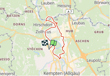
Tocht Te voet van 12,4 km beschikbaar op Beieren, Kempten (Allgäu). Deze tocht wordt voorgesteld door SityTrail - itinéraires balisés pédestres.
Beschrijving
Trail created by Stadt Kempten.
Symbol: Weiße 2 auf grünem Grund
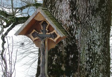
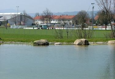
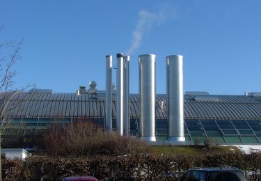
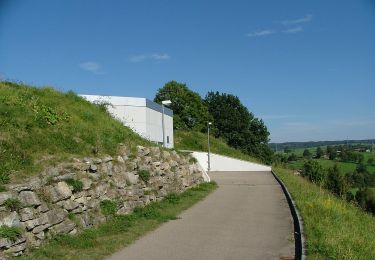
Plaatsbepaling
Land:
Germany
Regio :
Beieren
Departement/Provincie :
Kempten (Allgäu)
Gemeente :
Unknown
Locatie:
Unknown
Vertrek:(Dec)
Vertrek:(UTM)
597695 ; 5288740 (32T) N.
Opmerkingen
Wandeltochten in de omgeving
![Tocht Te voet Lauben - DE-L2 - Photo](https://media.geolcdn.com/t/375/260/ext.jpg?maxdim=2&url=https%3A%2F%2Fmedia.geolcdn.com%2Ff%2Fb59bf566-766e-4d41-b1ca-2925d5350bb1.jpeg)
![Te voet Te voet](https://static1.geolcdn.com/sitytour/trail-icons/100.png)
DE-L2
Te voet
Gemakkelijk
Lauben,
Beieren,
Landkreis Oberallgäu,
Germany
![](/images/other/stat-length.png)
16,1 km | 19,1 km-effort
4h 20min
![](https://static1.geolcdn.com/siteimages/upload/files/16400158638029165_repeat_loop_refresh_sync_direction_icon.png)
Ja
![Tocht Te voet Lauben - DE-L1 - Photo](https://media.geolcdn.com/t/375/260/ext.jpg?maxdim=2&url=https%3A%2F%2Fmedia.geolcdn.com%2Ff%2F5a34613f-9048-44fd-a322-dc6f0908cab9.jpeg)
![Te voet Te voet](https://static1.geolcdn.com/sitytour/trail-icons/100.png)
DE-L1
Te voet
Gemakkelijk
Lauben,
Beieren,
Landkreis Oberallgäu,
Germany
![](/images/other/stat-length.png)
11,3 km | 13,2 km-effort
3h 0min
![](https://static1.geolcdn.com/siteimages/upload/files/16400158638029165_repeat_loop_refresh_sync_direction_icon.png)
Ja
![Tocht Te voet - Mariaberg-Wanderung - Photo](https://media.geolcdn.com/t/375/260/ext.jpg?maxdim=2&url=https%3A%2F%2Fmedia.geolcdn.com%2Ff%2F2654ba42-09d1-496a-91b1-7142760f96ad.jpeg)
![Te voet Te voet](https://static1.geolcdn.com/sitytour/trail-icons/100.png)
Mariaberg-Wanderung
Te voet
Gemakkelijk
,
Beieren,
Kempten (Allgäu),
Germany
![](/images/other/stat-length.png)
12,3 km | 16,3 km-effort
3h 42min
![](https://static1.geolcdn.com/siteimages/upload/files/16400158638029165_repeat_loop_refresh_sync_direction_icon.png)
Ja
![Tocht Te voet Durach - Durach: Schreierwald-Runde - Photo](https://media.geolcdn.com/t/375/260/ext.jpg?maxdim=2&url=https%3A%2F%2Fmedia.geolcdn.com%2Ff%2Fa92f0811-a372-4391-9aeb-2d4ffdfb5a07.jpeg)
![Te voet Te voet](https://static1.geolcdn.com/sitytour/trail-icons/100.png)
Durach: Schreierwald-Runde
Te voet
Gemakkelijk
Durach,
Beieren,
Landkreis Oberallgäu,
Germany
![](/images/other/stat-length.png)
6,4 km | 7,8 km-effort
1h 45min
![](https://static1.geolcdn.com/siteimages/upload/files/16400158638029165_repeat_loop_refresh_sync_direction_icon.png)
Ja
![Tocht Te voet Durach - Durach: Panoramaweg - Photo](https://media.geolcdn.com/t/375/260/ext.jpg?maxdim=2&url=https%3A%2F%2Fmedia.geolcdn.com%2Ff%2Fec5c4031-2c51-488f-bace-d1fc00bebc3b.jpeg)
![Te voet Te voet](https://static1.geolcdn.com/sitytour/trail-icons/100.png)
Durach: Panoramaweg
Te voet
Gemakkelijk
Durach,
Beieren,
Landkreis Oberallgäu,
Germany
![](/images/other/stat-length.png)
9,1 km | 11,1 km-effort
2h 32min
![](https://static1.geolcdn.com/siteimages/upload/files/16400158638029165_repeat_loop_refresh_sync_direction_icon.png)
Ja
![Tocht Te voet - Kempten: Weitblick - Bergpanorama-Wanderung - Photo](https://media.geolcdn.com/t/375/260/ext.jpg?maxdim=2&url=https%3A%2F%2Fmedia.geolcdn.com%2Ff%2F783f154e-051a-4aa4-b44a-b8c1ba35b932.jpeg)
![Te voet Te voet](https://static1.geolcdn.com/sitytour/trail-icons/100.png)
Kempten: Weitblick - Bergpanorama-Wanderung
Te voet
Gemakkelijk
,
Beieren,
Kempten (Allgäu),
Germany
![](/images/other/stat-length.png)
10,1 km | 13,7 km-effort
3h 7min
![](https://static1.geolcdn.com/siteimages/upload/files/16400158638029165_repeat_loop_refresh_sync_direction_icon.png)
Ja
![Tocht Te voet - Kempten: Nordic Walking - Mariaberg - Photo](https://media.geolcdn.com/t/375/260/ext.jpg?maxdim=2&url=https%3A%2F%2Fmedia.geolcdn.com%2Ff%2F783f154e-051a-4aa4-b44a-b8c1ba35b932.jpeg)
![Te voet Te voet](https://static1.geolcdn.com/sitytour/trail-icons/100.png)
Kempten: Nordic Walking - Mariaberg
Te voet
Gemakkelijk
,
Beieren,
Kempten (Allgäu),
Germany
![](/images/other/stat-length.png)
7 km | 9,8 km-effort
2h 13min
![](https://static1.geolcdn.com/siteimages/upload/files/16400158638029165_repeat_loop_refresh_sync_direction_icon.png)
Ja
![Tocht Te voet - Kempten: Rundtour nördlicher Alpenrand - Photo](https://media.geolcdn.com/t/375/260/ext.jpg?maxdim=2&url=https%3A%2F%2Fmedia.geolcdn.com%2Ff%2F76c3764b-7c4a-46f7-9ae5-a18be5417aff.jpeg)
![Te voet Te voet](https://static1.geolcdn.com/sitytour/trail-icons/100.png)
Kempten: Rundtour nördlicher Alpenrand
Te voet
Gemakkelijk
,
Beieren,
Kempten (Allgäu),
Germany
![](/images/other/stat-length.png)
6 km | 7,5 km-effort
1h 41min
![](https://static1.geolcdn.com/siteimages/upload/files/16400158638029165_repeat_loop_refresh_sync_direction_icon.png)
Ja
![Tocht Te voet - Kempten: Nordic Walking - Bachtelweiher - Photo](https://media.geolcdn.com/t/375/260/ext.jpg?maxdim=2&url=https%3A%2F%2Fmedia.geolcdn.com%2Ff%2F9f4db427-e791-4da3-adb3-8264e07bd140.jpeg)
![Te voet Te voet](https://static1.geolcdn.com/sitytour/trail-icons/100.png)
Kempten: Nordic Walking - Bachtelweiher
Te voet
Gemakkelijk
,
Beieren,
Kempten (Allgäu),
Germany
![](/images/other/stat-length.png)
6,3 km | 7,8 km-effort
1h 46min
![](https://static1.geolcdn.com/siteimages/upload/files/16400158638029165_repeat_loop_refresh_sync_direction_icon.png)
Ja