![](/images/other/stat-length.png)
![Tocht Te voet Schnaittach - Rundweg Schnaittach – Glatzenstein - Photo](https://media.geolcdn.com/t/1900/400/4cd08f0e-1488-41f5-86e8-a39965dbd687.jpeg&format=pjpeg&maxdim=2)
Rundweg Schnaittach – Glatzenstein
SityTrail - itinéraires balisés pédestres
Tous les sentiers balisés d’Europe GUIDE+
![Lengte](/images/other/stat-length.png)
![Max. hoogte](https://static1.geolcdn.com/siteimages/upload/files/1508320355ic_sort_altitude_max_24dp.png)
![Positief hoogteverschil](https://static1.geolcdn.com/siteimages/upload/files/1508320355ic_sort_den_pos_24dp.png)
![Km-Effort](/images/other/stat-length.png)
![Min. hoogte](https://static1.geolcdn.com/siteimages/upload/files/1508320355ic_sort_altitude_min_24dp.png)
![Negatief hoogteverschil](https://static1.geolcdn.com/siteimages/upload/files/1508320355ic_sort_den_neg_24dp.png)
![Boucle](https://static1.geolcdn.com/siteimages/upload/files/16400158638029165_repeat_loop_refresh_sync_direction_icon.png)
![Te voet](https://static1.geolcdn.com/sitytour/trail-icons/100.png)
3h18
Moeilijkheid : Gemakkelijk
![Scan deze QR-code om de tocht te openen in de SityTrail-applicatie](https://capi.geolives.com/qq0zvz2zws4bq2lad0pu/sitytour/trails/3089700/qr.png?size=200)
Gratisgps-wandelapplicatie
Over ons
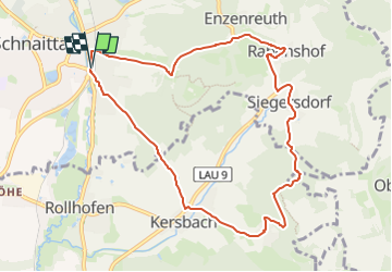
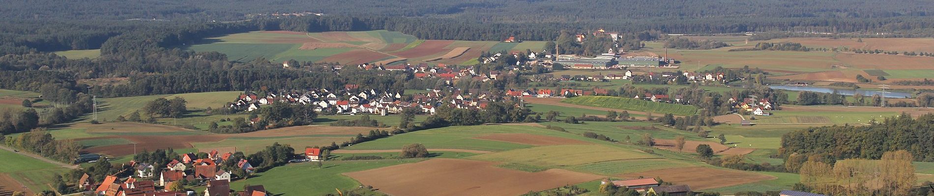
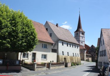
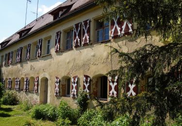
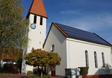
Tocht Te voet van 9,1 km beschikbaar op Beieren, Landkreis Nürnberger Land, Schnaittach. Deze tocht wordt voorgesteld door SityTrail - itinéraires balisés pédestres.
Beschrijving
Trail created by Verkehrsverein Schnaittachtal e.V..
Wegmakierung teilweise entfernt, Weg in neueren Karten nicht mehr aufgeführt, geprüft (Feb. 2015, by cycling_zno)
Symbol: weisse 4 auf gelb
Plaatsbepaling
Opmerkingen
Wandeltochten in de omgeving
![Tocht Te voet Kirchensittenbach - Kirchensittenbach 4a - Photo](https://media.geolcdn.com/t/375/260/814dae09-5fb1-442e-abdf-4f3252bdd922.jpeg&format=jpg&maxdim=2)
![Te voet Te voet](https://static1.geolcdn.com/sitytour/trail-icons/100.png)
Te voet
![](/images/other/stat-length.png)
![](https://static1.geolcdn.com/siteimages/upload/files/16400158638029165_repeat_loop_refresh_sync_direction_icon.png)
![Tocht Te voet Kirchensittenbach - Kirchensittenbach 4 - Photo](https://media.geolcdn.com/t/375/260/143d5234-ad74-4965-bef0-21d79ad60f89.jpeg&format=jpg&maxdim=2)
![Te voet Te voet](https://static1.geolcdn.com/sitytour/trail-icons/100.png)
Te voet
![](/images/other/stat-length.png)
![](https://static1.geolcdn.com/siteimages/upload/files/16400158638029165_repeat_loop_refresh_sync_direction_icon.png)
![Tocht Te voet Kirchensittenbach - Oberkrumbach-Kleedorf - Photo](https://media.geolcdn.com/t/375/260/43473ef1-7005-47bb-9daa-75911118c670.jpeg&format=jpg&maxdim=2)
![Te voet Te voet](https://static1.geolcdn.com/sitytour/trail-icons/100.png)
Te voet
![](/images/other/stat-length.png)
![](https://static1.geolcdn.com/siteimages/upload/files/16400158638029165_repeat_loop_refresh_sync_direction_icon.png)
![Tocht Te voet Schnaittach - Reingrub – Osternohe - Photo](https://media.geolcdn.com/t/375/260/abff5f7e-aafe-437f-9d3a-bf04e660ea77.jpeg&format=jpg&maxdim=2)
![Te voet Te voet](https://static1.geolcdn.com/sitytour/trail-icons/100.png)
Te voet
![](/images/other/stat-length.png)
![](https://static1.geolcdn.com/siteimages/upload/files/16400158638029165_repeat_loop_refresh_sync_direction_icon.png)
![Tocht Te voet Schnaittach - Osternohe – Hohenstein - Photo](https://media.geolcdn.com/t/375/260/23b981c0-88bd-4d2c-ac42-c5a479f4e1f2.jpeg&format=jpg&maxdim=2)
![Te voet Te voet](https://static1.geolcdn.com/sitytour/trail-icons/100.png)
Te voet
![](/images/other/stat-length.png)
![](https://static1.geolcdn.com/siteimages/upload/files/16400158638029165_repeat_loop_refresh_sync_direction_icon.png)
![Tocht Te voet Simmelsdorf - Simmelsdorfer Rundwanderweg Gelb 5 - Photo](https://media.geolcdn.com/t/375/260/4b3ec6c1-e7fe-4b9a-890e-68e11ef3781c.jpeg&format=jpg&maxdim=2)
![Te voet Te voet](https://static1.geolcdn.com/sitytour/trail-icons/100.png)
Te voet
![](/images/other/stat-length.png)
![](https://static1.geolcdn.com/siteimages/upload/files/16400158638029165_repeat_loop_refresh_sync_direction_icon.png)
![Tocht Te voet Neunkirchen a. Sand - Schnaittachtalwanderweg - Photo](https://media.geolcdn.com/t/375/260/4b3ec6c1-e7fe-4b9a-890e-68e11ef3781c.jpeg&format=jpg&maxdim=2)
![Te voet Te voet](https://static1.geolcdn.com/sitytour/trail-icons/100.png)
Te voet
![](/images/other/stat-length.png)
![](https://static1.geolcdn.com/siteimages/upload/files/16400158638029165_repeat_loop_refresh_sync_direction_icon.png)
![Tocht Te voet Neunkirchen a. Sand - Neunkirchen am Sand Rundwanderweg Rot 8 - Photo](https://media.geolcdn.com/t/375/260/214c787a-2260-4370-b7e8-4c4852b4eeaf.jpeg&format=jpg&maxdim=2)
![Te voet Te voet](https://static1.geolcdn.com/sitytour/trail-icons/100.png)
Te voet
![](/images/other/stat-length.png)
![](https://static1.geolcdn.com/siteimages/upload/files/16400158638029165_repeat_loop_refresh_sync_direction_icon.png)
![Tocht Te voet Schnaittach - Rundweg Schnaittach – Kleinbellhofen - Photo](https://media.geolcdn.com/t/375/260/148747ee-2631-4f0e-b50f-e44587244d86.jpeg&format=jpg&maxdim=2)
![Te voet Te voet](https://static1.geolcdn.com/sitytour/trail-icons/100.png)
Te voet
![](/images/other/stat-length.png)
![](https://static1.geolcdn.com/siteimages/upload/files/16400158638029165_repeat_loop_refresh_sync_direction_icon.png)