![](/images/other/stat-length.png)
![Tocht Te voet Onbekend - Höfeweg Enger-Schildesche - Photo](https://media.geolcdn.com/t/1900/400/326b912d-8b45-4ba9-986d-8692f2ade6c6.jpeg&format=pjpeg&maxdim=2)
Höfeweg Enger-Schildesche
SityTrail - itinéraires balisés pédestres
Tous les sentiers balisés d’Europe GUIDE+
![Lengte](/images/other/stat-length.png)
Lengte
15,3 km
![Max. hoogte](https://static1.geolcdn.com/siteimages/upload/files/1508320355ic_sort_altitude_max_24dp.png)
Max. hoogte
137 m
![Positief hoogteverschil](https://static1.geolcdn.com/siteimages/upload/files/1508320355ic_sort_den_pos_24dp.png)
Positief hoogteverschil
168 m
![Km-Effort](/images/other/stat-length.png)
Km-Effort
17,5 km
![Min. hoogte](https://static1.geolcdn.com/siteimages/upload/files/1508320355ic_sort_altitude_min_24dp.png)
Min. hoogte
82 m
![Negatief hoogteverschil](https://static1.geolcdn.com/siteimages/upload/files/1508320355ic_sort_den_neg_24dp.png)
Negatief hoogteverschil
170 m
![Boucle](https://static1.geolcdn.com/siteimages/upload/files/16400158638029165_repeat_loop_refresh_sync_direction_icon.png)
Boucle
Neen
Markering
Datum van aanmaak :
2022-02-11 13:04:27.315
Laatste wijziging :
2022-02-11 13:04:27.315
![Te voet](https://static1.geolcdn.com/sitytour/trail-icons/100.png)
3h59
Moeilijkheid : Gemakkelijk
![Scan deze QR-code om de tocht te openen in de SityTrail-applicatie](https://capi.geolives.com/qq0zvz2zws4bq2lad0pu/sitytour/trails/3089084/qr.png?size=200)
Gratisgps-wandelapplicatie
Over ons
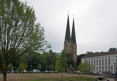
Tocht Te voet van 15,3 km beschikbaar op Noordrijn-Westfalen, Bielefeld, Onbekend. Deze tocht wordt voorgesteld door SityTrail - itinéraires balisés pédestres.
Beschrijving
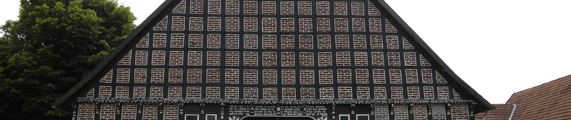
Symbol: Weißes stilisiertes Fachwerkhaus
Plaatsbepaling
Land:
Germany
Regio :
Noordrijn-Westfalen
Departement/Provincie :
Bielefeld
Gemeente :
Onbekend
Locatie:
Schildesche
Vertrek:(Dec)
Vertrek:(UTM)
468782 ; 5767362 (32U) N.
Opmerkingen
Wandeltochten in de omgeving
![Tocht Te voet Onbekend - Stadtrundgang - Photo](https://media.geolcdn.com/t/375/260/57497daa-a1c0-474e-bc4c-e77271ef28a9.jpeg&format=jpg&maxdim=2)
![Te voet Te voet](https://static1.geolcdn.com/sitytour/trail-icons/100.png)
Stadtrundgang
Te voet
Gemakkelijk
Onbekend,
Noordrijn-Westfalen,
Bielefeld,
Germany
![](/images/other/stat-length.png)
3,7 km | 4,5 km-effort
1h 1min
![](https://static1.geolcdn.com/siteimages/upload/files/16400158638029165_repeat_loop_refresh_sync_direction_icon.png)
Ja
![Tocht Te voet Onbekend - Weser-Lutter-Weg - Photo](https://media.geolcdn.com/t/375/260/c90dd43f-6f1d-498e-9eb5-c59a5139c94e.jpeg&format=jpg&maxdim=2)
![Te voet Te voet](https://static1.geolcdn.com/sitytour/trail-icons/100.png)
Weser-Lutter-Weg
Te voet
Gemakkelijk
Onbekend,
Noordrijn-Westfalen,
Bielefeld,
Germany
![](/images/other/stat-length.png)
11 km | 11,9 km-effort
2h 42min
![](https://static1.geolcdn.com/siteimages/upload/files/16400158638029165_repeat_loop_refresh_sync_direction_icon.png)
Neen
![Tocht Te voet Onbekend - Von Burg zu Berg - Photo](https://media.geolcdn.com/t/375/260/fb5868bb-e2ef-464c-940e-562613eca188.jpeg&format=jpg&maxdim=2)
![Te voet Te voet](https://static1.geolcdn.com/sitytour/trail-icons/100.png)
Von Burg zu Berg
Te voet
Gemakkelijk
Onbekend,
Noordrijn-Westfalen,
Bielefeld,
Germany
![](/images/other/stat-length.png)
4,4 km | 5,8 km-effort
1h 19min
![](https://static1.geolcdn.com/siteimages/upload/files/16400158638029165_repeat_loop_refresh_sync_direction_icon.png)
Neen
![Tocht Te voet Onbekend - Leineweberweg - Photo](https://media.geolcdn.com/t/375/260/0bdf46a2-9d20-47ac-bb68-cffdb7dd2466.jpeg&format=jpg&maxdim=2)
![Te voet Te voet](https://static1.geolcdn.com/sitytour/trail-icons/100.png)
Leineweberweg
Te voet
Gemakkelijk
Onbekend,
Noordrijn-Westfalen,
Bielefeld,
Germany
![](/images/other/stat-length.png)
6,9 km | 8,2 km-effort
1h 51min
![](https://static1.geolcdn.com/siteimages/upload/files/16400158638029165_repeat_loop_refresh_sync_direction_icon.png)
Neen
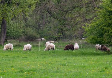
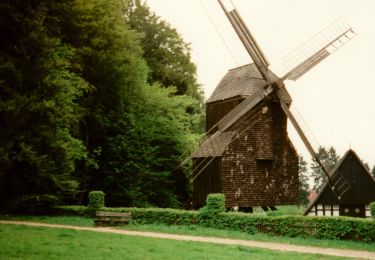
![Tocht Te voet Onbekend - KulturLand Schelphof - Erlebsnispfad Land[wirt]schaft - Photo](https://media.geolcdn.com/t/375/260/947f6235-968b-46c8-85c0-3056399ced95.jpeg&format=jpg&maxdim=2)
![Te voet Te voet](https://static1.geolcdn.com/sitytour/trail-icons/100.png)
KulturLand Schelphof - Erlebsnispfad Land[wirt]schaft
Te voet
Gemakkelijk
Onbekend,
Noordrijn-Westfalen,
Bielefeld,
Germany
![](/images/other/stat-length.png)
3,4 km | 3,7 km-effort
51min
![](https://static1.geolcdn.com/siteimages/upload/files/16400158638029165_repeat_loop_refresh_sync_direction_icon.png)
Ja
![Tocht Te voet Onbekend - A4 - Jöllenbeck - Photo](https://media.geolcdn.com/t/375/260/d456608d-1593-46a9-ba46-268f5f4b6c6d.jpeg&format=jpg&maxdim=2)
![Te voet Te voet](https://static1.geolcdn.com/sitytour/trail-icons/100.png)
A4 - Jöllenbeck
Te voet
Gemakkelijk
Onbekend,
Noordrijn-Westfalen,
Bielefeld,
Germany
![](/images/other/stat-length.png)
5,6 km | 6,5 km-effort
1h 28min
![](https://static1.geolcdn.com/siteimages/upload/files/16400158638029165_repeat_loop_refresh_sync_direction_icon.png)
Ja
![Tocht Te voet Onbekend - A3 - Jöllenbeck - Photo](https://media.geolcdn.com/t/375/260/8a677e59-94dd-4e61-97cd-94b71f1244bf.jpeg&format=jpg&maxdim=2)
![Te voet Te voet](https://static1.geolcdn.com/sitytour/trail-icons/100.png)
A3 - Jöllenbeck
Te voet
Gemakkelijk
Onbekend,
Noordrijn-Westfalen,
Bielefeld,
Germany
![](/images/other/stat-length.png)
9,6 km | 11,1 km-effort
2h 31min
![](https://static1.geolcdn.com/siteimages/upload/files/16400158638029165_repeat_loop_refresh_sync_direction_icon.png)
Ja
![Tocht Te voet Onbekend - Herfordweg - Photo](https://media.geolcdn.com/t/375/260/d456608d-1593-46a9-ba46-268f5f4b6c6d.jpeg&format=jpg&maxdim=2)
![Te voet Te voet](https://static1.geolcdn.com/sitytour/trail-icons/100.png)
Herfordweg
Te voet
Gemakkelijk
Onbekend,
Noordrijn-Westfalen,
Bielefeld,
Germany
![](/images/other/stat-length.png)
13,9 km | 15,7 km-effort
3h 33min
![](https://static1.geolcdn.com/siteimages/upload/files/16400158638029165_repeat_loop_refresh_sync_direction_icon.png)
Neen
![Tocht Te voet Onbekend - A2 - Jöllenbeck - Photo](https://media.geolcdn.com/t/375/260/d456608d-1593-46a9-ba46-268f5f4b6c6d.jpeg&format=jpg&maxdim=2)
![Te voet Te voet](https://static1.geolcdn.com/sitytour/trail-icons/100.png)
A2 - Jöllenbeck
Te voet
Gemakkelijk
Onbekend,
Noordrijn-Westfalen,
Bielefeld,
Germany
![](/images/other/stat-length.png)
7,8 km | 9,3 km-effort
2h 7min
![](https://static1.geolcdn.com/siteimages/upload/files/16400158638029165_repeat_loop_refresh_sync_direction_icon.png)
Neen