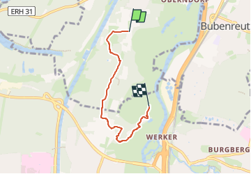
![](/images/other/stat-length.png)
![Tocht Te voet Möhrendorf - Naturerlebnispfad Erlangen - Photo](https://media.geolcdn.com/t/1900/400/ea22ba3f-a9ef-4aa3-9503-4a65b8526407.jpeg&format=pjpeg&maxdim=2)
Naturerlebnispfad Erlangen
SityTrail - itinéraires balisés pédestres
Tous les sentiers balisés d’Europe GUIDE+
![Lengte](/images/other/stat-length.png)
![Max. hoogte](https://static1.geolcdn.com/siteimages/upload/files/1508320355ic_sort_altitude_max_24dp.png)
![Positief hoogteverschil](https://static1.geolcdn.com/siteimages/upload/files/1508320355ic_sort_den_pos_24dp.png)
![Km-Effort](/images/other/stat-length.png)
![Min. hoogte](https://static1.geolcdn.com/siteimages/upload/files/1508320355ic_sort_altitude_min_24dp.png)
![Negatief hoogteverschil](https://static1.geolcdn.com/siteimages/upload/files/1508320355ic_sort_den_neg_24dp.png)
![Boucle](https://static1.geolcdn.com/siteimages/upload/files/16400158638029165_repeat_loop_refresh_sync_direction_icon.png)
![Te voet](https://static1.geolcdn.com/sitytour/trail-icons/100.png)
1h01
Moeilijkheid : Gemakkelijk
![Scan deze QR-code om de tocht te openen in de SityTrail-applicatie](https://capi.geolives.com/qq0zvz2zws4bq2lad0pu/sitytour/trails/3087974/qr.png?size=200)
Gratisgps-wandelapplicatie
Over ons
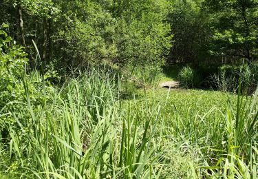
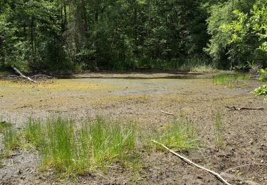
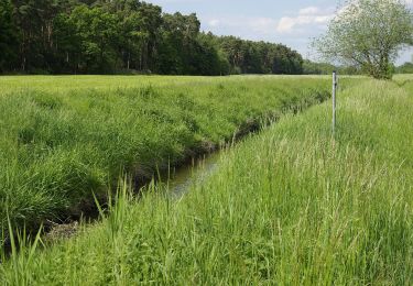
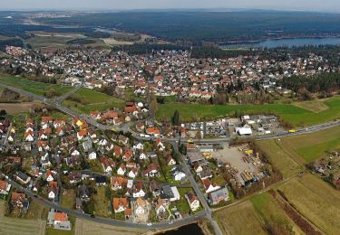
Tocht Te voet van 3,9 km beschikbaar op Beieren, Landkreis Erlangen-Höchstadt, Möhrendorf. Deze tocht wordt voorgesteld door SityTrail - itinéraires balisés pédestres.
Beschrijving
Als 100 prozentige Tochter der Stadt Erlangen bieten wir unseren Kunden eine zuverlässige Versorgung mit Elektrizität, Wärme, Erdgas und Wasser aus einer Hand.
Website: https://www.estw.de/naturerlebnispfad
Plaatsbepaling
Opmerkingen
Wandeltochten in de omgeving
![Tocht Te voet - Erlangen-Steudach - Photo](https://media.geolcdn.com/t/375/260/326b0b59-d310-4208-b907-9fdb0ba2140b.jpeg&format=jpg&maxdim=2)
![Te voet Te voet](https://static1.geolcdn.com/sitytour/trail-icons/100.png)
Te voet
![](/images/other/stat-length.png)
![](https://static1.geolcdn.com/siteimages/upload/files/16400158638029165_repeat_loop_refresh_sync_direction_icon.png)
![Tocht Te voet Baiersdorf - Meerrettichweg - Photo](https://media.geolcdn.com/t/375/260/92896cfd-f5cd-48c4-b2fd-c760b6de8ffd.jpeg&format=jpg&maxdim=2)
![Te voet Te voet](https://static1.geolcdn.com/sitytour/trail-icons/100.png)
Te voet
![](/images/other/stat-length.png)
![](https://static1.geolcdn.com/siteimages/upload/files/16400158638029165_repeat_loop_refresh_sync_direction_icon.png)
![Tocht Te voet Bubenreuth - Hochwasserweg - Photo](https://media.geolcdn.com/t/375/260/0d4ced9c-0240-4646-a9bb-3ad2a492dab7.jpeg&format=jpg&maxdim=2)
![Te voet Te voet](https://static1.geolcdn.com/sitytour/trail-icons/100.png)
Te voet
![](/images/other/stat-length.png)
![](https://static1.geolcdn.com/siteimages/upload/files/16400158638029165_repeat_loop_refresh_sync_direction_icon.png)
![Tocht Te voet Buckenhofer Forst - Hirschlecke Trail - Photo](https://media.geolcdn.com/t/375/260/b4b6bb74-7819-4b5c-9ec1-7ba33dbaf327.jpeg&format=jpg&maxdim=2)
![Te voet Te voet](https://static1.geolcdn.com/sitytour/trail-icons/100.png)
Te voet
![](/images/other/stat-length.png)
![](https://static1.geolcdn.com/siteimages/upload/files/16400158638029165_repeat_loop_refresh_sync_direction_icon.png)
![Tocht Te voet - Zigeunereck Trail - Photo](https://media.geolcdn.com/t/375/260/2d289e07-5fb0-4f85-a06b-129887d0ae8b.jpeg&format=jpg&maxdim=2)
![Te voet Te voet](https://static1.geolcdn.com/sitytour/trail-icons/100.png)
Te voet
![](/images/other/stat-length.png)
![](https://static1.geolcdn.com/siteimages/upload/files/16400158638029165_repeat_loop_refresh_sync_direction_icon.png)
![Tocht Te voet Möhrendorf - Wanderweg Südlicher Möhrendorfer Rundweg - Photo](https://media.geolcdn.com/t/375/260/ea22ba3f-a9ef-4aa3-9503-4a65b8526407.jpeg&format=jpg&maxdim=2)
![Te voet Te voet](https://static1.geolcdn.com/sitytour/trail-icons/100.png)
Te voet
![](/images/other/stat-length.png)
![](https://static1.geolcdn.com/siteimages/upload/files/16400158638029165_repeat_loop_refresh_sync_direction_icon.png)
![Tocht Te voet Möhrendorf - Wanderweg Nördlicher Möhrendorfer Rundweg - Photo](https://media.geolcdn.com/t/375/260/e180760a-0888-4e24-92e4-d287ef34491e.jpeg&format=jpg&maxdim=2)
![Te voet Te voet](https://static1.geolcdn.com/sitytour/trail-icons/100.png)
Te voet
![](/images/other/stat-length.png)
![](https://static1.geolcdn.com/siteimages/upload/files/16400158638029165_repeat_loop_refresh_sync_direction_icon.png)
![Tocht Te voet - DAK-Eisert-Nordic Walking Parcour - Photo](https://media.geolcdn.com/t/375/260/83bb39d6-d712-4c37-9cdf-22ccc440f885.jpeg&format=jpg&maxdim=2)
![Te voet Te voet](https://static1.geolcdn.com/sitytour/trail-icons/100.png)
Te voet
![](/images/other/stat-length.png)
![](https://static1.geolcdn.com/siteimages/upload/files/16400158638029165_repeat_loop_refresh_sync_direction_icon.png)
![Tocht Te voet - Erlangen 8 grün - Photo](https://media.geolcdn.com/t/375/260/4026b844-60dc-4d74-adfc-42edf5297bc2.jpeg&format=jpg&maxdim=2)
![Te voet Te voet](https://static1.geolcdn.com/sitytour/trail-icons/100.png)
Te voet
![](/images/other/stat-length.png)
![](https://static1.geolcdn.com/siteimages/upload/files/16400158638029165_repeat_loop_refresh_sync_direction_icon.png)