![](/images/other/stat-length.png)
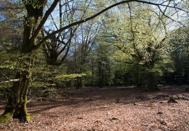
![Tocht Te voet Brakel - Toeppad - Photo](https://media.geolcdn.com/t/1900/400/09e5ced1-9302-45ec-a2ea-0bc749e41ee5.jpeg&format=pjpeg&maxdim=2)
Toeppad
SityTrail - itinéraires balisés pédestres
Tous les sentiers balisés d’Europe GUIDE+
![Lengte](/images/other/stat-length.png)
Lengte
8,1 km
![Max. hoogte](https://static1.geolcdn.com/siteimages/upload/files/1508320355ic_sort_altitude_max_24dp.png)
Max. hoogte
93 m
![Positief hoogteverschil](https://static1.geolcdn.com/siteimages/upload/files/1508320355ic_sort_den_pos_24dp.png)
Positief hoogteverschil
114 m
![Km-Effort](/images/other/stat-length.png)
Km-Effort
9,6 km
![Min. hoogte](https://static1.geolcdn.com/siteimages/upload/files/1508320355ic_sort_altitude_min_24dp.png)
Min. hoogte
31 m
![Negatief hoogteverschil](https://static1.geolcdn.com/siteimages/upload/files/1508320355ic_sort_den_neg_24dp.png)
Negatief hoogteverschil
112 m
![Boucle](https://static1.geolcdn.com/siteimages/upload/files/16400158638029165_repeat_loop_refresh_sync_direction_icon.png)
Boucle
Ja
Markering
Datum van aanmaak :
2022-02-09 19:24:07.086
Laatste wijziging :
2022-02-09 19:24:07.086
![Te voet](https://static1.geolcdn.com/sitytour/trail-icons/100.png)
2h11
Moeilijkheid : Gemakkelijk
![Scan deze QR-code om de tocht te openen in de SityTrail-applicatie](https://capi.geolives.com/qq0zvz2zws4bq2lad0pu/sitytour/trails/3085385/qr.png?size=200)
Gratisgps-wandelapplicatie
Over ons
Tocht Te voet van 8,1 km beschikbaar op Vlaanderen, Oost-Vlaanderen, Brakel. Deze tocht wordt voorgesteld door SityTrail - itinéraires balisés pédestres.
Beschrijving
Trail created by Gemeente Brakel.
Plaatsbepaling
Land:
Belgium
Regio :
Vlaanderen
Departement/Provincie :
Oost-Vlaanderen
Gemeente :
Brakel
Locatie:
Nederbrakel
Vertrek:(Dec)
Vertrek:(UTM)
553849 ; 5628284 (31U) N.
Opmerkingen
Wandeltochten in de omgeving
![Tocht Stappen Vloesberg - Flobecq, Natura 2000 des sites qui valent le détour. Ht10 - Photo](https://media.geolcdn.com/t/375/260/ext.jpg?maxdim=2&url=https%3A%2F%2Fservices.sitytrail.com%2FGeolivesWS%2FDownloadMedia.ashx%3FTrailID%3D909698%26Media%3D35121b2c-4aba-47c4-9fcc-6708631a1f90.jpg)
![Stappen Stappen](https://static1.geolcdn.com/sitytour/trail-icons/101.png)
Flobecq, Natura 2000 des sites qui valent le détour. Ht10
Stappen
Gemakkelijk
(1)
Vloesberg,
Wallonië,
Henegouwen,
Belgium
![](/images/other/stat-length.png)
5,2 km | 6,4 km-effort
1h 21min
![](https://static1.geolcdn.com/siteimages/upload/files/16400158638029165_repeat_loop_refresh_sync_direction_icon.png)
Neen
![Tocht Te voet Brakel - Everbeekpad - Photo](https://media.geolcdn.com/t/375/260/d08ad0f4-de55-4764-95c5-9e3d60aacb5d.jpeg&format=jpg&maxdim=2)
![Te voet Te voet](https://static1.geolcdn.com/sitytour/trail-icons/100.png)
Everbeekpad
Te voet
Gemakkelijk
Brakel,
Vlaanderen,
Oost-Vlaanderen,
Belgium
![](/images/other/stat-length.png)
14,5 km | 16,9 km-effort
3h 50min
![](https://static1.geolcdn.com/siteimages/upload/files/16400158638029165_repeat_loop_refresh_sync_direction_icon.png)
Ja
![Tocht Te voet Brakel - Tweebossenpad - Photo](https://media.geolcdn.com/t/375/260/0ea6d16c-e6be-4ad6-877d-eae169d349af.jpeg&format=jpg&maxdim=2)
![Te voet Te voet](https://static1.geolcdn.com/sitytour/trail-icons/100.png)
Tweebossenpad
Te voet
Gemakkelijk
Brakel,
Vlaanderen,
Oost-Vlaanderen,
Belgium
![](/images/other/stat-length.png)
10 km | 11,9 km-effort
2h 42min
![](https://static1.geolcdn.com/siteimages/upload/files/16400158638029165_repeat_loop_refresh_sync_direction_icon.png)
Ja
![Tocht Te voet Vloesberg - Tussen d'Hoppe en Bos ter Rijst - Photo](https://media.geolcdn.com/t/375/260/ext.jpg?maxdim=2&url=https%3A%2F%2Fpivotmedia.tourismewallonie.be%2FANX-02-000EUQ%2FANX-02-000EUQ.jpg)
![Te voet Te voet](https://static1.geolcdn.com/sitytour/trail-icons/100.png)
Tussen d'Hoppe en Bos ter Rijst
Te voet
Gemakkelijk
Vloesberg,
Wallonië,
Henegouwen,
Belgium
![](/images/other/stat-length.png)
12,7 km | 15,5 km-effort
3h 30min
![](https://static1.geolcdn.com/siteimages/upload/files/16400158638029165_repeat_loop_refresh_sync_direction_icon.png)
Ja
![Tocht Te voet Vloesberg - In het Brakelbos - Photo](https://media.geolcdn.com/t/375/260/ext.jpg?maxdim=2&url=https%3A%2F%2Fpivotmedia.tourismewallonie.be%2FANX-02-000EUU%2FANX-02-000EUU.jpg)
![Te voet Te voet](https://static1.geolcdn.com/sitytour/trail-icons/100.png)
In het Brakelbos
Te voet
Gemakkelijk
Vloesberg,
Wallonië,
Henegouwen,
Belgium
![](/images/other/stat-length.png)
7,7 km | 10 km-effort
2h 16min
![](https://static1.geolcdn.com/siteimages/upload/files/16400158638029165_repeat_loop_refresh_sync_direction_icon.png)
Ja
![Tocht Te voet Vloesberg - Tussen Everbeek-Boven en het Livierenbos - Photo](https://media.geolcdn.com/t/375/260/ext.jpg?maxdim=2&url=https%3A%2F%2Fpivotmedia.tourismewallonie.be%2FANX-02-000EUY%2FANX-02-000EUY.jpg)
![Te voet Te voet](https://static1.geolcdn.com/sitytour/trail-icons/100.png)
Tussen Everbeek-Boven en het Livierenbos
Te voet
Gemakkelijk
Vloesberg,
Wallonië,
Henegouwen,
Belgium
![](/images/other/stat-length.png)
9,3 km | 11,5 km-effort
2h 36min
![](https://static1.geolcdn.com/siteimages/upload/files/16400158638029165_repeat_loop_refresh_sync_direction_icon.png)
Ja
![Tocht Stappen Lierde - Sint-Maria-Lierde 22,1 km - Photo](https://media.geolcdn.com/t/375/260/a2be152f-8eb2-4f2d-918a-621eed7f210d.jpg&format=jpg&maxdim=2)
![Stappen Stappen](https://static1.geolcdn.com/sitytour/trail-icons/101.png)
Sint-Maria-Lierde 22,1 km
Stappen
Medium
Lierde,
Vlaanderen,
Oost-Vlaanderen,
Belgium
![](/images/other/stat-length.png)
22 km | 26 km-effort
6h 16min
![](https://static1.geolcdn.com/siteimages/upload/files/16400158638029165_repeat_loop_refresh_sync_direction_icon.png)
Ja
![Tocht Stappen Brakel - geutelingenpad - Photo](https://media.geolcdn.com/t/375/260/fc0b2c53-327a-42be-a950-604e6b442473.jpg&format=jpg&maxdim=2)
![Stappen Stappen](https://static1.geolcdn.com/sitytour/trail-icons/101.png)
geutelingenpad
Stappen
Gemakkelijk
Brakel,
Vlaanderen,
Oost-Vlaanderen,
Belgium
![](/images/other/stat-length.png)
7,7 km | 9,6 km-effort
1h 26min
![](https://static1.geolcdn.com/siteimages/upload/files/16400158638029165_repeat_loop_refresh_sync_direction_icon.png)
Ja
![Tocht Te voet Brakel - Geutelingenpad - Photo](https://media.geolcdn.com/t/375/260/c774d8d2-3580-43a8-8706-74fbb990c0d1.jpeg&format=jpg&maxdim=2)
![Te voet Te voet](https://static1.geolcdn.com/sitytour/trail-icons/100.png)
Geutelingenpad
Te voet
Gemakkelijk
Brakel,
Vlaanderen,
Oost-Vlaanderen,
Belgium
![](/images/other/stat-length.png)
7,7 km | 9,5 km-effort
2h 9min
![](https://static1.geolcdn.com/siteimages/upload/files/16400158638029165_repeat_loop_refresh_sync_direction_icon.png)
Ja