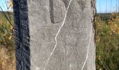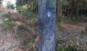

13. Promenade des Bruyères
SityTrail - itinéraires balisés pédestres
Tous les sentiers balisés d’Europe GUIDE+

Lengte
9,2 km

Max. hoogte
614 m

Positief hoogteverschil
215 m

Km-Effort
12,1 km

Min. hoogte
506 m

Negatief hoogteverschil
216 m
Boucle
Ja
Markering
Datum van aanmaak :
2022-02-09 19:16:02.395
Laatste wijziging :
2022-02-09 19:16:02.395
2h44
Moeilijkheid : Gemakkelijk

Gratisgps-wandelapplicatie
Over ons
Tocht Te voet van 9,2 km beschikbaar op Wallonië, Luik, Trois-Ponts. Deze tocht wordt voorgesteld door SityTrail - itinéraires balisés pédestres.
Beschrijving
Trail created by RSI de Trois-Ponts.
Plaatsbepaling
Land:
Belgium
Regio :
Wallonië
Departement/Provincie :
Luik
Gemeente :
Trois-Ponts
Locatie:
Unknown
Vertrek:(Dec)
Vertrek:(UTM)
710766 ; 5580829 (31U) N.
Opmerkingen
Wandeltochten in de omgeving
Logbiermé. Natura 2000, des sites qui valent le détour ! Lg5


Stappen
Gemakkelijk
(10)
Trois-Ponts,
Wallonië,
Luik,
Belgium

8,4 km | 10,9 km-effort
Onbekend
Ja
2021-03-10_14h59m08_1227


Stappen
Moeilijk
(3)
Stavelot,
Wallonië,
Luik,
Belgium

18,8 km | 26 km-effort
5h 53min
Neen
4. Promenade de l'Ecureuil


Te voet
Gemakkelijk
(1)
Stavelot,
Wallonië,
Luik,
Belgium

6,6 km | 9,1 km-effort
2h 3min
Ja
12. Promenade des Bornes Frontières


Te voet
Gemakkelijk
Trois-Ponts,
Wallonië,
Luik,
Belgium

8,4 km | 11 km-effort
2h 30min
Ja

7. Promenade du Hibou


Te voet
Gemakkelijk
Stavelot,
Wallonië,
Luik,
Belgium

8,6 km | 12,1 km-effort
2h 44min
Ja
Ennal Logbiermé


Stappen
Heel gemakkelijk
(2)
Vielsalm,
Wallonië,
Luxemburg,
Belgium

8,9 km | 12,5 km-effort
2h 29min
Ja
Balade à Grand-Halleux


Stappen
Heel gemakkelijk
Vielsalm,
Wallonië,
Luxemburg,
Belgium

13,7 km | 17,7 km-effort
5h 28min
Ja


 SityTrail


