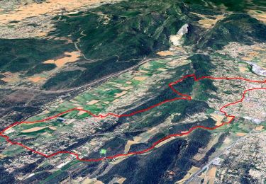
![](/images/other/stat-length.png)
![Tocht Stappen Garéoult - l'amarron et son dolmen au départ de Garréoult la Gabelle - Photo](https://media.geolcdn.com/t/1900/400/87a9b798-8a41-4999-9b8e-e89295cb67d3.jpg&format=pjpeg&maxdim=2)
l'amarron et son dolmen au départ de Garréoult la Gabelle
chrifor
Gebruiker
![Lengte](/images/other/stat-length.png)
![Max. hoogte](https://static1.geolcdn.com/siteimages/upload/files/1508320355ic_sort_altitude_max_24dp.png)
![Positief hoogteverschil](https://static1.geolcdn.com/siteimages/upload/files/1508320355ic_sort_den_pos_24dp.png)
![Km-Effort](/images/other/stat-length.png)
![Min. hoogte](https://static1.geolcdn.com/siteimages/upload/files/1508320355ic_sort_altitude_min_24dp.png)
![Negatief hoogteverschil](https://static1.geolcdn.com/siteimages/upload/files/1508320355ic_sort_den_neg_24dp.png)
![Boucle](https://static1.geolcdn.com/siteimages/upload/files/16400158638029165_repeat_loop_refresh_sync_direction_icon.png)
![Stappen](https://static1.geolcdn.com/sitytour/trail-icons/101.png)
6h08
Moeilijkheid : Medium
![Scan deze QR-code om de tocht te openen in de SityTrail-applicatie](https://capi.geolives.com/qq0zvz2zws4bq2lad0pu/sitytour/trails/3081839/qr.png?size=200)
Gratisgps-wandelapplicatie
Over ons
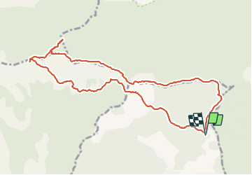
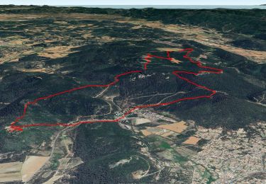
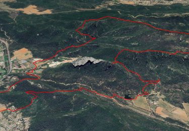
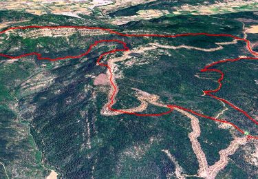
Tocht Stappen van 11,5 km beschikbaar op Provence-Alpes-Côte d'Azur, Var, Garéoult. Deze tocht wordt voorgesteld door chrifor.
Beschrijving
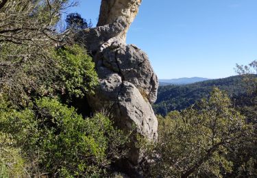
Le chemin du Vallon de Cavaillon n'a rien d'agréable (très creusé, caillouteux, tristounet...). Mieux vaut utiliser le tracé sud en A/R et rejoindre la montée à la cote 652.
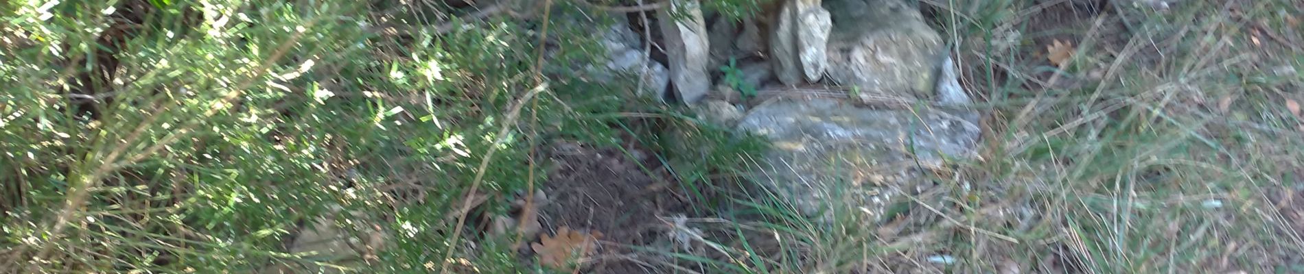
Le dolmen, effondré, est situé de suite à gauche en arrivant sur le plateau (cairns).
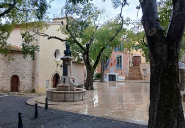
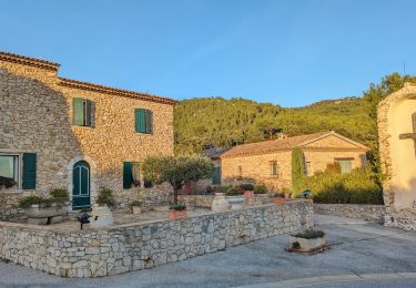
Rando parcourue le 08/02/2022
Plaatsbepaling
Opmerkingen
Wandeltochten in de omgeving
![Tocht Stappen Rocbaron - SityTrail - rocbaron victor - Photo](https://media.geolcdn.com/t/375/260/65b9c34e-6588-477e-8f02-e7295c203708.jpg&format=jpg&maxdim=2)
![Stappen Stappen](https://static1.geolcdn.com/sitytour/trail-icons/101.png)
Stappen
![](/images/other/stat-length.png)
![](https://static1.geolcdn.com/siteimages/upload/files/16400158638029165_repeat_loop_refresh_sync_direction_icon.png)
![Tocht Stappen La Celle - Trace_La_Celle - Photo](https://media.geolcdn.com/t/375/260/367c307f-f133-49ff-990b-24c0026569ab.jpg&format=jpg&maxdim=2)
![Stappen Stappen](https://static1.geolcdn.com/sitytour/trail-icons/101.png)
Stappen
![](/images/other/stat-length.png)
![](https://static1.geolcdn.com/siteimages/upload/files/16400158638029165_repeat_loop_refresh_sync_direction_icon.png)
![Tocht Stappen Brignoles - 18+Brignoles+-+l+eau+et+le+rocher+de+Gueit - Photo](https://media.geolcdn.com/t/375/260/31d7ffa9-7745-46d9-9b40-e3c546757624.jpg&format=jpg&maxdim=2)
![Stappen Stappen](https://static1.geolcdn.com/sitytour/trail-icons/101.png)
Stappen
![](/images/other/stat-length.png)
![](https://static1.geolcdn.com/siteimages/upload/files/16400158638029165_repeat_loop_refresh_sync_direction_icon.png)
![Tocht Stappen Néoules - Neoules crête 19,5 km - Photo](https://media.geolcdn.com/t/375/260/80c386c8-cc89-4ce0-b16a-56ff29c0cd34.jpg&format=jpg&maxdim=2)
![Stappen Stappen](https://static1.geolcdn.com/sitytour/trail-icons/101.png)
Stappen
![](/images/other/stat-length.png)
![](https://static1.geolcdn.com/siteimages/upload/files/16400158638029165_repeat_loop_refresh_sync_direction_icon.png)
![Tocht Stappen La Celle - L'Escarelle 1 - Photo](https://media.geolcdn.com/t/375/260/ext.jpg?maxdim=2&url=https%3A%2F%2Fstatic1.geolcdn.com%2Fsiteimages%2Fupload%2Ffiles%2F1553511878bg_sport_marche.png)
![Stappen Stappen](https://static1.geolcdn.com/sitytour/trail-icons/101.png)
Stappen
![](/images/other/stat-length.png)
![](https://static1.geolcdn.com/siteimages/upload/files/16400158638029165_repeat_loop_refresh_sync_direction_icon.png)
![Tocht Stappen Camps-la-Source - Rocher du Gueit- Camps la Source-06-11-2024 - Photo](https://media.geolcdn.com/t/375/260/e92a19e7-d25b-4cc7-a41e-f3e4999745e6.jpg&format=jpg&maxdim=2)
![Stappen Stappen](https://static1.geolcdn.com/sitytour/trail-icons/101.png)
Stappen
![](/images/other/stat-length.png)
![](https://static1.geolcdn.com/siteimages/upload/files/16400158638029165_repeat_loop_refresh_sync_direction_icon.png)
![Tocht Stappen La Celle - Roc de Candelon - Photo](https://media.geolcdn.com/t/375/260/a9cfb2ad-a53d-4040-a9b9-a70f08f9f434.jpg&format=jpg&maxdim=2)
![Stappen Stappen](https://static1.geolcdn.com/sitytour/trail-icons/101.png)
Stappen
![](/images/other/stat-length.png)
![](https://static1.geolcdn.com/siteimages/upload/files/16400158638029165_repeat_loop_refresh_sync_direction_icon.png)
![Tocht Stappen La Roquebrussanne - chapelle St André et grotte des irris - Photo](https://media.geolcdn.com/t/375/260/c17b726b-2dcc-44be-a87c-f260edf4e94a.jpg&format=jpg&maxdim=2)
![Stappen Stappen](https://static1.geolcdn.com/sitytour/trail-icons/101.png)
Stappen
![](/images/other/stat-length.png)
![](https://static1.geolcdn.com/siteimages/upload/files/16400158638029165_repeat_loop_refresh_sync_direction_icon.png)
![Tocht Stappen Garéoult - L'Amarron depuis Garéoult - Photo](https://media.geolcdn.com/t/375/260/47c5c3b8-59ea-460f-b034-de18890572e7.jpg&format=jpg&maxdim=2)
![Stappen Stappen](https://static1.geolcdn.com/sitytour/trail-icons/101.png)
Stappen
![](/images/other/stat-length.png)
![](https://static1.geolcdn.com/siteimages/upload/files/16400158638029165_repeat_loop_refresh_sync_direction_icon.png)