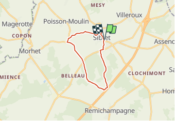
![](/images/other/stat-length.png)
![Tocht Te voet Vaux-sur-Sûre - Promenade du Renard (Wandeling van de vos) - Photo](https://media.geolcdn.com/t/1900/400/ext.pjpeg?maxdim=2&url=https%3A%2F%2Fstatic1.geolcdn.com%2Fsiteimages%2Fupload%2Ffiles%2F1545311037marcheuse_200dpi.jpg)
Promenade du Renard (Wandeling van de vos)
Commissariat général au Tourisme
Randonnées du CGT GUIDE+
![Lengte](/images/other/stat-length.png)
![Max. hoogte](https://static1.geolcdn.com/siteimages/upload/files/1508320355ic_sort_altitude_max_24dp.png)
![Positief hoogteverschil](https://static1.geolcdn.com/siteimages/upload/files/1508320355ic_sort_den_pos_24dp.png)
![Km-Effort](/images/other/stat-length.png)
![Min. hoogte](https://static1.geolcdn.com/siteimages/upload/files/1508320355ic_sort_altitude_min_24dp.png)
![Negatief hoogteverschil](https://static1.geolcdn.com/siteimages/upload/files/1508320355ic_sort_den_neg_24dp.png)
![Boucle](https://static1.geolcdn.com/siteimages/upload/files/16400158638029165_repeat_loop_refresh_sync_direction_icon.png)
![Te voet](https://static1.geolcdn.com/sitytour/trail-icons/100.png)
2h29
Moeilijkheid : Gemakkelijk
![Scan deze QR-code om de tocht te openen in de SityTrail-applicatie](https://capi.geolives.com/qq0zvz2zws4bq2lad0pu/sitytour/trails/3081156/qr.png?size=200)
Gratisgps-wandelapplicatie
Over ons
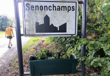
Tocht Te voet van 9 km beschikbaar op Wallonië, Luxemburg, Vaux-sur-Sûre. Deze tocht wordt voorgesteld door Commissariat général au Tourisme.
Beschrijving
Trail created by Haute-Süre Forêt d'Anlier en Ardenne.
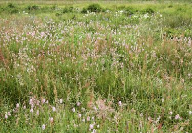
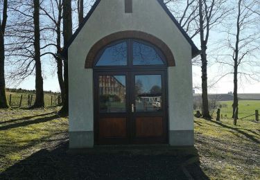
Na enkele kilometers zult u involle waardering vallen voor een eik van verschillende eeuwen “kofieboom” genoemd door de kinderen uit de buurt daar in de spleten vindt men bonen gelijkaardig aan koffiebonen. De omgeving is bedekt met bossen die kenmerkend zijn voor het Ardense plateau met een overwicht aan sparren. Al voortwandelend steekt u de Ravel over (voormalige spoorlijn Libramont-Bastogne-Gouvy) en komt u aan het einde een grot tegen die na het Ardennenoffensief van december 1944 is gebouwd.
Plaatsbepaling
Opmerkingen
Wandeltochten in de omgeving
![Tocht Stappen Vaux-sur-Sûre - Hompré. Natura 2000, des sites qui valent le détour. Lx8 - Photo](https://media.geolcdn.com/t/375/260/ext.jpg?maxdim=2&url=https%3A%2F%2Fservices.sitytrail.com%2FGeolivesWS%2FDownloadMedia.ashx%3FTrailID%3D163750%26Media%3D9b92826d-7fd7-4872-9569-36ed8015d89e.jpg)
![Stappen Stappen](https://static1.geolcdn.com/sitytour/trail-icons/101.png)
Stappen
![](/images/other/stat-length.png)
![](https://static1.geolcdn.com/siteimages/upload/files/16400158638029165_repeat_loop_refresh_sync_direction_icon.png)
![Tocht Stappen Sainte-Ode - Sainte-Ode Wandeling van de hagen van Magery - Photo](https://media.geolcdn.com/t/375/260/ext.jpg?maxdim=2&url=https%3A%2F%2Fstatic1.geolcdn.com%2Fsiteimages%2Fupload%2Ffiles%2F1553511878bg_sport_marche.png)
![Stappen Stappen](https://static1.geolcdn.com/sitytour/trail-icons/101.png)
Stappen
![](/images/other/stat-length.png)
![](https://static1.geolcdn.com/siteimages/upload/files/16400158638029165_repeat_loop_refresh_sync_direction_icon.png)
![Tocht Stappen Sainte-Ode - Sainte-Ode - Wandeling van de hagen van Valets - Photo](https://media.geolcdn.com/t/375/260/ext.jpg?maxdim=2&url=https%3A%2F%2Fstatic1.geolcdn.com%2Fsiteimages%2Fupload%2Ffiles%2F1553511878bg_sport_marche.png)
![Stappen Stappen](https://static1.geolcdn.com/sitytour/trail-icons/101.png)
Stappen
![](/images/other/stat-length.png)
![](https://static1.geolcdn.com/siteimages/upload/files/16400158638029165_repeat_loop_refresh_sync_direction_icon.png)
![Tocht Te voet Vaux-sur-Sûre - Promenade des Vanneaux - Photo](https://media.geolcdn.com/t/375/260/f25bda7f-df07-4cae-a9a3-cfe0c9000b2b.jpeg&format=jpg&maxdim=2)
![Te voet Te voet](https://static1.geolcdn.com/sitytour/trail-icons/100.png)
Te voet
![](/images/other/stat-length.png)
![](https://static1.geolcdn.com/siteimages/upload/files/16400158638029165_repeat_loop_refresh_sync_direction_icon.png)
![Tocht Stappen Bastenaken - Bastogne - Photo](https://media.geolcdn.com/t/375/260/c8ea2498-5648-4f6f-9372-83bfe35ec759.jpg&format=jpg&maxdim=2)
![Stappen Stappen](https://static1.geolcdn.com/sitytour/trail-icons/101.png)
Stappen
![](/images/other/stat-length.png)
![](https://static1.geolcdn.com/siteimages/upload/files/16400158638029165_repeat_loop_refresh_sync_direction_icon.png)
![Tocht Stappen Bastenaken - Marche 10 km 500 à Senonchamps. - Photo](https://media.geolcdn.com/t/375/260/5a88fca4-6ef8-4891-b167-25135544c6f2.jpg&format=jpg&maxdim=2)
![Stappen Stappen](https://static1.geolcdn.com/sitytour/trail-icons/101.png)
Stappen
![](/images/other/stat-length.png)
![](https://static1.geolcdn.com/siteimages/upload/files/16400158638029165_repeat_loop_refresh_sync_direction_icon.png)
![Tocht Te voet Vaux-sur-Sûre - Promenade de la Truite - Photo](https://media.geolcdn.com/t/375/260/dc8e6a7d-10c2-483c-849c-2c2e40a6aa00.jpeg&format=jpg&maxdim=2)
![Te voet Te voet](https://static1.geolcdn.com/sitytour/trail-icons/100.png)
Te voet
![](/images/other/stat-length.png)
![](https://static1.geolcdn.com/siteimages/upload/files/16400158638029165_repeat_loop_refresh_sync_direction_icon.png)
![Tocht Te voet Vaux-sur-Sûre - Promenade du Loup - Photo](https://media.geolcdn.com/t/375/260/a4b7c189-2aa3-4341-b070-c509f488a2a0.jpeg&format=jpg&maxdim=2)
![Te voet Te voet](https://static1.geolcdn.com/sitytour/trail-icons/100.png)
Te voet
![](/images/other/stat-length.png)
![](https://static1.geolcdn.com/siteimages/upload/files/16400158638029165_repeat_loop_refresh_sync_direction_icon.png)
![Tocht Te voet Vaux-sur-Sûre - Promenade du Renardeau - Photo](https://media.geolcdn.com/t/375/260/a4b7c189-2aa3-4341-b070-c509f488a2a0.jpeg&format=jpg&maxdim=2)
![Te voet Te voet](https://static1.geolcdn.com/sitytour/trail-icons/100.png)
Te voet
![](/images/other/stat-length.png)
![](https://static1.geolcdn.com/siteimages/upload/files/16400158638029165_repeat_loop_refresh_sync_direction_icon.png)