![](/images/other/stat-length.png)
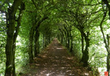
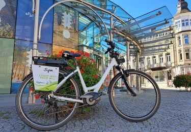
![Tocht Mountainbike Theux - Parcours vert - Photo](https://media.geolcdn.com/t/1900/400/ext.pjpeg?maxdim=2&url=https%3A%2F%2Fstatic1.geolcdn.com%2Fsiteimages%2Fupload%2Ffiles%2F1524743154velo.jpg)
Parcours vert
Commissariat général au Tourisme
Randonnées du CGT GUIDE+
![Lengte](/images/other/stat-length.png)
Lengte
17,8 km
![Max. hoogte](https://static1.geolcdn.com/siteimages/upload/files/1508320355ic_sort_altitude_max_24dp.png)
Max. hoogte
372 m
![Positief hoogteverschil](https://static1.geolcdn.com/siteimages/upload/files/1508320355ic_sort_den_pos_24dp.png)
Positief hoogteverschil
404 m
![Km-Effort](/images/other/stat-length.png)
Km-Effort
23 km
![Min. hoogte](https://static1.geolcdn.com/siteimages/upload/files/1508320355ic_sort_altitude_min_24dp.png)
Min. hoogte
169 m
![Negatief hoogteverschil](https://static1.geolcdn.com/siteimages/upload/files/1508320355ic_sort_den_neg_24dp.png)
Negatief hoogteverschil
402 m
![Boucle](https://static1.geolcdn.com/siteimages/upload/files/16400158638029165_repeat_loop_refresh_sync_direction_icon.png)
Boucle
Ja
Datum van aanmaak :
2022-02-08 11:32:23.451
Laatste wijziging :
2022-02-21 10:13:20.618
![Mountainbike](https://static1.geolcdn.com/sitytour/trail-icons/202.png)
1h36
Moeilijkheid : Medium
![Scan deze QR-code om de tocht te openen in de SityTrail-applicatie](https://capi.geolives.com/qq0zvz2zws4bq2lad0pu/sitytour/trails/3081063/qr.png?size=200)
Gratisgps-wandelapplicatie
Over ons
Tocht Mountainbike van 17,8 km beschikbaar op Wallonië, Luik, Theux. Deze tocht wordt voorgesteld door Commissariat général au Tourisme.
Beschrijving
Trail created by Spa Hautes Fagnes Ardennes.
Plaatsbepaling
Land:
Belgium
Regio :
Wallonië
Departement/Provincie :
Luik
Gemeente :
Theux
Locatie:
Theux
Vertrek:(Dec)
Vertrek:(UTM)
700216 ; 5601160 (31U) N.
Opmerkingen
Wandeltochten in de omgeving
![Tocht Stappen Theux - Theux - Natura 2000, des sites qui valent le détour - LG22 - Photo](https://media.geolcdn.com/t/375/260/ext.jpg?maxdim=2&url=https%3A%2F%2Fservices.sitytrail.com%2FGeolivesWS%2FDownloadMedia.ashx%3FTrailID%3D612638%26Media%3D53072597-f13a-4b1e-b213-a2c1df094f1f.JPG)
![Stappen Stappen](https://static1.geolcdn.com/sitytour/trail-icons/101.png)
Theux - Natura 2000, des sites qui valent le détour - LG22
Stappen
Medium
(6)
Theux,
Wallonië,
Luik,
Belgium
![](/images/other/stat-length.png)
12,7 km | 16,8 km-effort
3h 31min
![](https://static1.geolcdn.com/siteimages/upload/files/16400158638029165_repeat_loop_refresh_sync_direction_icon.png)
Ja
![Tocht Stappen Theux - RB-Lg-24_La-Reid_via-racc-1 - Photo](https://media.geolcdn.com/t/375/260/ext.jpg?maxdim=2&url=https%3A%2F%2Fservices.sitytrail.com%2FGeolivesWS%2FDownloadMedia.ashx%3FTrailID%3D400924%26Media%3De46f0d15-4872-47d2-9c6f-9e812d51cefb.jpg)
![Stappen Stappen](https://static1.geolcdn.com/sitytour/trail-icons/101.png)
RB-Lg-24_La-Reid_via-racc-1
Stappen
(11)
Theux,
Wallonië,
Luik,
Belgium
![](/images/other/stat-length.png)
15,9 km | 21 km-effort
4h 50min
![](https://static1.geolcdn.com/siteimages/upload/files/16400158638029165_repeat_loop_refresh_sync_direction_icon.png)
Ja
![Tocht Stappen Theux - RB-Lg-24_La-Reid - Photo](https://media.geolcdn.com/t/375/260/ext.jpg?maxdim=2&url=https%3A%2F%2Fservices.sitytrail.com%2FGeolivesWS%2FDownloadMedia.ashx%3FTrailID%3D400922%26Media%3De46f0d15-4872-47d2-9c6f-9e812d51cefb.jpg)
![Stappen Stappen](https://static1.geolcdn.com/sitytour/trail-icons/101.png)
![Tocht Stappen Theux - RF-Lg-08_Franchimont_Grande-boucle - Photo](https://media.geolcdn.com/t/375/260/ext.jpg?maxdim=2&url=https%3A%2F%2Fstatic1.geolcdn.com%2Fsiteimages%2Fupload%2Ffiles%2F1553511878bg_sport_marche.png)
![Stappen Stappen](https://static1.geolcdn.com/sitytour/trail-icons/101.png)
RF-Lg-08_Franchimont_Grande-boucle
Stappen
Heel gemakkelijk
(6)
Theux,
Wallonië,
Luik,
Belgium
![](/images/other/stat-length.png)
10,8 km | 14,6 km-effort
3h 9min
![](https://static1.geolcdn.com/siteimages/upload/files/16400158638029165_repeat_loop_refresh_sync_direction_icon.png)
Ja
![Tocht Fiets Spa - Tour van bronnen en fonteinen met de fiets - Photo](https://media.geolcdn.com/t/375/260/7c7fabc0-d10b-47d5-9c1b-3ff9eef1ffc8.jpg&format=jpg&maxdim=2)
![Fiets Fiets](https://static1.geolcdn.com/sitytour/trail-icons/200.png)
Tour van bronnen en fonteinen met de fiets
Fiets
Medium
(1)
Spa,
Wallonië,
Luik,
Belgium
![](/images/other/stat-length.png)
11,5 km | 14,5 km-effort
Onbekend
![](https://static1.geolcdn.com/siteimages/upload/files/16400158638029165_repeat_loop_refresh_sync_direction_icon.png)
Ja
![Tocht Elektrische fiets Spa - SPA - Thermisch Erfgoed met elektrische fiets - Photo](https://media.geolcdn.com/t/375/260/ee0abd42-ac04-4732-893c-f88ca135e7d8.jpg&format=jpg&maxdim=2)
![Elektrische fiets Elektrische fiets](https://static1.geolcdn.com/sitytour/trail-icons/205.png)
SPA - Thermisch Erfgoed met elektrische fiets
Elektrische fiets
Gemakkelijk
(1)
Spa,
Wallonië,
Luik,
Belgium
![](/images/other/stat-length.png)
7,7 km | 10,4 km-effort
Onbekend
![](https://static1.geolcdn.com/siteimages/upload/files/16400158638029165_repeat_loop_refresh_sync_direction_icon.png)
Ja
![Tocht Stappen Spa - Lac de Warfaaz - Balmoral - Photo](https://media.geolcdn.com/t/375/260/59f44734-f72a-4951-a8b9-710b565989ce.jpg&format=jpg&maxdim=2)
![Stappen Stappen](https://static1.geolcdn.com/sitytour/trail-icons/101.png)
Lac de Warfaaz - Balmoral
Stappen
Medium
(4)
Spa,
Wallonië,
Luik,
Belgium
![](/images/other/stat-length.png)
10,5 km | 13,8 km-effort
3h 8min
![](https://static1.geolcdn.com/siteimages/upload/files/16400158638029165_repeat_loop_refresh_sync_direction_icon.png)
Ja
![Tocht Te voet Spa - SPA 08 - Promenade d'Orléans 🟥 - Photo](https://media.geolcdn.com/t/375/260/cd59a142-0914-45eb-9465-a1c0a5c657d5.jpg&format=jpg&maxdim=2)
![Te voet Te voet](https://static1.geolcdn.com/sitytour/trail-icons/100.png)
SPA 08 - Promenade d'Orléans 🟥
Te voet
Moeilijk
(2)
Spa,
Wallonië,
Luik,
Belgium
![](/images/other/stat-length.png)
9,5 km | 12,9 km-effort
2h 55min
![](https://static1.geolcdn.com/siteimages/upload/files/16400158638029165_repeat_loop_refresh_sync_direction_icon.png)
Ja
![Tocht Te voet Spa - SPA 04 - Promenade du Golf (groene rechthoek) - Photo](https://media.geolcdn.com/t/375/260/96275f89-abfe-453d-984c-884201b099f1.jpg&format=jpg&maxdim=2)
![Te voet Te voet](https://static1.geolcdn.com/sitytour/trail-icons/100.png)
SPA 04 - Promenade du Golf (groene rechthoek)
Te voet
Gemakkelijk
(1)
Spa,
Wallonië,
Luik,
Belgium
![](/images/other/stat-length.png)
9,2 km | 12,2 km-effort
2h 46min
![](https://static1.geolcdn.com/siteimages/upload/files/16400158638029165_repeat_loop_refresh_sync_direction_icon.png)
Ja