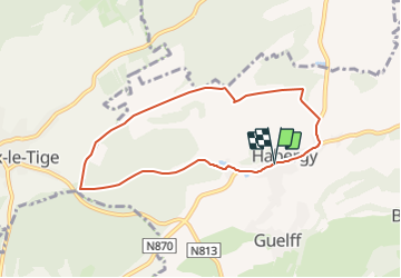
![](/images/other/stat-length.png)
![Tocht Te voet Messancy - Wandeling van Habergy - Photo](https://media.geolcdn.com/t/1900/400/ext.pjpeg?maxdim=2&url=https%3A%2F%2Fpivotmedia.tourismewallonie.be%2FOTH-A0-0062-14VV%2FOTH-A0-0062-14VV.jpg)
Wandeling van Habergy
Commissariat général au Tourisme
Randonnées du CGT GUIDE+
![Lengte](/images/other/stat-length.png)
![Max. hoogte](https://static1.geolcdn.com/siteimages/upload/files/1508320355ic_sort_altitude_max_24dp.png)
![Positief hoogteverschil](https://static1.geolcdn.com/siteimages/upload/files/1508320355ic_sort_den_pos_24dp.png)
![Km-Effort](/images/other/stat-length.png)
![Min. hoogte](https://static1.geolcdn.com/siteimages/upload/files/1508320355ic_sort_altitude_min_24dp.png)
![Negatief hoogteverschil](https://static1.geolcdn.com/siteimages/upload/files/1508320355ic_sort_den_neg_24dp.png)
![Boucle](https://static1.geolcdn.com/siteimages/upload/files/16400158638029165_repeat_loop_refresh_sync_direction_icon.png)
![Te voet](https://static1.geolcdn.com/sitytour/trail-icons/100.png)
1h54
Moeilijkheid : Gemakkelijk
![Scan deze QR-code om de tocht te openen in de SityTrail-applicatie](https://capi.geolives.com/qq0zvz2zws4bq2lad0pu/sitytour/trails/3080158/qr.png?size=200)
Gratisgps-wandelapplicatie
Over ons
Tocht Te voet van 6,7 km beschikbaar op Wallonië, Luxemburg, Messancy. Deze tocht wordt voorgesteld door Commissariat général au Tourisme.
Beschrijving
Trail created by Pays d'Arlon.
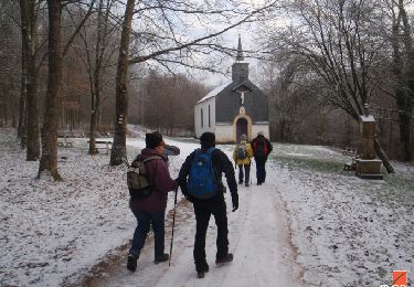
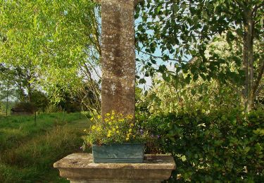
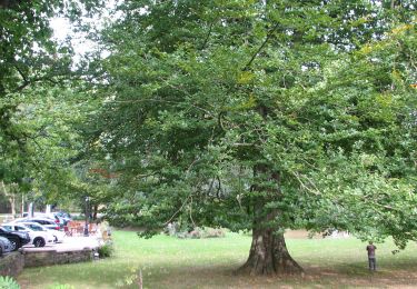
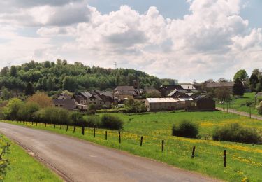
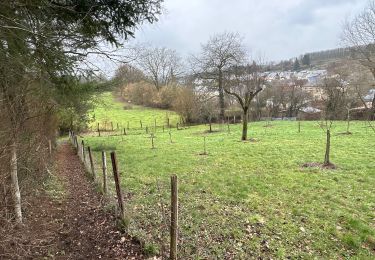
Langs het water ontdek je gebouwen van het plaatselijke landelijke erfgoed: een wasplaats (‘lavoir’), een molen en een vijver. De route leidt langs boswegels op de grens met de naburige gemeente Saint-Léger. Deze wandeling volgt een deel van de langeafstandswandelroute GR 570, met prachtige vergezichten op de omliggende dorpen. Je wandelt langs rustige en weinig bezochte plaatsen met een rijke en zeer gevarieerde fauna en flora. Je doorkruist golvende landschappen met heuvels die ‘cuestas’ worden genoemd voor je het dorp bereikt, waar je via een laatste erfdienstbaarheid terugwandelt naar de kerk, het vertrekpunt van de wandeling.
Plaatsbepaling
Opmerkingen
Wandeltochten in de omgeving
![Tocht Stappen Musson - Willancourt - Natura 2000, des sites qui valent le détour - Lx13 - Photo](https://media.geolcdn.com/t/375/260/ext.jpg?maxdim=2&url=https%3A%2F%2Fservices.sitytrail.com%2FGeolivesWS%2FDownloadMedia.ashx%3FTrailID%3D181441%26Media%3D78228147-13f6-4f8a-9ed5-33e8c071dddd.jpg)
![Stappen Stappen](https://static1.geolcdn.com/sitytour/trail-icons/101.png)
Stappen
![](/images/other/stat-length.png)
![](https://static1.geolcdn.com/siteimages/upload/files/16400158638029165_repeat_loop_refresh_sync_direction_icon.png)
![Tocht Mountainbike Musson - Willancourt Chapelle du Bonlieu Site de Montauban Eperons barre - Photo](https://media.geolcdn.com/t/375/260/ext.jpg?maxdim=2&url=https%3A%2F%2Fservices.sitytrail.com%2FGeolivesWS%2FDownloadMedia.ashx%3FTrailID%3D848004%26Media%3Dfix__20171018173409.jpg)
![Mountainbike Mountainbike](https://static1.geolcdn.com/sitytour/trail-icons/202.png)
Mountainbike
![](/images/other/stat-length.png)
![](https://static1.geolcdn.com/siteimages/upload/files/16400158638029165_repeat_loop_refresh_sync_direction_icon.png)
![Tocht Stappen Saint-Léger - RF-Lu-14 - Au pays des lavoirs anciens et des usoirs : Châtillon - Photo](https://media.geolcdn.com/t/375/260/ext.jpg?maxdim=2&url=https%3A%2F%2Fservices.sitytrail.com%2FGeolivesWS%2FDownloadMedia.ashx%3FTrailID%3D407136%26Media%3D623ce8e1-010c-490a-9987-548abb1b02b7.jpg)
![Stappen Stappen](https://static1.geolcdn.com/sitytour/trail-icons/101.png)
Stappen
![](/images/other/stat-length.png)
![](https://static1.geolcdn.com/siteimages/upload/files/16400158638029165_repeat_loop_refresh_sync_direction_icon.png)
![Tocht Te voet Aarlen - N° 5 - Udange - Au cœur de la forêt primitive - Photo](https://media.geolcdn.com/t/375/260/256ffff4-9371-48c3-8e4d-7f2e673b9ec6.jpeg&format=jpg&maxdim=2)
![Te voet Te voet](https://static1.geolcdn.com/sitytour/trail-icons/100.png)
Te voet
![](/images/other/stat-length.png)
![](https://static1.geolcdn.com/siteimages/upload/files/16400158638029165_repeat_loop_refresh_sync_direction_icon.png)
![Tocht Te voet Aubange - BE-AU 01 - Photo](https://media.geolcdn.com/t/375/260/7f7289b5-d5ab-4003-b78e-f5dd73f8883f.jpeg&format=jpg&maxdim=2)
![Te voet Te voet](https://static1.geolcdn.com/sitytour/trail-icons/100.png)
Te voet
![](/images/other/stat-length.png)
![](https://static1.geolcdn.com/siteimages/upload/files/16400158638029165_repeat_loop_refresh_sync_direction_icon.png)
![Tocht Te voet Musson - Bloemendorp Willancourt](https://media.geolcdn.com/t/375/260/ext.jpg?maxdim=2&url=https%3A%2F%2Fpivotmedia.tourismewallonie.be%2FOTH-A0-006F-0EIN%2FOTH-A0-006F-0EIN.jpg)
![Te voet Te voet](https://static1.geolcdn.com/sitytour/trail-icons/100.png)
Te voet
![](/images/other/stat-length.png)
![](https://static1.geolcdn.com/siteimages/upload/files/16400158638029165_repeat_loop_refresh_sync_direction_icon.png)
![Tocht Te voet Messancy - Wandeling van Bébange - Photo](https://media.geolcdn.com/t/375/260/ext.jpg?maxdim=2&url=https%3A%2F%2Fpivotmedia.tourismewallonie.be%2FOTH-A0-0061-225L%2FOTH-A0-0061-225L.jpg)
![Te voet Te voet](https://static1.geolcdn.com/sitytour/trail-icons/100.png)
Te voet
![](/images/other/stat-length.png)
![](https://static1.geolcdn.com/siteimages/upload/files/16400158638029165_repeat_loop_refresh_sync_direction_icon.png)
![Tocht Stappen Saint-Léger - GAUME Balade dans les dunes de chatillon - Photo](https://media.geolcdn.com/t/375/260/ext.jpg?maxdim=2&url=https%3A%2F%2Fstatic1.geolcdn.com%2Fsiteimages%2Fupload%2Ffiles%2F1553511878bg_sport_marche.png)
![Stappen Stappen](https://static1.geolcdn.com/sitytour/trail-icons/101.png)
Stappen
![](/images/other/stat-length.png)
![](https://static1.geolcdn.com/siteimages/upload/files/16400158638029165_repeat_loop_refresh_sync_direction_icon.png)
![Tocht Stappen Aubange - Rachecourt-Willancourt-Battincourt (boucle 19k) - Photo](https://media.geolcdn.com/t/375/260/65ee0acc-13c4-4bc5-a4a5-cce1492b52f3.jpg&format=jpg&maxdim=2)
![Stappen Stappen](https://static1.geolcdn.com/sitytour/trail-icons/101.png)
Stappen
![](/images/other/stat-length.png)
![](https://static1.geolcdn.com/siteimages/upload/files/16400158638029165_repeat_loop_refresh_sync_direction_icon.png)