Tocht Paardrijden Cappy - etape 2 Cappy / Heilly - Photo

etape 2 Cappy / Heilly

© OpenStreetMap contributors
Lengte
Lengte
22 km
Max. hoogte
Max. hoogte
102 m
Positief hoogteverschil
217 m
Km-Effort
Km-Effort  
25 km
Min. hoogte
Min. hoogte
33 m
Negatief hoogteverschil
237 m
Boucle
Boucle
Neen
Datum van aanmaak :
2022-01-20 15:14:33.927
Laatste wijziging :
2022-02-01 14:50:17.164

(0 Bericht)

Paardrijden
Paardrijden
3h14
Moeilijkheid : Medium
Huifkarwandeling
Huifkarwandeling
--
Moeilijkheid : Heel gemakkelijk

Scan deze QR-code om de tocht te openen in de SityTrail-applicatie

Gratisgps-wandelapplicatie

Logo SityTrail SityTrail

IGN / Geografische instituten

SityTrail uit de App Store downloaden SityTrail uit Google Play downloaden

Logo SityTrail SityTrail World

De wereld gaat voor u open

SityTrail uit de App Store downloaden SityTrail uit Google Play downloaden SityTrail op Huawei AppGallery downloaden

Over ons

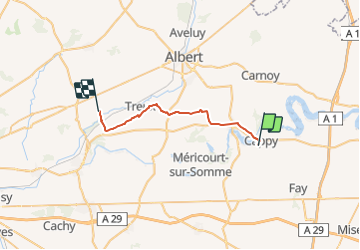
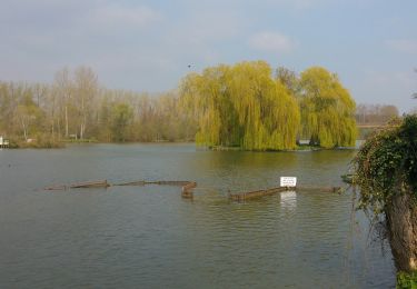
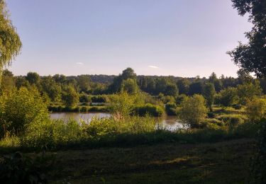
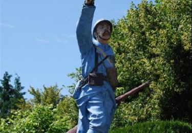
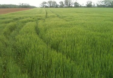
Tocht Paardrijden van 22 km beschikbaar op Hauts-de-France, Somme, Cappy. Deze tocht wordt voorgesteld door Laetitia Brandicourt.

Beschrijving

vérifier passage par le bois du bois de Treux sinon possible par le haut

Hoogteprofiel

Plaatsbepaling

Land:
France
Regio :
Hauts-de-France
Departement/Provincie :
Somme
Gemeente :
Cappy
Locatie:
Unknown
Vertrek:(UTM)
482315 ; 5530104 (31U) N.

Wandeltochten in de omgeving

Tocht Stappen Cappy - Les Marais de Suzanne - Cappy - Photo
Stappen
tracegps

Stappen

Medium
(1)
Cappy, Hauts-de-France, Somme, France
11,2 km | 13,2 km-effort
2h 45min
Ja
Tocht Stappen Frise - La Montagne de Frise - Photo
Stappen
tracegps

Stappen

Medium
(1)
Frise, Hauts-de-France, Somme, France
2,2 km | 2,8 km-effort
49min
Ja
Tocht Te voet Cappy - Les Royards - Photo
Te voet
GUIDE+

Te voet

Gemakkelijk
Cappy, Hauts-de-France, Somme, France
8,9 km | 10,4 km-effort
2h 22min
Ja
Tocht Stappen Curlu - tour des étangs de curlu - Photo
Stappen
terminio

Stappen

Heel gemakkelijk
Curlu, Hauts-de-France, Somme, France
10,5 km | 11,6 km-effort
2h 41min
Ja
Tocht Stappen Curlu - Autour des étangs de Curlu et Feuillères - Photo
Stappen
terminio

Stappen

Gemakkelijk
(1)
Curlu, Hauts-de-France, Somme, France
11,6 km | 12,7 km-effort
3h 11min
Ja
Tocht Andere activiteiten Éclusier-Vaux - Vaux - Marais de la Somme - Photo
Andere activiteiten
rarnaud

Andere activiteiten

Heel gemakkelijk
Éclusier-Vaux, Hauts-de-France, Somme, France
8,7 km | 10,1 km-effort
2h 13min
Ja
Tocht Stappen Cappy - Les Champs Muraine - Cappy - Photo
Stappen
tracegps

Stappen

Medium
Cappy, Hauts-de-France, Somme, France
9,9 km | 11,9 km-effort
2h 15min
Ja
Tocht Stappen Frise - montagne de frise - Photo
Stappen
Bernard.voyageur

Stappen

Medium
(1)
Frise, Hauts-de-France, Somme, France
2 km | 2,5 km-effort
1h 0min
Ja
Tocht Stappen Curlu - Le chemin des Automitrailleuses - Curlu - Photo
Stappen
tracegps

Stappen

Medium
(1)
Curlu, Hauts-de-France, Somme, France
11 km | 12 km-effort
3h 19min
Ja


Sluiten
Mijn abonnementen