![](/images/other/stat-length.png)
![Tocht Stappen Büllingen - Rocher du Bieley - Photo](https://media.geolcdn.com/t/1900/400/669e4f82-1f7b-41ec-94b2-f43792433cc6.jpg&format=pjpeg&maxdim=2)
Rocher du Bieley
Au fil de nos découvertes
« L’heure de la fin des découvertes ne sonne jamais. » Colette GUIDE+
![Lengte](/images/other/stat-length.png)
![Max. hoogte](https://static1.geolcdn.com/siteimages/upload/files/1508320355ic_sort_altitude_max_24dp.png)
![Positief hoogteverschil](https://static1.geolcdn.com/siteimages/upload/files/1508320355ic_sort_den_pos_24dp.png)
![Km-Effort](/images/other/stat-length.png)
![Min. hoogte](https://static1.geolcdn.com/siteimages/upload/files/1508320355ic_sort_altitude_min_24dp.png)
![Negatief hoogteverschil](https://static1.geolcdn.com/siteimages/upload/files/1508320355ic_sort_den_neg_24dp.png)
![Boucle](https://static1.geolcdn.com/siteimages/upload/files/16400158638029165_repeat_loop_refresh_sync_direction_icon.png)
![Stappen](https://static1.geolcdn.com/sitytour/trail-icons/101.png)
3h30
Moeilijkheid : Moeilijk
![Scan deze QR-code om de tocht te openen in de SityTrail-applicatie](https://capi.geolives.com/qq0zvz2zws4bq2lad0pu/sitytour/trails/3047308/qr.png?size=200)
Gratisgps-wandelapplicatie
Over ons
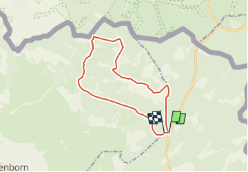
Tocht Stappen van 12,3 km beschikbaar op Wallonië, Luik, Büllingen. Deze tocht wordt voorgesteld door Au fil de nos découvertes.
Beschrijving
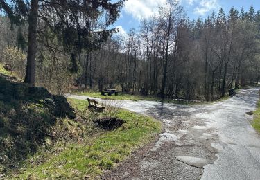
🅿️ Départ et Parking:
Rocherath,
4761 Bullange
Mais le plus simple est d’entrer les cooordonnées GPS: 50°28’05.2″N 6°18’07.1″E dans Google maps ou dans votre GPS
⚠️ Toujours vérifier sur le site internet qu’aucun entraînement militaire ne se fasse le jour où vous voulez faire cette randonnée.
https://www.mil.be/fr/agenda/grandes-manoeuvres/#exercise3 -> Agenda
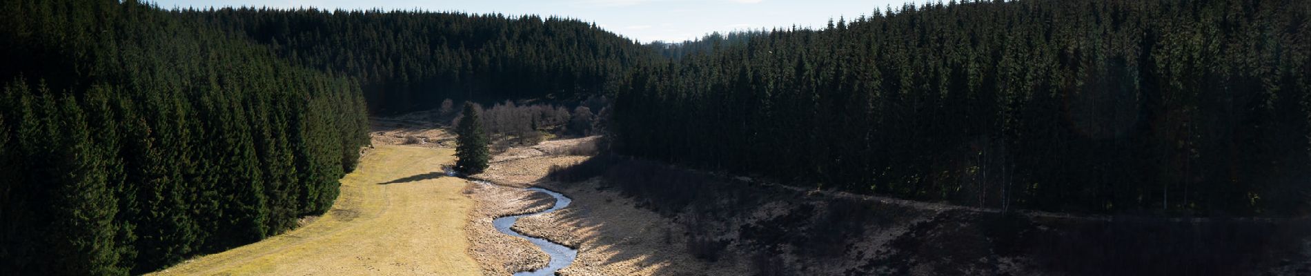
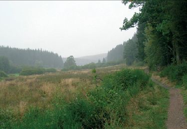
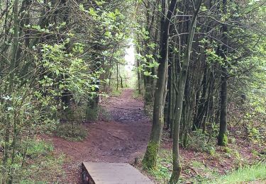
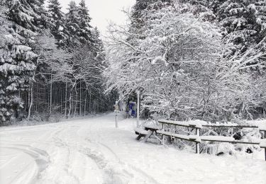
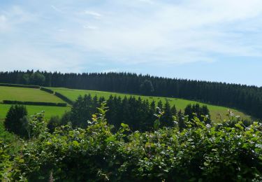
La promenade au coeur de la forêt d’Elsenborn vous emmènera vers un point de vue unique, qu’est le Rocher du Bieley.
Possibilités de pique-niquer. 🥪🍴
Chiens autorisés en laisse. 🐩🐶🐕
Convient pour les enfants . 👱👱♂️
Ne convient pas pour les poussettes et personnes à mobilité réduite. 👨🦽👩🦽👶
N'hésitez pas à aller faire un tour sur notre site internet et nos réseaux :
www.aufildenosdecouvertes.com
www.facebook.com/aufildenosdecouvertes
https://www.instagram.com/au_fil_de_nos_decouvertes/
Plaatsbepaling
Opmerkingen
Wandeltochten in de omgeving
![Tocht Stappen Büllingen - RB-LG-07 - Entre Warche et Holzwarche - Photo](https://media.geolcdn.com/t/375/260/ext.jpg?maxdim=2&url=https%3A%2F%2Fservices.sitytrail.com%2FGeolivesWS%2FDownloadMedia.ashx%3FTrailID%3D179565%26Media%3Dc51bfdfa-2f3a-47fc-b12d-6def8be3ad34.jpg)
![Stappen Stappen](https://static1.geolcdn.com/sitytour/trail-icons/101.png)
Stappen
![](/images/other/stat-length.png)
![](https://static1.geolcdn.com/siteimages/upload/files/16400158638029165_repeat_loop_refresh_sync_direction_icon.png)
![Tocht Stappen Monschau - Rando Eifel des jonquilles narcisses 18,3 - Photo](https://media.geolcdn.com/t/375/260/29cf751c-7851-449b-b365-4b88ea56faf3.jpg&format=jpg&maxdim=2)
![Stappen Stappen](https://static1.geolcdn.com/sitytour/trail-icons/101.png)
Stappen
![](/images/other/stat-length.png)
![](https://static1.geolcdn.com/siteimages/upload/files/16400158638029165_repeat_loop_refresh_sync_direction_icon.png)
![Tocht Stappen Bütgenbach - Butgenbach lac et environs - Photo](https://media.geolcdn.com/t/375/260/1cc5a1a5-5393-4407-895e-d7863ada15a3.jpg&format=jpg&maxdim=2)
![Stappen Stappen](https://static1.geolcdn.com/sitytour/trail-icons/101.png)
Stappen
![](/images/other/stat-length.png)
![](https://static1.geolcdn.com/siteimages/upload/files/16400158638029165_repeat_loop_refresh_sync_direction_icon.png)
![Tocht Te voet Büllingen - Balade des Jonquilles Krinkelt 12 Km - Photo](https://media.geolcdn.com/t/375/260/634345eb-5787-4f3c-9ced-f45f24f65838.jpg&format=jpg&maxdim=2)
![Te voet Te voet](https://static1.geolcdn.com/sitytour/trail-icons/100.png)
Te voet
![](/images/other/stat-length.png)
![](https://static1.geolcdn.com/siteimages/upload/files/16400158638029165_repeat_loop_refresh_sync_direction_icon.png)
![Tocht Stappen Büllingen - Rocherath - Photo](https://media.geolcdn.com/t/375/260/9865e976-42a9-4272-b5a8-4a981efc6f01.jpg&format=jpg&maxdim=2)
![Stappen Stappen](https://static1.geolcdn.com/sitytour/trail-icons/101.png)
![Tocht Stappen Büllingen - Enkelbergermühle - Photo](https://media.geolcdn.com/t/375/260/3d7866fb-ce22-48f1-ac64-4b561fccb9aa.jpg&format=jpg&maxdim=2)
![Stappen Stappen](https://static1.geolcdn.com/sitytour/trail-icons/101.png)
Stappen
![](/images/other/stat-length.png)
![](https://static1.geolcdn.com/siteimages/upload/files/16400158638029165_repeat_loop_refresh_sync_direction_icon.png)
![Tocht Te voet Büllingen - Rund um den See - Photo](https://media.geolcdn.com/t/375/260/cac08000-d68b-426e-b2c6-1c6cf4781a94.jpeg&format=jpg&maxdim=2)
![Te voet Te voet](https://static1.geolcdn.com/sitytour/trail-icons/100.png)
Te voet
![](/images/other/stat-length.png)
![](https://static1.geolcdn.com/siteimages/upload/files/16400158638029165_repeat_loop_refresh_sync_direction_icon.png)
![Tocht Stappen Büllingen - La vallée perdue - Rocherath - Photo](https://media.geolcdn.com/t/375/260/5033c82c-f26d-4ed7-b97f-52628b611391.jpg&format=jpg&maxdim=2)
![Stappen Stappen](https://static1.geolcdn.com/sitytour/trail-icons/101.png)
Stappen
![](/images/other/stat-length.png)
![](https://static1.geolcdn.com/siteimages/upload/files/16400158638029165_repeat_loop_refresh_sync_direction_icon.png)
![Te voet Te voet](https://static1.geolcdn.com/sitytour/trail-icons/100.png)
Te voet
![](/images/other/stat-length.png)
![](https://static1.geolcdn.com/siteimages/upload/files/16400158638029165_repeat_loop_refresh_sync_direction_icon.png)