![](/images/other/stat-length.png)
![Tocht Stappen Heers - Promenade à travers champs à Vechmaal - Photo](https://media.geolcdn.com/t/1900/400/e55d745a-b3fd-4546-aa7c-22ee2ed0d2f4.jpg&format=pjpeg&maxdim=2)
Promenade à travers champs à Vechmaal
Au fil de nos découvertes
« L’heure de la fin des découvertes ne sonne jamais. » Colette GUIDE+
![Lengte](/images/other/stat-length.png)
![Max. hoogte](https://static1.geolcdn.com/siteimages/upload/files/1508320355ic_sort_altitude_max_24dp.png)
![Positief hoogteverschil](https://static1.geolcdn.com/siteimages/upload/files/1508320355ic_sort_den_pos_24dp.png)
![Km-Effort](/images/other/stat-length.png)
![Min. hoogte](https://static1.geolcdn.com/siteimages/upload/files/1508320355ic_sort_altitude_min_24dp.png)
![Negatief hoogteverschil](https://static1.geolcdn.com/siteimages/upload/files/1508320355ic_sort_den_neg_24dp.png)
![Boucle](https://static1.geolcdn.com/siteimages/upload/files/16400158638029165_repeat_loop_refresh_sync_direction_icon.png)
![Stappen](https://static1.geolcdn.com/sitytour/trail-icons/101.png)
2h17
Moeilijkheid : Medium
![Scan deze QR-code om de tocht te openen in de SityTrail-applicatie](https://capi.geolives.com/qq0zvz2zws4bq2lad0pu/sitytour/trails/3036445/qr.png?size=200)
Gratisgps-wandelapplicatie
Over ons
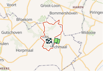
Tocht Stappen van 8,9 km beschikbaar op Vlaanderen, Limburg, Heers. Deze tocht wordt voorgesteld door Au fil de nos découvertes.
Beschrijving
🅿️ Départ et Parking:
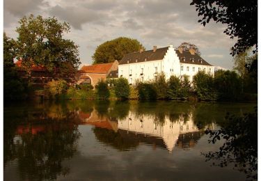
Herberg De Horne
Brugstraat 30, 3870 Vechmaal
▶️ Suivre la balise « triangle rouge »
D’autres promenades sont faisables à partir du point de départ.
🌲🌳
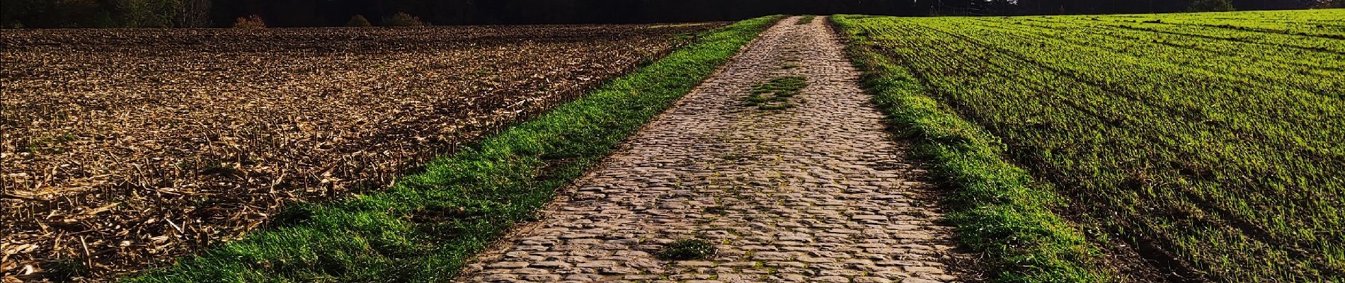
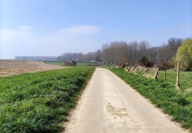
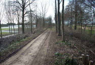
La majorité de la promenade se fait à travers champs. 🌱🌿🌼🐄
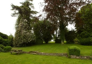
Possibilités de pic-niquer. 🥪🍴
Chiens autorisés en laisse. 🐩🐶🐕
Convient pour les enfants . 👱👱♂️
Convient pour les poussettes sportives. 👶
Plaatsbepaling
Opmerkingen
Wandeltochten in de omgeving
![Tocht Stappen Tongeren - 2021-10-23_19h52m36_1502 - Photo](https://media.geolcdn.com/t/375/260/d71d4a1e-f4de-4acf-94ea-656bc11edf66.jpg&format=jpg&maxdim=2)
![Stappen Stappen](https://static1.geolcdn.com/sitytour/trail-icons/101.png)
Stappen
![](/images/other/stat-length.png)
![](https://static1.geolcdn.com/siteimages/upload/files/16400158638029165_repeat_loop_refresh_sync_direction_icon.png)
![Tocht Stappen Borgloon - randonnee de l eglise fantôme (doorkijkkerkje) - Photo](https://media.geolcdn.com/t/375/260/35833fe8-8dcf-4404-b0af-d88e0896892e.jpg&format=jpg&maxdim=2)
![Stappen Stappen](https://static1.geolcdn.com/sitytour/trail-icons/101.png)
Stappen
![](/images/other/stat-length.png)
![](https://static1.geolcdn.com/siteimages/upload/files/16400158638029165_repeat_loop_refresh_sync_direction_icon.png)
![Tocht Stappen Tongeren - Promenade de la beauté cachée à Lauw - Photo](https://media.geolcdn.com/t/375/260/e09aa99f-84cb-4b46-8a0c-50d633d5a7ef.jpg&format=jpg&maxdim=2)
![Stappen Stappen](https://static1.geolcdn.com/sitytour/trail-icons/101.png)
Stappen
![](/images/other/stat-length.png)
![](https://static1.geolcdn.com/siteimages/upload/files/16400158638029165_repeat_loop_refresh_sync_direction_icon.png)
![Tocht Te voet Tongeren - Rond de bronnen van de Mombeek - Photo](https://media.geolcdn.com/t/375/260/13e3acb7-2467-4a11-bfa7-f876dab6b0eb.jpeg&format=jpg&maxdim=2)
![Te voet Te voet](https://static1.geolcdn.com/sitytour/trail-icons/100.png)
Te voet
![](/images/other/stat-length.png)
![](https://static1.geolcdn.com/siteimages/upload/files/16400158638029165_repeat_loop_refresh_sync_direction_icon.png)
![Tocht Te voet Tongeren - Widooie - Photo](https://media.geolcdn.com/t/375/260/1460d0c9-37d5-4e75-86eb-ce79ff244b22.jpeg&format=jpg&maxdim=2)
![Te voet Te voet](https://static1.geolcdn.com/sitytour/trail-icons/100.png)
Te voet
![](/images/other/stat-length.png)
![](https://static1.geolcdn.com/siteimages/upload/files/16400158638029165_repeat_loop_refresh_sync_direction_icon.png)
![Tocht Te voet Herstappe - Jan Zonder Vrees groen - Photo](https://media.geolcdn.com/t/375/260/8c994372-58a4-4468-b951-db2635919c01.jpeg&format=jpg&maxdim=2)
![Te voet Te voet](https://static1.geolcdn.com/sitytour/trail-icons/100.png)
Te voet
![](/images/other/stat-length.png)
![](https://static1.geolcdn.com/siteimages/upload/files/16400158638029165_repeat_loop_refresh_sync_direction_icon.png)
![Tocht Te voet Herstappe - Jan Zonder Vrees geel - Photo](https://media.geolcdn.com/t/375/260/8c994372-58a4-4468-b951-db2635919c01.jpeg&format=jpg&maxdim=2)
![Te voet Te voet](https://static1.geolcdn.com/sitytour/trail-icons/100.png)
Te voet
![](/images/other/stat-length.png)
![](https://static1.geolcdn.com/siteimages/upload/files/16400158638029165_repeat_loop_refresh_sync_direction_icon.png)
![Tocht Te voet Tongeren - Piringen - Photo](https://media.geolcdn.com/t/375/260/1fca9dc1-ead7-42b1-b391-18d60f1522f5.jpeg&format=jpg&maxdim=2)
![Te voet Te voet](https://static1.geolcdn.com/sitytour/trail-icons/100.png)
Te voet
![](/images/other/stat-length.png)
![](https://static1.geolcdn.com/siteimages/upload/files/16400158638029165_repeat_loop_refresh_sync_direction_icon.png)
![Tocht Te voet Tongeren - Overrepen Oranje - Photo](https://media.geolcdn.com/t/375/260/1fca9dc1-ead7-42b1-b391-18d60f1522f5.jpeg&format=jpg&maxdim=2)
![Te voet Te voet](https://static1.geolcdn.com/sitytour/trail-icons/100.png)
Te voet
![](/images/other/stat-length.png)
![](https://static1.geolcdn.com/siteimages/upload/files/16400158638029165_repeat_loop_refresh_sync_direction_icon.png)