![](/images/other/stat-length.png)
![Tocht Wegfiets Neufchâteau - Cirkwi-Circuit_des_cols (1) - Photo](https://media.geolcdn.com/t/1900/400/ext.pjpeg?maxdim=2&url=https%3A%2F%2Fstatic1.geolcdn.com%2Fsiteimages%2Fupload%2Ffiles%2F1524743154velo.jpg)
Cirkwi-Circuit_des_cols (1)
proosen
Gebruiker
![Lengte](/images/other/stat-length.png)
Lengte
37 km
![Max. hoogte](https://static1.geolcdn.com/siteimages/upload/files/1508320355ic_sort_altitude_max_24dp.png)
Max. hoogte
500 m
![Positief hoogteverschil](https://static1.geolcdn.com/siteimages/upload/files/1508320355ic_sort_den_pos_24dp.png)
Positief hoogteverschil
563 m
![Km-Effort](/images/other/stat-length.png)
Km-Effort
44 km
![Min. hoogte](https://static1.geolcdn.com/siteimages/upload/files/1508320355ic_sort_altitude_min_24dp.png)
Min. hoogte
367 m
![Negatief hoogteverschil](https://static1.geolcdn.com/siteimages/upload/files/1508320355ic_sort_den_neg_24dp.png)
Negatief hoogteverschil
566 m
![Boucle](https://static1.geolcdn.com/siteimages/upload/files/16400158638029165_repeat_loop_refresh_sync_direction_icon.png)
Boucle
Ja
Datum van aanmaak :
2021-12-10 17:18:06.532
Laatste wijziging :
2021-12-10 17:18:06.532
![Wegfiets](https://static1.geolcdn.com/sitytour/trail-icons/201.png)
--
Moeilijkheid : Onbekend
![Scan deze QR-code om de tocht te openen in de SityTrail-applicatie](https://capi.geolives.com/qq0zvz2zws4bq2lad0pu/sitytour/trails/3023195/qr.png?size=200)
Gratisgps-wandelapplicatie
Over ons
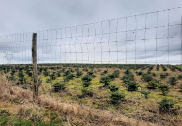
Tocht Wegfiets van 37 km beschikbaar op Wallonië, Luxemburg, Neufchâteau. Deze tocht wordt voorgesteld door proosen.
Beschrijving
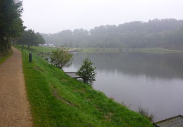
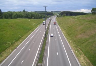
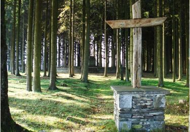
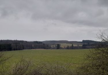
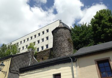
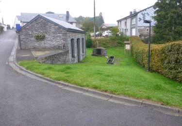
Le circuit des cols vous emmène au départ de la Maison du Tourisme explorer de magnifiques endroits et panoramas à Neufchâteau et ses alentours.
Plaatsbepaling
Land:
Belgium
Regio :
Wallonië
Departement/Provincie :
Luxemburg
Gemeente :
Neufchâteau
Locatie:
Unknown
Vertrek:(Dec)
Vertrek:(UTM)
675097 ; 5523709 (31U) N.
Opmerkingen
Wandeltochten in de omgeving
![Stappen Stappen](https://static1.geolcdn.com/sitytour/trail-icons/101.png)
RB-Lu-21_Neufchâteau
Stappen
Heel gemakkelijk
(8)
Neufchâteau,
Wallonië,
Luxemburg,
Belgium
![](/images/other/stat-length.png)
24 km | 31 km-effort
6h 29min
![](https://static1.geolcdn.com/siteimages/upload/files/16400158638029165_repeat_loop_refresh_sync_direction_icon.png)
Ja
![Stappen Stappen](https://static1.geolcdn.com/sitytour/trail-icons/101.png)
RB-Lu-21_Neufchâteau_via-racc-1
Stappen
Heel gemakkelijk
(2)
Neufchâteau,
Wallonië,
Luxemburg,
Belgium
![](/images/other/stat-length.png)
11,2 km | 14,4 km-effort
3h 4min
![](https://static1.geolcdn.com/siteimages/upload/files/16400158638029165_repeat_loop_refresh_sync_direction_icon.png)
Ja
![Tocht Stappen Libramont-Chevigny - 5. Wandeling op niet-verharde weg aan het begin van het dorp Lamouline - Photo](https://media.geolcdn.com/t/375/260/ext.jpg?maxdim=2&url=https%3A%2F%2Fservices.sitytrail.com%2FGeolivesWS%2FDownloadMedia.ashx%3FTrailID%3D537894%26Media%3Dd4f09763-3f4e-4f58-b9ef-7a20178fcd7b.jpg)
![Stappen Stappen](https://static1.geolcdn.com/sitytour/trail-icons/101.png)
5. Wandeling op niet-verharde weg aan het begin van het dorp Lamouline
Stappen
Gemakkelijk
(2)
Libramont-Chevigny,
Wallonië,
Luxemburg,
Belgium
![](/images/other/stat-length.png)
5 km | 6,1 km-effort
1h 21min
![](https://static1.geolcdn.com/siteimages/upload/files/16400158638029165_repeat_loop_refresh_sync_direction_icon.png)
Ja
![Tocht Stappen Neufchâteau - Le Sentier du Bois d'Ospôt - Photo](https://media.geolcdn.com/t/375/260/ext.jpg?maxdim=2&url=https%3A%2F%2Fservices.sitytrail.com%2FGeolivesWS%2FDownloadMedia.ashx%3FTrailID%3D314177%26Media%3Da3f0c943-b6aa-42ba-a976-375fc630bff4.jpg)
![Stappen Stappen](https://static1.geolcdn.com/sitytour/trail-icons/101.png)
Le Sentier du Bois d'Ospôt
Stappen
Gemakkelijk
(2)
Neufchâteau,
Wallonië,
Luxemburg,
Belgium
![](/images/other/stat-length.png)
6,6 km | 8,2 km-effort
1h 48min
![](https://static1.geolcdn.com/siteimages/upload/files/16400158638029165_repeat_loop_refresh_sync_direction_icon.png)
Ja
![Tocht Stappen Neufchâteau - Marche ADEPS 8K500?? à (Namoussart) Neufchateau - Photo](https://media.geolcdn.com/t/375/260/394ab4a5-c5a6-43e2-b98b-c33bbaf2a33e.jpg&format=jpg&maxdim=2)
![Stappen Stappen](https://static1.geolcdn.com/sitytour/trail-icons/101.png)
Marche ADEPS 8K500?? à (Namoussart) Neufchateau
Stappen
Gemakkelijk
Neufchâteau,
Wallonië,
Luxemburg,
Belgium
![](/images/other/stat-length.png)
8,5 km | 10,4 km-effort
1h 43min
![](https://static1.geolcdn.com/siteimages/upload/files/16400158638029165_repeat_loop_refresh_sync_direction_icon.png)
Ja
![Tocht Te voet Neufchâteau - Promenade des Vannettes - Photo](https://media.geolcdn.com/t/375/260/c94cab10-49b6-4e98-8b22-803163741678.jpeg&format=jpg&maxdim=2)
![Te voet Te voet](https://static1.geolcdn.com/sitytour/trail-icons/100.png)
Promenade des Vannettes
Te voet
Gemakkelijk
Neufchâteau,
Wallonië,
Luxemburg,
Belgium
![](/images/other/stat-length.png)
12,4 km | 16 km-effort
3h 38min
![](https://static1.geolcdn.com/siteimages/upload/files/16400158638029165_repeat_loop_refresh_sync_direction_icon.png)
Ja
![Stappen Stappen](https://static1.geolcdn.com/sitytour/trail-icons/101.png)
RB-Lu-21_Neufchâteau_via-racc-2
Stappen
Heel gemakkelijk
Neufchâteau,
Wallonië,
Luxemburg,
Belgium
![](/images/other/stat-length.png)
16,5 km | 21 km-effort
4h 32min
![](https://static1.geolcdn.com/siteimages/upload/files/16400158638029165_repeat_loop_refresh_sync_direction_icon.png)
Ja
![Tocht Stappen Neufchâteau - marche adeps Tournay - Photo](https://media.geolcdn.com/t/375/260/35c4aa2c-8320-436a-a267-b854bb22564b.jpg&format=jpg&maxdim=2)
![Stappen Stappen](https://static1.geolcdn.com/sitytour/trail-icons/101.png)
marche adeps Tournay
Stappen
Heel gemakkelijk
Neufchâteau,
Wallonië,
Luxemburg,
Belgium
![](/images/other/stat-length.png)
34 km | 42 km-effort
1h 59min
![](https://static1.geolcdn.com/siteimages/upload/files/16400158638029165_repeat_loop_refresh_sync_direction_icon.png)
Neen
![Tocht Stappen Neufchâteau - Molinfaing observatoire - Photo](https://media.geolcdn.com/t/375/260/b919928e-52d2-473c-aa25-425059cdb9d1.jpg&format=jpg&maxdim=2)
![Stappen Stappen](https://static1.geolcdn.com/sitytour/trail-icons/101.png)
Molinfaing observatoire
Stappen
Gemakkelijk
Neufchâteau,
Wallonië,
Luxemburg,
Belgium
![](/images/other/stat-length.png)
5,8 km | 7,5 km-effort
1h 27min
![](https://static1.geolcdn.com/siteimages/upload/files/16400158638029165_repeat_loop_refresh_sync_direction_icon.png)
Ja