![](/images/other/stat-length.png)
![Tocht Te voet Médis - 17 Médis (la Rigaudière) 8 km - Photo](https://media.geolcdn.com/t/1900/400/35caea18-5f22-4128-8f0f-2422743ad201.jpg&format=pjpeg&maxdim=2)
17 Médis (la Rigaudière) 8 km
Jos17
Gebruiker
![Lengte](/images/other/stat-length.png)
Lengte
8 km
![Max. hoogte](https://static1.geolcdn.com/siteimages/upload/files/1508320355ic_sort_altitude_max_24dp.png)
Max. hoogte
27 m
![Positief hoogteverschil](https://static1.geolcdn.com/siteimages/upload/files/1508320355ic_sort_den_pos_24dp.png)
Positief hoogteverschil
69 m
![Km-Effort](/images/other/stat-length.png)
Km-Effort
8,9 km
![Min. hoogte](https://static1.geolcdn.com/siteimages/upload/files/1508320355ic_sort_altitude_min_24dp.png)
Min. hoogte
8 m
![Negatief hoogteverschil](https://static1.geolcdn.com/siteimages/upload/files/1508320355ic_sort_den_neg_24dp.png)
Negatief hoogteverschil
69 m
![Boucle](https://static1.geolcdn.com/siteimages/upload/files/16400158638029165_repeat_loop_refresh_sync_direction_icon.png)
Boucle
Ja
Datum van aanmaak :
2021-12-06 09:22:16.062
Laatste wijziging :
2022-01-20 11:05:36.39
![Te voet](https://static1.geolcdn.com/sitytour/trail-icons/100.png)
1h58
Moeilijkheid : Gemakkelijk
![Scan deze QR-code om de tocht te openen in de SityTrail-applicatie](https://capi.geolives.com/qq0zvz2zws4bq2lad0pu/sitytour/trails/3020018/qr.png?size=200)
Gratisgps-wandelapplicatie
Over ons
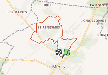
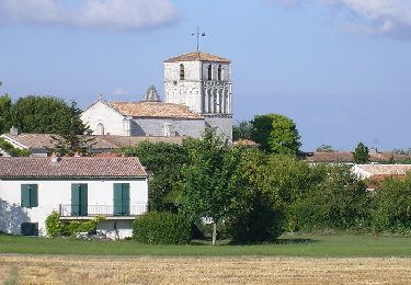
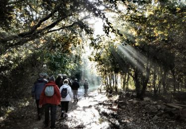
Tocht Te voet van 8 km beschikbaar op Nieuw-Aquitanië, Charente-Maritime, Médis. Deze tocht wordt voorgesteld door Jos17.
Beschrijving
Facile, entre bois et zones pavillonnaires.
Traverse 2 fois la ligne Saintes-Royan
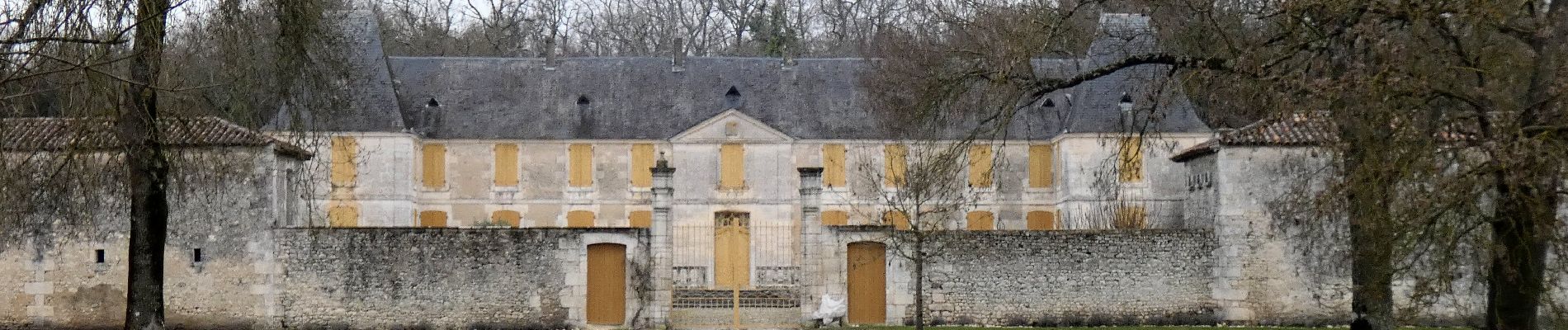
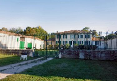
Passe très près du chäteau de La Rigaudière
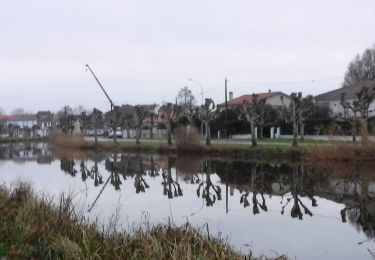
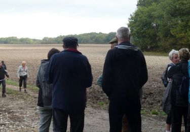
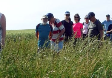
Plaatsbepaling
Land:
France
Regio :
Nieuw-Aquitanië
Departement/Provincie :
Charente-Maritime
Gemeente :
Médis
Locatie:
Unknown
Vertrek:(Dec)
Vertrek:(UTM)
658703 ; 5056651 (30T) N.
Opmerkingen
Wandeltochten in de omgeving
![Tocht Stappen Royan - Gr4 De Royan au phrare de Terre Nègre - Photo](https://media.geolcdn.com/t/375/260/e2e1be40-3353-49e2-9bdd-4bdd833373c6.jpg&format=jpg&maxdim=2)
![Stappen Stappen](https://static1.geolcdn.com/sitytour/trail-icons/101.png)
Gr4 De Royan au phrare de Terre Nègre
Stappen
Heel gemakkelijk
Royan,
Nieuw-Aquitanië,
Charente-Maritime,
France
![](/images/other/stat-length.png)
14,3 km | 16,3 km-effort
3h 11min
![](https://static1.geolcdn.com/siteimages/upload/files/16400158638029165_repeat_loop_refresh_sync_direction_icon.png)
Neen
![Tocht Mountainbike Saint-Georges-de-Didonne - 2018.04.30- 37.3km-Catalpas Mes chers Talmont - Photo](https://media.geolcdn.com/t/375/260/ext.jpg?maxdim=2&url=https%3A%2F%2Fservices.sitytrail.com%2FGeolivesWS%2FDownloadMedia.ashx%3FTrailID%3D955017%26Media%3Dfix__20180430165558.jpg)
![Mountainbike Mountainbike](https://static1.geolcdn.com/sitytour/trail-icons/202.png)
2018.04.30- 37.3km-Catalpas Mes chers Talmont
Mountainbike
Gemakkelijk
Saint-Georges-de-Didonne,
Nieuw-Aquitanië,
Charente-Maritime,
France
![](/images/other/stat-length.png)
37 km | 42 km-effort
2h 32min
![](https://static1.geolcdn.com/siteimages/upload/files/16400158638029165_repeat_loop_refresh_sync_direction_icon.png)
Ja
![Tocht Mountainbike Saint-Sulpice-de-Royan - VTT1 - Photo](https://media.geolcdn.com/t/375/260/ext.jpg?maxdim=2&url=https%3A%2F%2Fstatic1.geolcdn.com%2Fsiteimages%2Fupload%2Ffiles%2F1524743154velo.jpg)
![Mountainbike Mountainbike](https://static1.geolcdn.com/sitytour/trail-icons/202.png)
VTT1
Mountainbike
Gemakkelijk
(1)
Saint-Sulpice-de-Royan,
Nieuw-Aquitanië,
Charente-Maritime,
France
![](/images/other/stat-length.png)
49 km | 54 km-effort
3h 46min
![](https://static1.geolcdn.com/siteimages/upload/files/16400158638029165_repeat_loop_refresh_sync_direction_icon.png)
Ja
![Te voet Te voet](https://static1.geolcdn.com/sitytour/trail-icons/100.png)
17 Saujon (4) -8 km
Te voet
Gemakkelijk
Saujon,
Nieuw-Aquitanië,
Charente-Maritime,
France
![](/images/other/stat-length.png)
8 km | 8,4 km-effort
1h 54min
![](https://static1.geolcdn.com/siteimages/upload/files/16400158638029165_repeat_loop_refresh_sync_direction_icon.png)
Ja
![Stappen Stappen](https://static1.geolcdn.com/sitytour/trail-icons/101.png)
17 St Sulpice-de-Royan 7km7
Stappen
Gemakkelijk
Saint-Sulpice-de-Royan,
Nieuw-Aquitanië,
Charente-Maritime,
France
![](/images/other/stat-length.png)
7,7 km | 8,7 km-effort
2h 1min
![](https://static1.geolcdn.com/siteimages/upload/files/16400158638029165_repeat_loop_refresh_sync_direction_icon.png)
Ja
![Stappen Stappen](https://static1.geolcdn.com/sitytour/trail-icons/101.png)
17 Saint Sulpice de Royan 6 km
Stappen
Medium
Saint-Sulpice-de-Royan,
Nieuw-Aquitanië,
Charente-Maritime,
France
![](/images/other/stat-length.png)
5,9 km | 6,6 km-effort
1h 32min
![](https://static1.geolcdn.com/siteimages/upload/files/16400158638029165_repeat_loop_refresh_sync_direction_icon.png)
Ja
![Tocht Te voet Saint-Sulpice-de-Royan - St Sulpice de Royan 17 (9km3) - Photo](https://media.geolcdn.com/t/375/260/e31ae771-bc2e-4359-aee0-61d7624a5a00.jpg&format=jpg&maxdim=2)
![Te voet Te voet](https://static1.geolcdn.com/sitytour/trail-icons/100.png)
St Sulpice de Royan 17 (9km3)
Te voet
Heel gemakkelijk
Saint-Sulpice-de-Royan,
Nieuw-Aquitanië,
Charente-Maritime,
France
![](/images/other/stat-length.png)
9,3 km | 10,6 km-effort
Onbekend
![](https://static1.geolcdn.com/siteimages/upload/files/16400158638029165_repeat_loop_refresh_sync_direction_icon.png)
Ja
![Tocht Stappen Royan - Jaffe 17 (9km4) - Photo](https://media.geolcdn.com/t/375/260/45fc81b5-b06e-4a59-9b32-b35f904339a1.jpg&format=jpg&maxdim=2)
![Stappen Stappen](https://static1.geolcdn.com/sitytour/trail-icons/101.png)
Jaffe 17 (9km4)
Stappen
Heel gemakkelijk
Royan,
Nieuw-Aquitanië,
Charente-Maritime,
France
![](/images/other/stat-length.png)
9,3 km | 10 km-effort
2h 37min
![](https://static1.geolcdn.com/siteimages/upload/files/16400158638029165_repeat_loop_refresh_sync_direction_icon.png)
Ja
![Te voet Te voet](https://static1.geolcdn.com/sitytour/trail-icons/100.png)
Médis 17 bis -7km9
Te voet
Heel gemakkelijk
Médis,
Nieuw-Aquitanië,
Charente-Maritime,
France
![](/images/other/stat-length.png)
7,9 km | 8,5 km-effort
Onbekend
![](https://static1.geolcdn.com/siteimages/upload/files/16400158638029165_repeat_loop_refresh_sync_direction_icon.png)
Ja