![](/images/other/stat-length.png)
Lodève - Fontbonne - Grézac
mdauzat
Gebruiker
![Lengte](/images/other/stat-length.png)
![Max. hoogte](https://static1.geolcdn.com/siteimages/upload/files/1508320355ic_sort_altitude_max_24dp.png)
![Positief hoogteverschil](https://static1.geolcdn.com/siteimages/upload/files/1508320355ic_sort_den_pos_24dp.png)
![Km-Effort](/images/other/stat-length.png)
![Min. hoogte](https://static1.geolcdn.com/siteimages/upload/files/1508320355ic_sort_altitude_min_24dp.png)
![Negatief hoogteverschil](https://static1.geolcdn.com/siteimages/upload/files/1508320355ic_sort_den_neg_24dp.png)
![Boucle](https://static1.geolcdn.com/siteimages/upload/files/16400158638029165_repeat_loop_refresh_sync_direction_icon.png)
![Noords wandelen](https://static1.geolcdn.com/sitytour/trail-icons/102.png)
1h50
Moeilijkheid : Heel gemakkelijk
![Scan deze QR-code om de tocht te openen in de SityTrail-applicatie](https://capi.geolives.com/qq0zvz2zws4bq2lad0pu/sitytour/trails/3016860/qr.png?size=200)
Gratisgps-wandelapplicatie
Over ons
Tocht Noords wandelen van 7 km beschikbaar op Occitanië, Hérault, Lodève. Deze tocht wordt voorgesteld door mdauzat.
Beschrijving
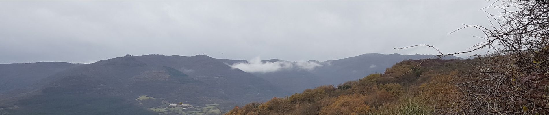
Par une journée pluvieuse de début décembre, il est sage de ne pas s'éloigner trop de la ville, et ce parcours est tout à fait adapté. Partant du stationnement devant le collège, le circuit entreprend d'abord, pour une mise en jambes, de grimper le chemin Fontbonne jusqu'à Payssials, puis en direction de Mayres. Il faut penser à s'arrêter, de temps à autre, pour admirer le panorama, avec Saint-Martin et la vallée en contrebas, et de belles vues du Lac du Salagou en arrière. On croise une première fois la piste forestière pour continuer sur le sentier et retrouver plus haut la piste, que l'on prend alors à droite. On rejoint à nouveau un sentier qui serpente en descendant vers Grézac le bas, et offre de superbes vues sur le Lac du Salagou, mais aussi sur l'ensemble de la ville de Lodève. Les arbres feuillus étant désormais dénudés, on peut observer les multiples traces d'une occupation humaine intense, développée à partir de la fin du XVIIIème siècle, avec des murs monumentaux ("clapas") résultant de l'épierrement des lopins de terre, de très nombreuses capitelles aux formes variées, et des ruines d'habitations. On retrouve encore la piste forestière qui passe au sud de l'Oppidum avant de redescendre vers la ville par le quartier de Versailles...
Et la pluie qui accompagne les randonneurs les prie gentiment de presser le pas !
Plaatsbepaling
Opmerkingen
Wandeltochten in de omgeving
![Tocht Noords wandelen Olmet-et-Villecun - Villecun Lavalette - Photo](https://media.geolcdn.com/t/375/260/ff5dbcc8-7f6e-486e-b563-291aeb3db524.jpg&format=jpg&maxdim=2)
![Noords wandelen Noords wandelen](https://static1.geolcdn.com/sitytour/trail-icons/102.png)
Noords wandelen
![](/images/other/stat-length.png)
![](https://static1.geolcdn.com/siteimages/upload/files/16400158638029165_repeat_loop_refresh_sync_direction_icon.png)
![Tocht Noords wandelen Lodève - Chemin des Tines - La Défriche - Belbezet - Montifort - Photo](https://media.geolcdn.com/t/375/260/5db620f0-9bce-46db-b4f7-036de46feabc.jpg&format=jpg&maxdim=2)
![Noords wandelen Noords wandelen](https://static1.geolcdn.com/sitytour/trail-icons/102.png)
Noords wandelen
![](/images/other/stat-length.png)
![](https://static1.geolcdn.com/siteimages/upload/files/16400158638029165_repeat_loop_refresh_sync_direction_icon.png)
![Stappen Stappen](https://static1.geolcdn.com/sitytour/trail-icons/101.png)
Stappen
![](/images/other/stat-length.png)
![](https://static1.geolcdn.com/siteimages/upload/files/16400158638029165_repeat_loop_refresh_sync_direction_icon.png)
![Tocht Stappen Lodève - Saint-Martin - L'Ambeyran - Photo](https://media.geolcdn.com/t/375/260/ef8a520f-2d1e-48a3-a95d-ed76e0089665.jpg&format=jpg&maxdim=2)
![Stappen Stappen](https://static1.geolcdn.com/sitytour/trail-icons/101.png)
Stappen
![](/images/other/stat-length.png)
![](https://static1.geolcdn.com/siteimages/upload/files/16400158638029165_repeat_loop_refresh_sync_direction_icon.png)
![Tocht Stappen Soumont - Balcons de Soumont - Photo](https://media.geolcdn.com/t/375/260/d9f45190-3768-4750-9561-de3d1f0991af.jpg&format=jpg&maxdim=2)
![Stappen Stappen](https://static1.geolcdn.com/sitytour/trail-icons/101.png)
Stappen
![](/images/other/stat-length.png)
![](https://static1.geolcdn.com/siteimages/upload/files/16400158638029165_repeat_loop_refresh_sync_direction_icon.png)
![Tocht Stappen Lauroux - les corniches de lauroux - Photo](https://media.geolcdn.com/t/375/260/ext.jpg?maxdim=2&url=https%3A%2F%2Fservices.sitytrail.com%2FGeolivesWS%2FDownloadMedia.ashx%3FTrailID%3D333456%26Media%3D20140811173610.jpg)
![Stappen Stappen](https://static1.geolcdn.com/sitytour/trail-icons/101.png)
Stappen
![](/images/other/stat-length.png)
![](https://static1.geolcdn.com/siteimages/upload/files/16400158638029165_repeat_loop_refresh_sync_direction_icon.png)
![Tocht Stappen Lodève - Le plateau de Grezac au depart de Lodève - Photo](https://media.geolcdn.com/t/375/260/ext.jpg?maxdim=2&url=https%3A%2F%2Fservices.sitytrail.com%2FGeolivesWS%2FDownloadMedia.ashx%3FTrailID%3D272866%26Media%3Dfix__20140430102722.jpg)
![Stappen Stappen](https://static1.geolcdn.com/sitytour/trail-icons/101.png)
Stappen
![](/images/other/stat-length.png)
![](https://static1.geolcdn.com/siteimages/upload/files/16400158638029165_repeat_loop_refresh_sync_direction_icon.png)
![Tocht Stappen Soumont - Soumont et ses Dolmens - Photo](https://media.geolcdn.com/t/375/260/ext.jpg?maxdim=2&url=https%3A%2F%2Fservices.sitytrail.com%2FGeolivesWS%2FDownloadMedia.ashx%3FTrailID%3D198665%26Media%3D20130616160313.jpg)
![Stappen Stappen](https://static1.geolcdn.com/sitytour/trail-icons/101.png)
Stappen
![](/images/other/stat-length.png)
![](https://static1.geolcdn.com/siteimages/upload/files/16400158638029165_repeat_loop_refresh_sync_direction_icon.png)
![Tocht Stappen Soubès - Cirque du Bout du monde au départ de Soulès - Photo](https://media.geolcdn.com/t/375/260/f51750a0-9c67-4c78-b203-2c61c136c414.jpg&format=jpg&maxdim=2)
![Stappen Stappen](https://static1.geolcdn.com/sitytour/trail-icons/101.png)
Stappen
![](/images/other/stat-length.png)
![](https://static1.geolcdn.com/siteimages/upload/files/16400158638029165_repeat_loop_refresh_sync_direction_icon.png)