


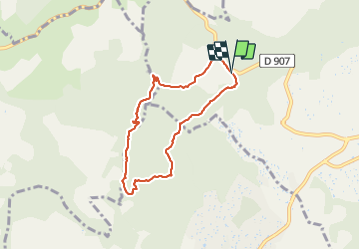

4,7 km | 6,5 km-effort

Gebruiker


Gratisgps-wandelapplicatie
 SityTrail
IGN / Geografische instituten
SityTrail World
De wereld gaat voor u open
Tocht Stappen van 6,8 km beschikbaar op Provence-Alpes-Côte d'Azur, Alpes-de-Haute-Provence, Manosque. Deze tocht wordt voorgesteld door liocol.
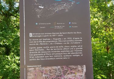
Sur la route d' Apt, D907, un petit parking sur la gauche. Les 180 m de dénivelé se font en une fois.


Stappen
Stappen

Stappen
Stappen
Stappen
Stappen
Stappen
Stappen
Stappen