


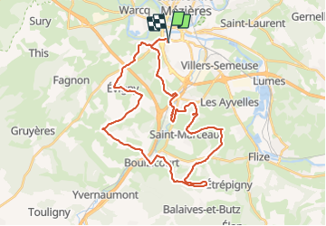

28 km | 33 km-effort


Gebruiker


Gratisgps-wandelapplicatie
 SityTrail
IGN / Geografische instituten
SityTrail World
De wereld gaat voor u open
Tocht Mountainbike van 37 km beschikbaar op Grand Est, Ardennes, Charleville-Mézières. Deze tocht wordt voorgesteld door GeGe08.
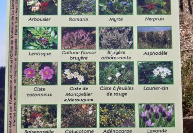
Charleville la Francheville La Vence Saint Marceau Chalandry spéciale bois Balaives Boulzicourt Champigneul Evigny Warnecourt Mézières
Stappen
Stappen

Stappen
Mountainbike

Stappen

Stappen
Mountainbike
Mountainbike
Mountainbike