Tocht Stappen Le Castellet - ste anne du castelet - Photo
 gaggiroland
gaggiroland

Gebruiker

© OpenStreetMap contributors
Lengte
Lengte
10,7 km
Max. hoogte
Max. hoogte
429 m
Positief hoogteverschil
365 m
Km-Effort
Km-Effort  
15,6 km
Min. hoogte
Min. hoogte
178 m
Negatief hoogteverschil
365 m
Boucle
Boucle
Ja
Datum van aanmaak :
2021-11-10 17:40:35.651
Laatste wijziging :
2021-11-10 17:44:29.351

(0 Bericht)

Stappen
Stappen
3h32
Moeilijkheid : Medium

Scan deze QR-code om de tocht te openen in de SityTrail-applicatie

Gratisgps-wandelapplicatie

Logo SityTrail SityTrail

IGN / Geografische instituten

SityTrail uit de App Store downloaden SityTrail uit Google Play downloaden

Logo SityTrail SityTrail World

De wereld gaat voor u open

SityTrail uit de App Store downloaden SityTrail uit Google Play downloaden SityTrail op Huawei AppGallery downloaden

Over ons

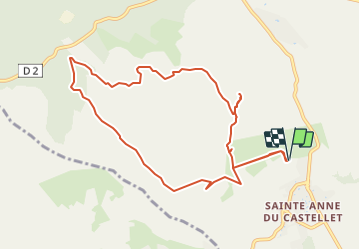
Tocht Stappen van 10,7 km beschikbaar op Provence-Alpes-Côte d'Azur, Var, Le Castellet. Deze tocht wordt voorgesteld door gaggiroland.

Beschrijving

chapelle ste anne pont du caunet camp pennon dessus de roche fond de mars four cade chaud poix source

Hoogteprofiel

Plaatsbepaling

Land:
France
Regio :
Provence-Alpes-Côte d'Azur
Departement/Provincie :
Var
Gemeente :
Le Castellet
Locatie:
Unknown
Vertrek:(UTM)
724304 ; 4790352 (31T) N.

Wandeltochten in de omgeving

Tocht Stappen Le Beausset - Trace_Quatre_Freres - Photo
Stappen
GUIDE
affinetataille

Stappen

Zeer moeilijk
(1)
Le Beausset, Provence-Alpes-Côte d'Azur, Var, France
14,8 km | 19,6 km-effort
4h 26min
Ja
Tocht Stappen Le Castellet - SityTrail - 2361987 - begude - Photo
Stappen
GUIDE
affinetataille

Stappen

Medium
(1)
Le Castellet, Provence-Alpes-Côte d'Azur, Var, France
11,5 km | 15,1 km-effort
4h 0min
Ja
Tocht Stappen Le Beausset - Tête du Cade par abime de Maramouyé - Photo
Stappen
sonneville

Stappen

Heel gemakkelijk
(1)
Le Beausset, Provence-Alpes-Côte d'Azur, Var, France
12,4 km | 16,1 km-effort
3h 36min
Ja
Tocht Noords wandelen La Cadière-d'Azur - 20220329_La Cadière d'Azur - Photo
Noords wandelen
Marcsaintcyr

Noords wandelen

Heel gemakkelijk
(1)
La Cadière-d'Azur, Provence-Alpes-Côte d'Azur, Var, France
6,8 km | 8,6 km-effort
1h 30min
Ja
Tocht Noords wandelen La Cadière-d'Azur - 20220329_La Cadière d'Azur - Photo
Noords wandelen
Marcsaintcyr

Noords wandelen

Heel gemakkelijk
(1)
La Cadière-d'Azur, Provence-Alpes-Côte d'Azur, Var, France
6,8 km | 8,6 km-effort
1h 30min
Ja
Tocht Stappen Cuges-les-Pins - cuges barres de castillon OK coral - Photo
Stappen
michelpaulin

Stappen

Medium
(1)
Cuges-les-Pins, Provence-Alpes-Côte d'Azur, Bouches-du-Rhône, France
10,9 km | 14,9 km-effort
5h 54min
Ja
Tocht Stappen Signes - grotte du mounoi signes - Photo
Stappen
marchev

Stappen

Medium
(1)
Signes, Provence-Alpes-Côte d'Azur, Var, France
17 km | 21 km-effort
4h 45min
Ja
Tocht Stappen La Cadière-d'Azur - LA CADIERE  - Photo
Stappen
michelpaulin

Stappen

Medium
La Cadière-d'Azur, Provence-Alpes-Côte d'Azur, Var, France
10,4 km | 14,4 km-effort
3h 16min
Ja
Tocht Stappen Le Castellet - Roche Redonne depuis Ste Anne du Castelet - Photo
Stappen
Daniel.BRUN-PICARD

Stappen

Moeilijk
Le Castellet, Provence-Alpes-Côte d'Azur, Var, France
11 km | 15,7 km-effort
3h 34min
Ja


Sluiten
Mijn abonnementen