![](/images/other/stat-length.png)
Circuit Saorge Chapelles Stes croix et Anne Col de Peïremont
GrouGary
Gebruiker
![Lengte](/images/other/stat-length.png)
![Max. hoogte](https://static1.geolcdn.com/siteimages/upload/files/1508320355ic_sort_altitude_max_24dp.png)
![Positief hoogteverschil](https://static1.geolcdn.com/siteimages/upload/files/1508320355ic_sort_den_pos_24dp.png)
![Km-Effort](/images/other/stat-length.png)
![Min. hoogte](https://static1.geolcdn.com/siteimages/upload/files/1508320355ic_sort_altitude_min_24dp.png)
![Negatief hoogteverschil](https://static1.geolcdn.com/siteimages/upload/files/1508320355ic_sort_den_neg_24dp.png)
![Boucle](https://static1.geolcdn.com/siteimages/upload/files/16400158638029165_repeat_loop_refresh_sync_direction_icon.png)
![Stappen](https://static1.geolcdn.com/sitytour/trail-icons/101.png)
2h59
Moeilijkheid : Medium
![Scan deze QR-code om de tocht te openen in de SityTrail-applicatie](https://capi.geolives.com/qq0zvz2zws4bq2lad0pu/sitytour/trails/2994273/qr.png?size=200)
Gratisgps-wandelapplicatie
Over ons
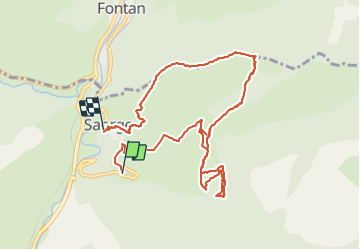
Tocht Stappen van 11,1 km beschikbaar op Provence-Alpes-Côte d'Azur, Alpes-Maritimes, Saorge. Deze tocht wordt voorgesteld door GrouGary.
Beschrijving
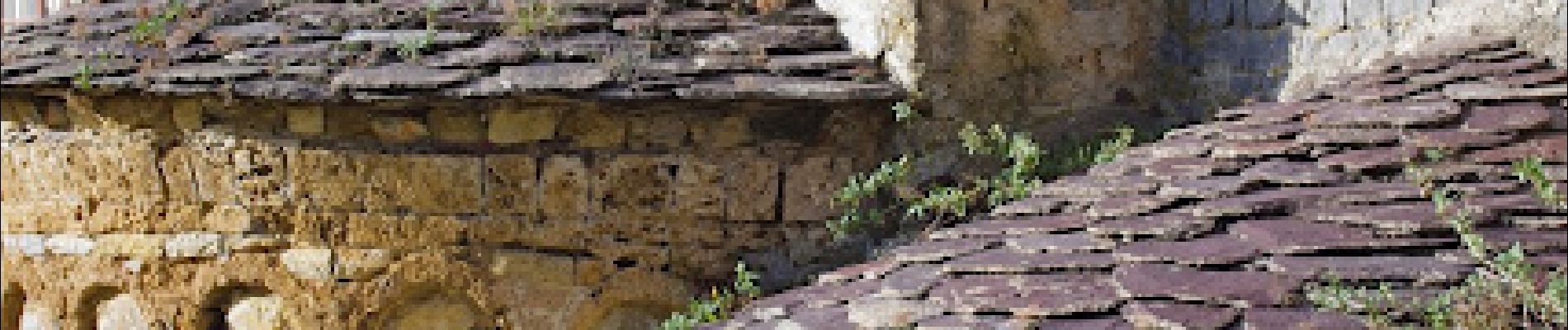
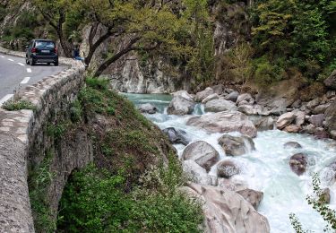
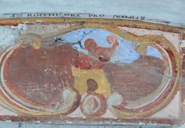
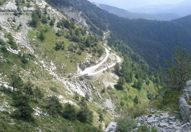
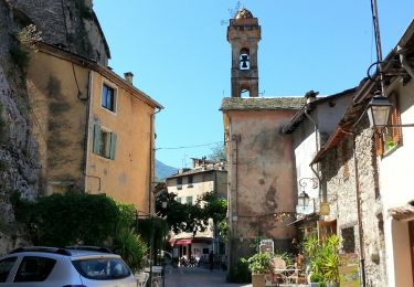
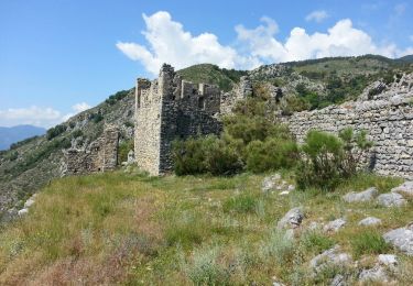
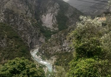
Du parking en-dessous de la Madone de Poggio, prendre à droite le chemin pavé du Monastère de Notre Dame des miracles. Serpenter par un sentier entre les antiques planches agricoles jusqu'à la chapelle Ste Croix. Faire un détour pour la chapelle ste Anne qui domine le vallon de Bendola. Remonter jusqu'à l'abreuvoir de la Pinée (b.433) puis par des lacets le col de Peïremont (b.432). On domine alors le vallon de fontaine froide. Retour par crête puis lacets avec vue plongeante sur les toits en lauzes violettes et bulbes vernissés des chapelle/eglise de Saorge
Plaatsbepaling
Opmerkingen
Wandeltochten in de omgeving
![Tocht Te voet Saorge - Croix du mont Agu - Photo](https://media.geolcdn.com/t/375/260/b4a7dd39-6b80-42ce-9148-3809bbaa5a9f.jpeg&format=jpg&maxdim=2)
![Te voet Te voet](https://static1.geolcdn.com/sitytour/trail-icons/100.png)
Te voet
![](/images/other/stat-length.png)
![](https://static1.geolcdn.com/siteimages/upload/files/16400158638029165_repeat_loop_refresh_sync_direction_icon.png)
![Tocht Te voet Saorge - Château fort de Malmort - Photo](https://media.geolcdn.com/t/375/260/72f8b7aa-cd47-408c-94b9-787f287758ec.jpeg&format=jpg&maxdim=2)
![Te voet Te voet](https://static1.geolcdn.com/sitytour/trail-icons/100.png)
Te voet
![](/images/other/stat-length.png)
![](https://static1.geolcdn.com/siteimages/upload/files/16400158638029165_repeat_loop_refresh_sync_direction_icon.png)
![Tocht Te voet Fontan - Hameaux de Bergue - Photo](https://media.geolcdn.com/t/375/260/634dee80-915e-4f51-9b14-8044a08a3919.jpeg&format=jpg&maxdim=2)
![Te voet Te voet](https://static1.geolcdn.com/sitytour/trail-icons/100.png)
Te voet
![](/images/other/stat-length.png)
![](https://static1.geolcdn.com/siteimages/upload/files/16400158638029165_repeat_loop_refresh_sync_direction_icon.png)
![Tocht Te voet Saorge - Circuit de Peiremont - Photo](https://media.geolcdn.com/t/375/260/0e9d7e0a-b443-41b8-b13c-cfab4797bdc2.jpeg&format=jpg&maxdim=2)
![Te voet Te voet](https://static1.geolcdn.com/sitytour/trail-icons/100.png)
Te voet
![](/images/other/stat-length.png)
![](https://static1.geolcdn.com/siteimages/upload/files/16400158638029165_repeat_loop_refresh_sync_direction_icon.png)
![Tocht Te voet Pigna - Colle Scarassan - Sella d'Agnaira - Photo](https://media.geolcdn.com/t/375/260/d8790286-424c-448d-96a0-38ca6dd16227.jpeg&format=jpg&maxdim=2)
![Te voet Te voet](https://static1.geolcdn.com/sitytour/trail-icons/100.png)
Te voet
![](/images/other/stat-length.png)
![](https://static1.geolcdn.com/siteimages/upload/files/16400158638029165_repeat_loop_refresh_sync_direction_icon.png)
![Tocht Stappen Saorge - Saorge - abreuvoir b162 - 2016 06 22 - Photo](https://media.geolcdn.com/t/375/260/ext.jpg?maxdim=2&url=https%3A%2F%2Fservices.sitytrail.com%2FGeolivesWS%2FDownloadMedia.ashx%3FTrailID%3D597962%26Media%3Dfix__20160622113635.jpg)
![Stappen Stappen](https://static1.geolcdn.com/sitytour/trail-icons/101.png)
Stappen
![](/images/other/stat-length.png)
![](https://static1.geolcdn.com/siteimages/upload/files/16400158638029165_repeat_loop_refresh_sync_direction_icon.png)
![Tocht Stappen Fontan - Cayrosina (Fontan) - Chateau de Malmort - pont de Gafeug - Photo](https://media.geolcdn.com/t/375/260/ext.jpg?maxdim=2&url=https%3A%2F%2Fservices.sitytrail.com%2FGeolivesWS%2FDownloadMedia.ashx%3FTrailID%3D597942%26Media%3Dfix__20160627105920.jpg)
![Stappen Stappen](https://static1.geolcdn.com/sitytour/trail-icons/101.png)
Stappen
![](/images/other/stat-length.png)
![](https://static1.geolcdn.com/siteimages/upload/files/16400158638029165_repeat_loop_refresh_sync_direction_icon.png)
![Tocht Stappen Fontan - Bergue Inférieur - Tour de Corvo - 2016 06 30 - Photo](https://media.geolcdn.com/t/375/260/ext.jpg?maxdim=2&url=https%3A%2F%2Fservices.sitytrail.com%2FGeolivesWS%2FDownloadMedia.ashx%3FTrailID%3D597852%26Media%3Dfix__20160630135626.jpg)
![Stappen Stappen](https://static1.geolcdn.com/sitytour/trail-icons/101.png)
Stappen
![](/images/other/stat-length.png)
![](https://static1.geolcdn.com/siteimages/upload/files/16400158638029165_repeat_loop_refresh_sync_direction_icon.png)
![Tocht Stappen Saorge - saorge - Photo](https://media.geolcdn.com/t/375/260/60d421de-92fa-43e8-988f-c672b78627d7.jpg&format=jpg&maxdim=2)
![Stappen Stappen](https://static1.geolcdn.com/sitytour/trail-icons/101.png)
Stappen
![](/images/other/stat-length.png)
![](https://static1.geolcdn.com/siteimages/upload/files/16400158638029165_repeat_loop_refresh_sync_direction_icon.png)