![](/images/other/stat-length.png)
![Tocht Stappen Hermigua - Ibo Alvaro - Vallehermoso - Photo](https://media.geolcdn.com/t/1900/400/dde858dd-4e70-43e2-9f8b-6a43896be5d6.jpg&format=pjpeg&maxdim=2)
Ibo Alvaro - Vallehermoso
romanceline
Gebruiker GUIDE
![Lengte](/images/other/stat-length.png)
Lengte
16,9 km
![Max. hoogte](https://static1.geolcdn.com/siteimages/upload/files/1508320355ic_sort_altitude_max_24dp.png)
Max. hoogte
796 m
![Positief hoogteverschil](https://static1.geolcdn.com/siteimages/upload/files/1508320355ic_sort_den_pos_24dp.png)
Positief hoogteverschil
1025 m
![Km-Effort](/images/other/stat-length.png)
Km-Effort
31 km
![Min. hoogte](https://static1.geolcdn.com/siteimages/upload/files/1508320355ic_sort_altitude_min_24dp.png)
Min. hoogte
176 m
![Negatief hoogteverschil](https://static1.geolcdn.com/siteimages/upload/files/1508320355ic_sort_den_neg_24dp.png)
Negatief hoogteverschil
1021 m
![Boucle](https://static1.geolcdn.com/siteimages/upload/files/16400158638029165_repeat_loop_refresh_sync_direction_icon.png)
Boucle
Neen
Datum van aanmaak :
2021-10-30 07:51:51.348
Laatste wijziging :
2021-10-30 14:19:19.545
![Stappen](https://static1.geolcdn.com/sitytour/trail-icons/101.png)
6h25
Moeilijkheid : Moeilijk
![Scan deze QR-code om de tocht te openen in de SityTrail-applicatie](https://capi.geolives.com/qq0zvz2zws4bq2lad0pu/sitytour/trails/2987492/qr.png?size=200)
Gratisgps-wandelapplicatie
Over ons
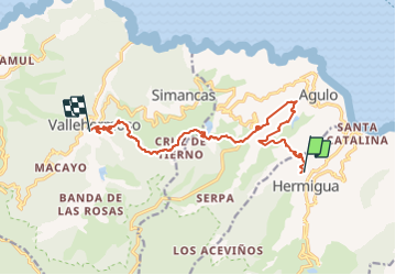
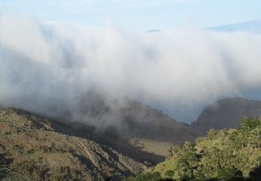
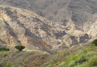
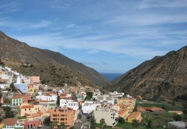
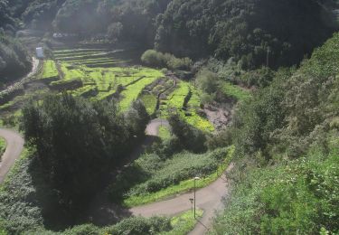
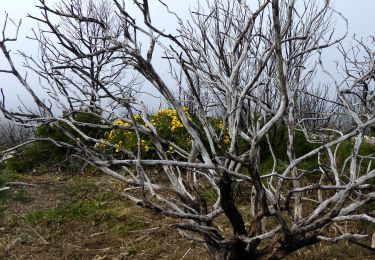
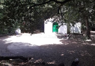
Tocht Stappen van 16,9 km beschikbaar op Canarische Eilanden, Santa Cruz de Tenerife, Hermigua. Deze tocht wordt voorgesteld door romanceline.
Beschrijving
Passing by Mirador de Abrante and Juego de Bolos
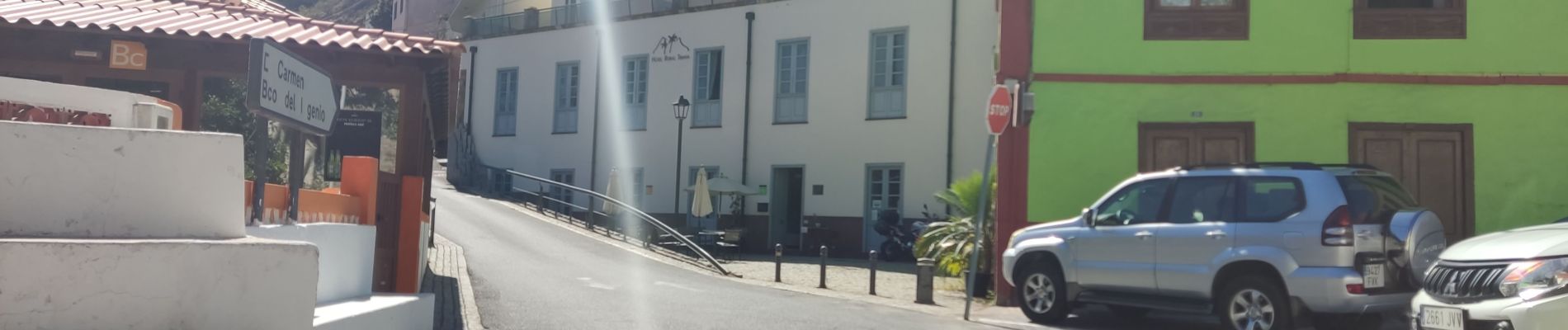
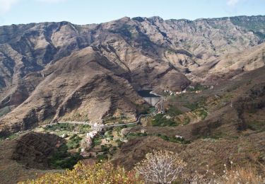
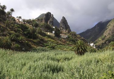
Plaatsbepaling
Land:
Spain
Regio :
Canarische Eilanden
Departement/Provincie :
Santa Cruz de Tenerife
Gemeente :
Hermigua
Locatie:
Unknown
Vertrek:(Dec)
Vertrek:(UTM)
284065 ; 3117611 (28R) N.
Opmerkingen
Wandeltochten in de omgeving
![Tocht Te voet San Sebastián de la Gomera - Ruta 31 - Photo](https://media.geolcdn.com/t/375/260/a2ad51f1-33e3-4b11-a53c-eb0fc685fb27.jpeg&format=jpg&maxdim=2)
![Te voet Te voet](https://static1.geolcdn.com/sitytour/trail-icons/100.png)
Ruta 31
Te voet
Gemakkelijk
San Sebastián de la Gomera,
Canarische Eilanden,
Santa Cruz de Tenerife,
Spain
![](/images/other/stat-length.png)
5,1 km | 9,4 km-effort
2h 7min
![](https://static1.geolcdn.com/siteimages/upload/files/16400158638029165_repeat_loop_refresh_sync_direction_icon.png)
Neen
![Tocht Te voet Hermigua - Ruta 37 - Photo](https://media.geolcdn.com/t/375/260/86efd7c3-9675-4951-afc6-abaa1b072042.jpeg&format=jpg&maxdim=2)
![Te voet Te voet](https://static1.geolcdn.com/sitytour/trail-icons/100.png)
Ruta 37
Te voet
Gemakkelijk
Hermigua,
Canarische Eilanden,
Santa Cruz de Tenerife,
Spain
![](/images/other/stat-length.png)
3,2 km | 8,5 km-effort
1h 56min
![](https://static1.geolcdn.com/siteimages/upload/files/16400158638029165_repeat_loop_refresh_sync_direction_icon.png)
Neen
![Tocht Te voet Hermigua - Ruta 32 - Photo](https://media.geolcdn.com/t/375/260/91c0beb8-ab87-4461-86a4-75e9d6c23f39.jpeg&format=jpg&maxdim=2)
![Te voet Te voet](https://static1.geolcdn.com/sitytour/trail-icons/100.png)
Ruta 32
Te voet
Gemakkelijk
Hermigua,
Canarische Eilanden,
Santa Cruz de Tenerife,
Spain
![](/images/other/stat-length.png)
4,4 km | 6,4 km-effort
1h 26min
![](https://static1.geolcdn.com/siteimages/upload/files/16400158638029165_repeat_loop_refresh_sync_direction_icon.png)
Neen
![Tocht Te voet Hermigua - Ruta 33 - Photo](https://media.geolcdn.com/t/375/260/cf4876e3-19d3-4520-8999-19226e345e35.jpeg&format=jpg&maxdim=2)
![Te voet Te voet](https://static1.geolcdn.com/sitytour/trail-icons/100.png)
Ruta 33
Te voet
Gemakkelijk
Hermigua,
Canarische Eilanden,
Santa Cruz de Tenerife,
Spain
![](/images/other/stat-length.png)
5,1 km | 8,5 km-effort
1h 56min
![](https://static1.geolcdn.com/siteimages/upload/files/16400158638029165_repeat_loop_refresh_sync_direction_icon.png)
Neen
![Tocht Te voet Vallehermoso - Ruta 38 - Photo](https://media.geolcdn.com/t/375/260/a5114c43-9390-43db-ae2f-f55e2339105d.jpeg&format=jpg&maxdim=2)
![Te voet Te voet](https://static1.geolcdn.com/sitytour/trail-icons/100.png)
Ruta 38
Te voet
Gemakkelijk
Vallehermoso,
Canarische Eilanden,
Santa Cruz de Tenerife,
Spain
![](/images/other/stat-length.png)
4,1 km | 7,3 km-effort
1h 40min
![](https://static1.geolcdn.com/siteimages/upload/files/16400158638029165_repeat_loop_refresh_sync_direction_icon.png)
Neen
![Tocht Te voet Hermigua - Reventón Oscuro - El Cedro - Photo](https://media.geolcdn.com/t/375/260/894e2729-5fef-471c-801f-1eaa4ed76d4c.jpeg&format=jpg&maxdim=2)
![Te voet Te voet](https://static1.geolcdn.com/sitytour/trail-icons/100.png)
Reventón Oscuro - El Cedro
Te voet
Gemakkelijk
Hermigua,
Canarische Eilanden,
Santa Cruz de Tenerife,
Spain
![](/images/other/stat-length.png)
3,2 km | 6,3 km-effort
1h 25min
![](https://static1.geolcdn.com/siteimages/upload/files/16400158638029165_repeat_loop_refresh_sync_direction_icon.png)
Neen
![Tocht Te voet Hermigua - Ruta 9: El Contadero - Chorro del Cedro - Photo](https://media.geolcdn.com/t/375/260/170a792b-f466-4df4-95eb-754e8c2f554c.jpeg&format=jpg&maxdim=2)
![Te voet Te voet](https://static1.geolcdn.com/sitytour/trail-icons/100.png)
Ruta 9: El Contadero - Chorro del Cedro
Te voet
Gemakkelijk
Hermigua,
Canarische Eilanden,
Santa Cruz de Tenerife,
Spain
![](/images/other/stat-length.png)
5,8 km | 11,4 km-effort
2h 35min
![](https://static1.geolcdn.com/siteimages/upload/files/16400158638029165_repeat_loop_refresh_sync_direction_icon.png)
Neen
![Tocht Te voet Hermigua - Ruta 11: La Meseta de Hermigua - Chorro del Cedro - Photo](https://media.geolcdn.com/t/375/260/9ee5583b-8203-4e03-a5fc-f7ea80c15335.jpeg&format=jpg&maxdim=2)
![Te voet Te voet](https://static1.geolcdn.com/sitytour/trail-icons/100.png)
Ruta 11: La Meseta de Hermigua - Chorro del Cedro
Te voet
Gemakkelijk
Hermigua,
Canarische Eilanden,
Santa Cruz de Tenerife,
Spain
![](/images/other/stat-length.png)
5,4 km | 9,2 km-effort
2h 5min
![](https://static1.geolcdn.com/siteimages/upload/files/16400158638029165_repeat_loop_refresh_sync_direction_icon.png)
Neen
![Tocht Stappen Hermigua - Canaries - La Gomera - El Cedro - jour 7 - Photo](https://media.geolcdn.com/t/375/260/7697a606-f099-4be7-9c1b-9518519b3af3.jpg&format=jpg&maxdim=2)
![Stappen Stappen](https://static1.geolcdn.com/sitytour/trail-icons/101.png)
Canaries - La Gomera - El Cedro - jour 7
Stappen
Medium
Hermigua,
Canarische Eilanden,
Santa Cruz de Tenerife,
Spain
![](/images/other/stat-length.png)
9,4 km | 17,2 km-effort
5h 30min
![](https://static1.geolcdn.com/siteimages/upload/files/16400158638029165_repeat_loop_refresh_sync_direction_icon.png)
Ja