![](/images/other/stat-length.png)
![Tocht Mountainbike Fort-Mahon-Plage - ballade bord de mer - Photo](https://media.geolcdn.com/t/1900/400/ext.pjpeg?maxdim=2&url=https%3A%2F%2Fstatic1.geolcdn.com%2Fsiteimages%2Fupload%2Ffiles%2F1524743154velo.jpg)
ballade bord de mer
Maxime Devaux
Gebruiker
![Lengte](/images/other/stat-length.png)
Lengte
23 km
![Max. hoogte](https://static1.geolcdn.com/siteimages/upload/files/1508320355ic_sort_altitude_max_24dp.png)
Max. hoogte
26 m
![Positief hoogteverschil](https://static1.geolcdn.com/siteimages/upload/files/1508320355ic_sort_den_pos_24dp.png)
Positief hoogteverschil
93 m
![Km-Effort](/images/other/stat-length.png)
Km-Effort
24 km
![Min. hoogte](https://static1.geolcdn.com/siteimages/upload/files/1508320355ic_sort_altitude_min_24dp.png)
Min. hoogte
0 m
![Negatief hoogteverschil](https://static1.geolcdn.com/siteimages/upload/files/1508320355ic_sort_den_neg_24dp.png)
Negatief hoogteverschil
92 m
![Boucle](https://static1.geolcdn.com/siteimages/upload/files/16400158638029165_repeat_loop_refresh_sync_direction_icon.png)
Boucle
Ja
Datum van aanmaak :
2021-10-25 07:42:57.201
Laatste wijziging :
2021-10-25 09:32:52.456
![Mountainbike](https://static1.geolcdn.com/sitytour/trail-icons/202.png)
1h46
Moeilijkheid : Medium
![Scan deze QR-code om de tocht te openen in de SityTrail-applicatie](https://capi.geolives.com/qq0zvz2zws4bq2lad0pu/sitytour/trails/2981897/qr.png?size=200)
Gratisgps-wandelapplicatie
Over ons
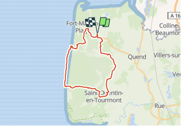
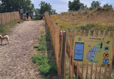
Tocht Mountainbike van 23 km beschikbaar op Hauts-de-France, Somme, Fort-Mahon-Plage. Deze tocht wordt voorgesteld door Maxime Devaux.
Beschrijving
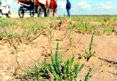
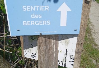
très difficile dans le sentier de la mer.
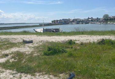
mais très beau spectacle pour les yeux à l'arrivée
Plaatsbepaling
Land:
France
Regio :
Hauts-de-France
Departement/Provincie :
Somme
Gemeente :
Fort-Mahon-Plage
Locatie:
Unknown
Vertrek:(Dec)
Vertrek:(UTM)
399144 ; 5576931 (31U) N.
Opmerkingen
Wandeltochten in de omgeving
![Tocht Stappen Quend - Le Colombier - Photo](https://media.geolcdn.com/t/375/260/ext.jpg?maxdim=2&url=https%3A%2F%2Fservices.sitytrail.com%2FGeolivesWS%2FDownloadMedia.ashx%3FTrailID%3D108606%26Media%3D1514_1.jpg)
![Stappen Stappen](https://static1.geolcdn.com/sitytour/trail-icons/101.png)
Le Colombier
Stappen
Moeilijk
(2)
Quend,
Hauts-de-France,
Somme,
France
![](/images/other/stat-length.png)
9,9 km | 10,5 km-effort
3h 19min
![](https://static1.geolcdn.com/siteimages/upload/files/16400158638029165_repeat_loop_refresh_sync_direction_icon.png)
Ja
![Tocht Stappen Fort-Mahon-Plage - La dune de Royon - Photo](https://media.geolcdn.com/t/375/260/ext.jpg?maxdim=2&url=https%3A%2F%2Fservices.sitytrail.com%2FGeolivesWS%2FDownloadMedia.ashx%3FTrailID%3D108543%26Media%3D1446_1.jpg)
![Stappen Stappen](https://static1.geolcdn.com/sitytour/trail-icons/101.png)
La dune de Royon
Stappen
Medium
(1)
Fort-Mahon-Plage,
Hauts-de-France,
Somme,
France
![](/images/other/stat-length.png)
4,1 km | 4,5 km-effort
1h 30min
![](https://static1.geolcdn.com/siteimages/upload/files/16400158638029165_repeat_loop_refresh_sync_direction_icon.png)
Ja
![Tocht Elektrische fiets Fort-Mahon-Plage - Tour de la baie D’Authie - Photo](https://media.geolcdn.com/t/375/260/009af033-fc32-419b-94c5-466a83f3fabb.jpeg&format=jpg&maxdim=2)
![Elektrische fiets Elektrische fiets](https://static1.geolcdn.com/sitytour/trail-icons/205.png)
Tour de la baie D’Authie
Elektrische fiets
Fort-Mahon-Plage,
Hauts-de-France,
Somme,
France
![](/images/other/stat-length.png)
50 km | 53 km-effort
3h 57min
![](https://static1.geolcdn.com/siteimages/upload/files/16400158638029165_repeat_loop_refresh_sync_direction_icon.png)
Ja
![Tocht Stappen Quend - dixk-mônchaux - Photo](https://media.geolcdn.com/t/375/260/0c33e945-d50d-4b4a-bef0-ad25dd476496.jpg&format=jpg&maxdim=2)
![Stappen Stappen](https://static1.geolcdn.com/sitytour/trail-icons/101.png)
dixk-mônchaux
Stappen
Medium
Quend,
Hauts-de-France,
Somme,
France
![](/images/other/stat-length.png)
11,4 km | 12 km-effort
2h 17min
![](https://static1.geolcdn.com/siteimages/upload/files/16400158638029165_repeat_loop_refresh_sync_direction_icon.png)
Neen
![Tocht Stappen Fort-Mahon-Plage - les CROCS -SAINT QUENTIN EN TOURMONT - Photo](https://media.geolcdn.com/t/375/260/20e8182c-4abb-4f1d-a47e-2b1a6b27419f.jpg&format=jpg&maxdim=2)
![Stappen Stappen](https://static1.geolcdn.com/sitytour/trail-icons/101.png)
les CROCS -SAINT QUENTIN EN TOURMONT
Stappen
Zeer moeilijk
Fort-Mahon-Plage,
Hauts-de-France,
Somme,
France
![](/images/other/stat-length.png)
23 km | 24 km-effort
3h 32min
![](https://static1.geolcdn.com/siteimages/upload/files/16400158638029165_repeat_loop_refresh_sync_direction_icon.png)
Neen
![Tocht Te voet Quend - Le Colombier - Photo](https://media.geolcdn.com/t/375/260/716ce54f-89a0-4335-b6e0-2d178a29836d.jpeg&format=jpg&maxdim=2)
![Te voet Te voet](https://static1.geolcdn.com/sitytour/trail-icons/100.png)
Le Colombier
Te voet
Gemakkelijk
Quend,
Hauts-de-France,
Somme,
France
![](/images/other/stat-length.png)
9,9 km | 10,4 km-effort
2h 22min
![](https://static1.geolcdn.com/siteimages/upload/files/16400158638029165_repeat_loop_refresh_sync_direction_icon.png)
Ja
![Tocht Stappen Waben - Le Tour de Groffliers à pied - Photo](https://media.geolcdn.com/t/375/260/ext.jpg?maxdim=2&url=https%3A%2F%2Fservices.sitytrail.com%2FGeolivesWS%2FDownloadMedia.ashx%3FTrailID%3D112284%26Media%3D10292_6.jpg)
![Stappen Stappen](https://static1.geolcdn.com/sitytour/trail-icons/101.png)
Le Tour de Groffliers à pied
Stappen
Medium
Waben,
Hauts-de-France,
Pas-de-Calais,
France
![](/images/other/stat-length.png)
11,9 km | 12,5 km-effort
2h 55min
![](https://static1.geolcdn.com/siteimages/upload/files/16400158638029165_repeat_loop_refresh_sync_direction_icon.png)
Ja
![Tocht Noords wandelen Fort-Mahon-Plage - fort mahon 2 Isabelle - Photo](https://media.geolcdn.com/t/375/260/98f2fec9-4d89-4669-b420-28181b1cce2f.jpg&format=jpg&maxdim=2)
![Noords wandelen Noords wandelen](https://static1.geolcdn.com/sitytour/trail-icons/102.png)
fort mahon 2 Isabelle
Noords wandelen
Heel gemakkelijk
Fort-Mahon-Plage,
Hauts-de-France,
Somme,
France
![](/images/other/stat-length.png)
13,2 km | 14 km-effort
3h 26min
![](https://static1.geolcdn.com/siteimages/upload/files/16400158638029165_repeat_loop_refresh_sync_direction_icon.png)
Neen
![Tocht Wegfiets Fort-Mahon-Plage - Entre Baie d’Authie et Baie de Somme - Photo](https://media.geolcdn.com/t/375/260/759f87bc-0d64-4ca9-a22c-63392fb82368.jpg&format=jpg&maxdim=2)
![Wegfiets Wegfiets](https://static1.geolcdn.com/sitytour/trail-icons/201.png)
Entre Baie d’Authie et Baie de Somme
Wegfiets
Gemakkelijk
Fort-Mahon-Plage,
Hauts-de-France,
Somme,
France
![](/images/other/stat-length.png)
54 km | 57 km-effort
4h 3min
![](https://static1.geolcdn.com/siteimages/upload/files/16400158638029165_repeat_loop_refresh_sync_direction_icon.png)
Ja